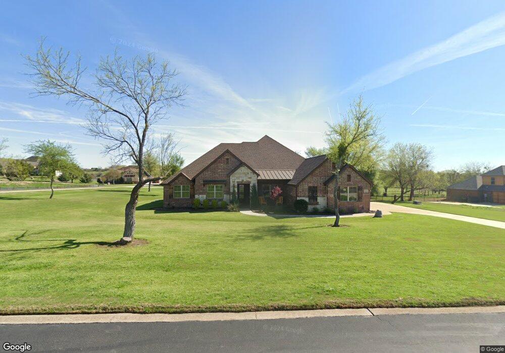
193 Pinnacle Peak Ln Weatherford, TX 76087
Estimated Value: $717,326 - $890,000
4
Beds
3
Baths
2,812
Sq Ft
$277/Sq Ft
Est. Value
About This Home
This home is located at 193 Pinnacle Peak Ln, Weatherford, TX 76087 and is currently estimated at $777,582, approximately $276 per square foot. 193 Pinnacle Peak Ln is a home located in Parker County with nearby schools including Brock Intermediate School, Brock Junior High School, and Brock High School.
Ownership History
Date
Name
Owned For
Owner Type
Purchase Details
Closed on
Jan 13, 2015
Sold by
Killian Custom Homes Llc
Bought by
Foust Joseph W and Foust Terry M
Current Estimated Value
Home Financials for this Owner
Home Financials are based on the most recent Mortgage that was taken out on this home.
Original Mortgage
$308,500
Outstanding Balance
$237,080
Interest Rate
3.93%
Mortgage Type
New Conventional
Estimated Equity
$540,502
Purchase Details
Closed on
Jun 16, 2014
Sold by
Solomon George and Solomon Jini
Bought by
Foust Joseph W and Foust Terry
Purchase Details
Closed on
Apr 9, 2004
Sold by
Goff Development Corp
Bought by
Foust Joseph W and Foust Terry
Purchase Details
Closed on
Jan 20, 2003
Sold by
Canyon West Development Co
Bought by
Foust Joseph W and Foust Terry
Create a Home Valuation Report for This Property
The Home Valuation Report is an in-depth analysis detailing your home's value as well as a comparison with similar homes in the area
Home Values in the Area
Average Home Value in this Area
Purchase History
| Date | Buyer | Sale Price | Title Company |
|---|---|---|---|
| Foust Joseph W | -- | Capital Title | |
| Foust Joseph W | -- | -- | |
| Foust Joseph W | -- | -- | |
| Foust Joseph W | -- | -- |
Source: Public Records
Mortgage History
| Date | Status | Borrower | Loan Amount |
|---|---|---|---|
| Open | Foust Joseph W | $308,500 |
Source: Public Records
Tax History Compared to Growth
Tax History
| Year | Tax Paid | Tax Assessment Tax Assessment Total Assessment is a certain percentage of the fair market value that is determined by local assessors to be the total taxable value of land and additions on the property. | Land | Improvement |
|---|---|---|---|---|
| 2025 | $5,651 | $603,112 | -- | -- |
| 2024 | $5,651 | $548,284 | -- | -- |
| 2023 | $5,651 | $498,440 | $0 | $0 |
| 2022 | $9,199 | $453,130 | $65,000 | $388,130 |
| 2021 | $9,092 | $453,130 | $65,000 | $388,130 |
| 2020 | $8,380 | $387,140 | $50,000 | $337,140 |
| 2019 | $9,023 | $387,140 | $50,000 | $337,140 |
| 2018 | $8,409 | $359,200 | $25,000 | $334,200 |
| 2017 | $8,264 | $359,200 | $25,000 | $334,200 |
| 2016 | $7,897 | $343,240 | $25,000 | $318,240 |
| 2015 | $7,795 | $343,240 | $25,000 | $318,240 |
| 2014 | $344 | $15,000 | $15,000 | $0 |
Source: Public Records
Map
Nearby Homes
- 197 Pinnacle Peak Ln
- 205 Pinnacle Peak Ln
- 162 Pinnacle Peak Ln
- 123 Club House Dr
- 113 Laser Ln
- 150 Top Flight Dr
- 234 Trail Ridge
- 120 Trail Ridge
- 2053 Verona Dr
- 1060 Kessler Rd
- 101 Trail Ridge
- 0 Quanah Hill Rd Unit 23872058
- 125 Summer Stone Ct
- 2042 Verona Dr
- 1051 Kingsley Ct
- 304 Red Roan Ridge
- 2030 Verona Dr
- 313 Canyon Creek Cir
- 2026 Verona Dr
- 873 Canyon Creek Ln
- lot 52 Pinnacle Peak Ln
- Lot 51 Pinnacle Peak Ln
- L 51-52 Pinnacle Peak Ln
- lot 50 Pinnacle Peak Ln
- L49-50 Pinnacle Peak Ln
- 45to48 Pinnacle Peak Ln
- 45to48 Pinnacle Peak Ln
- 45to48 Pinnacle Peak Ln
- 54to56 Pinnacle Peak Ln
- 54to56 Pinnacle Peak Ln
- 212425 Pinnacle Peak Ln
- 212425 Pinnacle Peak Ln
- 54to56 Pinnacle Peak Ln
- 1 Pinnacle Peak Ln
- 181 Pinnacle Peak Ln
- 189 Pinnacle Peak Ln
- L28r Pinnacle Peak Ln
- 196 Pinnacle Peak Ln
- 192 Pinnacle Peak Ln
- 177 Pinnacle Peak Ln