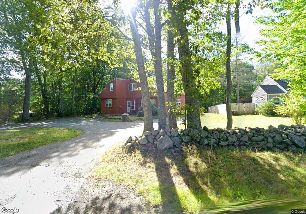
193 Pommogussett Rd Rutland, MA 01543
Estimated Value: $366,431 - $636,000
3
Beds
2
Baths
1,974
Sq Ft
$238/Sq Ft
Est. Value
About This Home
This home is located at 193 Pommogussett Rd, Rutland, MA 01543 and is currently estimated at $468,858, approximately $237 per square foot. 193 Pommogussett Rd is a home located in Worcester County with nearby schools including Wachusett Regional High School.
Ownership History
Date
Name
Owned For
Owner Type
Purchase Details
Closed on
Mar 2, 2023
Sold by
Jarvi Jana S
Bought by
193 Pommogussett Road Rt
Current Estimated Value
Purchase Details
Closed on
Mar 31, 2021
Sold by
Jarvi William E and Jarvi Jana S
Bought by
Jarvi Jana S
Purchase Details
Closed on
Jun 5, 1973
Bought by
Jarvi William E
Create a Home Valuation Report for This Property
The Home Valuation Report is an in-depth analysis detailing your home's value as well as a comparison with similar homes in the area
Home Values in the Area
Average Home Value in this Area
Purchase History
| Date | Buyer | Sale Price | Title Company |
|---|---|---|---|
| 193 Pommogussett Road Rt | -- | None Available | |
| Jarvi Jana S | -- | None Available | |
| Jarvi William E | $12,000 | -- |
Source: Public Records
Mortgage History
| Date | Status | Borrower | Loan Amount |
|---|---|---|---|
| Previous Owner | Jarvi William E | $60,000 |
Source: Public Records
Tax History Compared to Growth
Tax History
| Year | Tax Paid | Tax Assessment Tax Assessment Total Assessment is a certain percentage of the fair market value that is determined by local assessors to be the total taxable value of land and additions on the property. | Land | Improvement |
|---|---|---|---|---|
| 2025 | $4,145 | $291,100 | $83,600 | $207,500 |
| 2024 | $3,960 | $267,000 | $79,800 | $187,200 |
| 2023 | $3,684 | $268,500 | $75,300 | $193,200 |
| 2022 | $3,396 | $215,100 | $63,500 | $151,600 |
| 2021 | $3,497 | $209,400 | $63,500 | $145,900 |
| 2020 | $3,725 | $211,500 | $60,100 | $151,400 |
| 2019 | $3,678 | $205,600 | $57,300 | $148,300 |
| 2018 | $3,398 | $187,400 | $57,300 | $130,100 |
| 2017 | $3,435 | $187,500 | $57,300 | $130,200 |
| 2016 | $3,582 | $206,200 | $56,700 | $149,500 |
| 2015 | $3,233 | $183,200 | $56,700 | $126,500 |
| 2014 | $3,135 | $183,200 | $56,700 | $126,500 |
Source: Public Records
Map
Nearby Homes
- 2 Simon Davis Dr
- 35 Brintnal Dr
- 40 Brunelle Dr
- 73 Brintnal Dr
- 16 Richards Ave
- 101 Brintnal Dr
- 55 Pommogussett Rd
- 175 Glenwood Rd
- 25 Watson Ln
- 5 Miles Rd
- 32 Pommogussett Rd Unit 1
- 47 Woodside Ave
- 51 Woodside Ave
- 10 Soucy Dr
- 28 Forest Hill Dr
- Lot 24R Quail Run
- Lot 29 Quail Run
- Lot 27A Quail Run
- 4 Fidelity Dr Unit 2
- 6 Fidelity Dr Unit 3
- 195 Pommogussett Rd
- 0 Pommagussett Rd Unit 30673989
- 199 Pommogussett Rd
- 1 Simon Davis Dr
- 4 Simon Davis Dr
- 3 Simon Davis Dr
- 5 Simon Davis Dr
- 6 Simon Davis Dr
- 4 Rufus Putnam Place
- 210 Pommogussett Rd
- 209 Pommogussett Rd
- 2 Rufus Putnam Place
- 6 Rufus Putnam Place
- 7 Rufus Putnam Place
- 214 Pommogussett Rd
- 3 Rufus Putnam Place
- 1 Rufus Putnam Place
- 219 Pommogussett Rd
- 5 Rufus Putnam Place
- 14 Sassawanna Rd