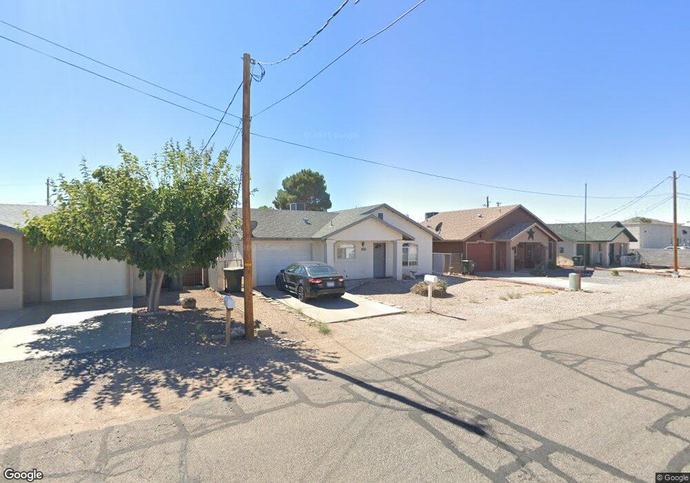
1930 Davis Ave Kingman, AZ 86401
Estimated Value: $199,000 - $210,000
3
Beds
1
Bath
1,134
Sq Ft
$178/Sq Ft
Est. Value
About This Home
This home is located at 1930 Davis Ave, Kingman, AZ 86401 and is currently estimated at $202,400, approximately $178 per square foot. 1930 Davis Ave is a home located in Mohave County with nearby schools including Manzanita Elementary School, Kingman Middle School, and Kingman High School.
Ownership History
Date
Name
Owned For
Owner Type
Purchase Details
Closed on
Nov 13, 2020
Sold by
Blaha Judith A
Bought by
Blaha Richard Paul and Blaha Kimberly K
Current Estimated Value
Purchase Details
Closed on
Mar 29, 2017
Sold by
Dike Marvin L
Bought by
Blaha Richard Paul and Blaha Kimberly K
Purchase Details
Closed on
Mar 3, 2004
Sold by
Briggs Betty L and Briggs Dennis Lee
Bought by
Dike Marvin L and Dike Gail R
Home Financials for this Owner
Home Financials are based on the most recent Mortgage that was taken out on this home.
Original Mortgage
$66,800
Interest Rate
5.64%
Mortgage Type
Unknown
Create a Home Valuation Report for This Property
The Home Valuation Report is an in-depth analysis detailing your home's value as well as a comparison with similar homes in the area
Home Values in the Area
Average Home Value in this Area
Purchase History
| Date | Buyer | Sale Price | Title Company |
|---|---|---|---|
| Blaha Richard Paul | -- | Chicago Title Agency Inc | |
| Blaha Richard Paul | -- | Pioneer Title Inc | |
| Dike Marvin L | $83,500 | Transnation Title Ins Co |
Source: Public Records
Mortgage History
| Date | Status | Borrower | Loan Amount |
|---|---|---|---|
| Previous Owner | Dike Marvin L | $66,800 |
Source: Public Records
Tax History
| Year | Tax Paid | Tax Assessment Tax Assessment Total Assessment is a certain percentage of the fair market value that is determined by local assessors to be the total taxable value of land and additions on the property. | Land | Improvement |
|---|---|---|---|---|
| 2026 | $299 | -- | -- | -- |
| 2025 | $611 | $14,895 | $0 | $0 |
| 2024 | $611 | $16,241 | $0 | $0 |
| 2023 | $611 | $13,144 | $0 | $0 |
| 2022 | $567 | $11,045 | $0 | $0 |
| 2021 | $587 | $9,818 | $0 | $0 |
| 2019 | $536 | $8,864 | $0 | $0 |
| 2018 | $554 | $8,209 | $0 | $0 |
| 2017 | $510 | $7,101 | $0 | $0 |
| 2016 | $492 | $6,569 | $0 | $0 |
| 2015 | $502 | $5,574 | $0 | $0 |
Source: Public Records
Map
Nearby Homes
- 1953 Club Ave
- 1955 Motor Ave
- 1959 Golden Gate Ave
- 1943 Hope Ave
- 2027 Motor Ave
- 1820 Motor Ave
- 1816 Motor Ave
- 2106 Fairgrounds Blvd
- 1935 Lucille Ave
- 0000 Lucille Ave
- 1810 Airfield Ave
- 2803 Fairgrounds Blvd
- 1974 Miami Ave
- 1744 Motor Ave
- 1825 Atlantic Ave
- 2209 Los Angeles St
- 1736 Golden Gate Ave
- 1707 Golden Gate Ave
- 1936 Mullen Ave
- 2604 Airfield Ct
- 1934 Davis Ave
- 1926 Davis Ave
- 1926 Davis Ave Unit 7
- 1938 Davis Ave
- 1922 Davis Ave
- 1921 Club Ave
- 1937 Club Ave
- 1942 Davis Ave
- 1929 Davis Ave
- 1925 Davis Ave
- 1933 Davis Ave
- 1939 Davis Ave
- 1941 Club Ave
- 2302 N Stockton Hill Rd
- 2302 N Stockton Hill Rd Unit 7
- 2302 N Stockton Hill Rd Unit D
- 2302 N Stockton Hill Rd Unit E-G
- 1946 Davis Ave
- 1945 Club Ave
- 1930 Motor Ave
Your Personal Tour Guide
Ask me questions while you tour the home.