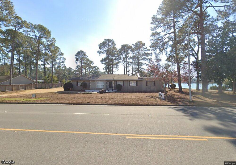
1930 Dawson Rd Albany, GA 31707
Lake Park NeighborhoodEstimated Value: $300,959 - $353,000
4
Beds
4
Baths
2,818
Sq Ft
$112/Sq Ft
Est. Value
About This Home
This home is located at 1930 Dawson Rd, Albany, GA 31707 and is currently estimated at $314,740, approximately $111 per square foot. 1930 Dawson Rd is a home located in Dougherty County with nearby schools including Lake Park Elementary School, Merry Acres Middle School, and Westover High School.
Ownership History
Date
Name
Owned For
Owner Type
Purchase Details
Closed on
Aug 1, 2018
Sold by
Thomas Richard R
Bought by
Cfs Realco Llc
Current Estimated Value
Purchase Details
Closed on
Jan 17, 1994
Sold by
Anderson Bruce P
Bought by
Thomas Richard
Purchase Details
Closed on
Aug 14, 1992
Sold by
Johnston Clarence R
Bought by
Anderson Bruce P
Purchase Details
Closed on
Jan 1, 1963
Bought by
Johnston Clarence
Create a Home Valuation Report for This Property
The Home Valuation Report is an in-depth analysis detailing your home's value as well as a comparison with similar homes in the area
Home Values in the Area
Average Home Value in this Area
Purchase History
| Date | Buyer | Sale Price | Title Company |
|---|---|---|---|
| Cfs Realco Llc | $200,000 | -- | |
| Thomas Richard | $100,000 | -- | |
| Anderson Bruce P | $100,000 | -- | |
| Johnston Clarence | -- | -- |
Source: Public Records
Tax History Compared to Growth
Tax History
| Year | Tax Paid | Tax Assessment Tax Assessment Total Assessment is a certain percentage of the fair market value that is determined by local assessors to be the total taxable value of land and additions on the property. | Land | Improvement |
|---|---|---|---|---|
| 2024 | $3,761 | $78,832 | $18,240 | $60,592 |
| 2023 | $3,673 | $78,832 | $18,240 | $60,592 |
| 2022 | $3,686 | $78,832 | $18,240 | $60,592 |
| 2021 | $3,418 | $78,832 | $18,240 | $60,592 |
| 2020 | $3,426 | $78,832 | $18,240 | $60,592 |
| 2019 | $3,439 | $78,832 | $18,240 | $60,592 |
| 2018 | $2,523 | $57,600 | $18,240 | $39,360 |
| 2017 | $2,350 | $57,600 | $18,240 | $39,360 |
| 2016 | $2,352 | $57,600 | $18,240 | $39,360 |
| 2015 | $2,666 | $65,112 | $18,240 | $46,872 |
| 2014 | $2,299 | $56,872 | $10,000 | $46,872 |
Source: Public Records
Map
Nearby Homes
- 1021 Summit Dr
- 1911 Lynwood Ln
- 1009 Summit Dr
- 1807 Pineknoll Ln
- 1805 Pineknoll Ln
- 1201 Hilltop Dr
- 2012 W Lakeridge Dr
- 1914 W Lakeridge Dr
- 1801 Oak Glen Ln
- 1728 Lynwood Ln
- 1234 Hilltop Dr
- 1101 Valley Rd
- 1721 Lynwood Ln
- 2316 Pembroke Dr
- 1714 Marbury Ln
- 1802 W Lakeridge Dr
- 1812 Robinhood Rd
- 1913 Forest Glen Dr
- 1708 Marbury Ln
- 1705 Lynwood Ln
- 1928 Dawson Rd
- 2001 1/2 Dawson Rd
- 1102 Edgewater Dr
- 1926 Dawson Rd
- 1935 Dawson Rd
- 1922 Dawson Rd
- 1100 Edgewater Dr
- 2007 Pineknoll Ln
- 2005 Pineknoll Ln
- 1918 Dawson Rd
- 1032 Edgewater Dr
- Lot 5 Meredyth Dr
- 2001 Pineknoll Ln
- 2001 Dawson Rd
- 2004 Pineknoll Ln
- 1030 Edgewater Dr
- 1914 Dawson Rd
- 1915 Pineknoll Ln
- 2002 Pineknoll Ln
- 1028 Edgewater Dr