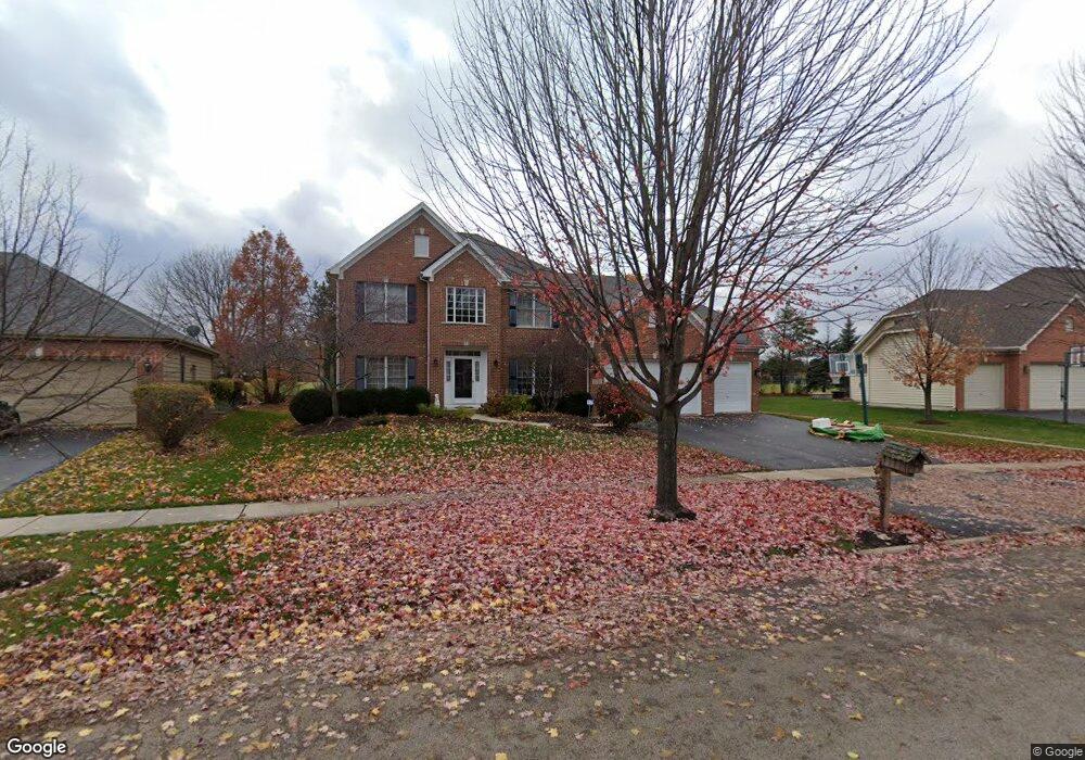
1930 Eldorado Dr Geneva, IL 60134
Eagle Brook NeighborhoodEstimated Value: $668,000 - $692,143
About This Home
This home is located at 1930 Eldorado Dr, Geneva, IL 60134 and is currently estimated at $676,536, approximately $247 per square foot. 1930 Eldorado Dr is a home located in Kane County with nearby schools including Western Avenue Elementary School, Geneva Middle School North, and Geneva Middle School South.
Ownership History
We collect this data history from publicly available records. To have your information removed, we recommend requesting removal directly through your county’s website.
Purchase Details
Home Financials for this Owner
Home Financials are based on the most recent Mortgage that was taken out on this home.Purchase Details
Home Financials for this Owner
Home Financials are based on the most recent Mortgage that was taken out on this home.Purchase Details
Home Financials for this Owner
Home Financials are based on the most recent Mortgage that was taken out on this home.Purchase Details
Purchase Details
Home Financials for this Owner
Home Financials are based on the most recent Mortgage that was taken out on this home.Home Values in the Area
Average Home Value in this Area
Purchase History
We collect this data history from publicly available records. To have your information removed, we recommend requesting removal directly through your county’s website.
| Date | Buyer | Sale Price | Title Company |
|---|---|---|---|
| $384,000 | First American Title Co | ||
| $384,000 | First American Title Co | ||
| $374,000 | Republic Title | ||
| $74,500 | Chicago Title Insurance Co | ||
| $341,000 | Chicago Title Insurance Co |
Mortgage History
We collect this data history from publicly available records. To have your information removed, we recommend requesting removal directly through your county’s website.
| Date | Status | Borrower | Loan Amount |
|---|---|---|---|
| Previous Owner | $300,700 | ||
| Previous Owner | $170,000 | ||
| Previous Owner | $306,675 | ||
| Closed | $38,400 |
Tax History
We collect this data history from publicly available records. To have your information removed, we recommend requesting removal directly through your county’s website.
| Year | Tax Paid | Tax Assessment Tax Assessment Total Assessment is a certain percentage of the fair market value that is determined by local assessors to be the total taxable value of land and additions on the property. | Land | Improvement |
|---|---|---|---|---|
| 2024 | $13,181 | $179,173 | $53,268 | $125,905 |
| 2023 | $12,785 | $162,884 | $48,425 | $114,459 |
| 2022 | $12,215 | $151,351 | $44,996 | $106,355 |
| 2021 | $11,863 | $145,726 | $43,324 | $102,402 |
| 2020 | $11,729 | $143,502 | $42,663 | $100,839 |
| 2019 | $11,700 | $140,785 | $41,855 | $98,930 |
| 2018 | $11,849 | $142,711 | $41,855 | $100,856 |
| 2017 | $11,719 | $138,905 | $40,739 | $98,166 |
| 2016 | $11,778 | $137,027 | $40,188 | $96,839 |
| 2015 | -- | $130,279 | $38,209 | $92,070 |
| 2014 | -- | $124,107 | $38,209 | $85,898 |
| 2013 | -- | $124,107 | $38,209 | $85,898 |
Map
- 839 S Randall Rd
- Unit 8A Prairie Grove Dr
- Unit 6A Prairie Grove Dr
- Unit 4B Prairie Grove Dr
- Unit 5B Prairie Grove Dr
- Unit 8B Prairie Grove Dr
- Unit 9A Prairie Grove Dr
- Unit 4A Prairie Grove Dr
- Unit 5A Prairie Grove Dr
- Unit 7A Prairie Grove Dr
- Unit 6C Prairie Grove Dr
- Unit 5C Prairie Grove Dr
- Unit 6B Prairie Grove Dr
- Unit 4C Prairie Grove Dr
- Unit 7C Prairie Grove Dr
- 955 Harbor Town Ct
- 2725 Miller Rd
- 926 Ginger Ln Unit B
- 2814 Miller Rd
- 2778 Miller Rd
- 2000 Eldorado Dr
- 1920 Eldorado Dr
- 2004 Eldorado Dr
- 1910 Eldorado Dr
- 1925 Eldorado Dr
- 1915 Eldorado Dr
- 2003 Eldorado Dr
- 2006 Eldorado Dr
- 1900 Eldorado Dr
- 1909 Eldorado Dr
- 2671 Cir
- 821 N First St
- 0S980 E Mallory Dr
- ON614 Titus Place
- lot 7 Syril Dr
- 0N784 Old Kirk Rd
- LOT 2 Pine St
- LOT 1 Pine St
- 2008 Eldorado Dr
- 1880 Eldorado Dr
Ask me questions while you tour the home.