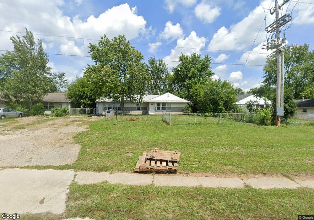
1930 Frank Rd Unit 1932 Columbus, OH 43223
Estimated Value: $170,000 - $219,000
4
Beds
2
Baths
1,816
Sq Ft
$110/Sq Ft
Est. Value
About This Home
This home is located at 1930 Frank Rd Unit 1932, Columbus, OH 43223 and is currently estimated at $200,340, approximately $110 per square foot. 1930 Frank Rd Unit 1932 is a home located in Franklin County with nearby schools including Finland Elementary School, Franklin Woods Intermediate School, and Finland Middle School.
Ownership History
Date
Name
Owned For
Owner Type
Purchase Details
Closed on
Oct 2, 2025
Sold by
Snider Fred John
Bought by
Morquecho Ivan
Current Estimated Value
Purchase Details
Closed on
Feb 19, 2001
Sold by
Messer Randy E and Messer Betty J
Bought by
Snider Fred John
Home Financials for this Owner
Home Financials are based on the most recent Mortgage that was taken out on this home.
Original Mortgage
$51,000
Interest Rate
6.91%
Purchase Details
Closed on
Aug 17, 1998
Sold by
Estate Virgie L Campbell
Bought by
Messer Randy E and Messer Betty J
Home Financials for this Owner
Home Financials are based on the most recent Mortgage that was taken out on this home.
Original Mortgage
$57,600
Interest Rate
7.07%
Purchase Details
Closed on
May 1, 1980
Create a Home Valuation Report for This Property
The Home Valuation Report is an in-depth analysis detailing your home's value as well as a comparison with similar homes in the area
Home Values in the Area
Average Home Value in this Area
Purchase History
| Date | Buyer | Sale Price | Title Company |
|---|---|---|---|
| Morquecho Ivan | $126,000 | Quality Choice Title | |
| Snider Fred John | $68,000 | Title First Agency Inc | |
| Messer Randy E | $64,000 | Amerititle Mill Run | |
| -- | $38,100 | -- |
Source: Public Records
Mortgage History
| Date | Status | Borrower | Loan Amount |
|---|---|---|---|
| Previous Owner | Snider Fred John | $51,000 | |
| Previous Owner | Messer Randy E | $57,600 |
Source: Public Records
Tax History Compared to Growth
Tax History
| Year | Tax Paid | Tax Assessment Tax Assessment Total Assessment is a certain percentage of the fair market value that is determined by local assessors to be the total taxable value of land and additions on the property. | Land | Improvement |
|---|---|---|---|---|
| 2024 | $3,163 | $60,660 | $8,230 | $52,430 |
| 2023 | $3,147 | $60,660 | $8,230 | $52,430 |
| 2022 | $2,355 | $31,220 | $13,440 | $17,780 |
| 2021 | $2,240 | $31,220 | $13,440 | $17,780 |
| 2020 | $2,237 | $31,220 | $13,440 | $17,780 |
| 2019 | $2,079 | $26,010 | $11,200 | $14,810 |
| 2018 | $1,825 | $26,010 | $11,200 | $14,810 |
| 2017 | $2,061 | $26,010 | $11,200 | $14,810 |
| 2016 | $1,697 | $20,060 | $3,710 | $16,350 |
| 2015 | $1,579 | $20,060 | $3,710 | $16,350 |
| 2014 | $1,580 | $20,060 | $3,710 | $16,350 |
| 2013 | $913 | $23,590 | $4,375 | $19,215 |
Source: Public Records
Map
Nearby Homes
- 1543 Red Leaf Ln
- 1948 Big Run Bluffs Blvd
- 1949 Big Run Bluffs Blvd
- 2210 October Ridge Dr
- 1417 Fahy Dr
- 4745 Big Run Rd E
- 0 S Central Ave
- 1390 Gray Meadow Dr
- 1723 Farberdale Dr
- 2436 Onyx Ct
- 1994 Little Ave
- 1532 Westmeadow Dr
- 2336 Woodbrook Cir N Unit 92 B
- 2362 Woodbrook Cir N Unit 81
- 2242 Topaz Dr
- 2272 Anndel Ct
- 2103 Keller Place W
- 2180 Eakin Rd
- 2365 Creek View Place
- 2272 Topaz Dr
- 1938 Frank Rd
- 1933 Westfield Dr S
- 1918 Frank Rd Unit 1920
- 1918 Frank Rd
- 1917 Westfield Dr S Unit 919
- 1950 Frank Rd
- 1948 Frank Rd Unit 950
- 1943 Westfield Dr S Unit 945
- 1958 Frank Rd Unit 960
- 1926 Westfield Dr S
- 1951-1953 Westfield Dr S
- 1951 Westfield Dr S Unit 1953
- 1932 Westfield Dr S
- 1918 Westfield Dr S
- 1904 Frank Rd
- 1940 Westfield Dr S
- 1984 Westfield Dr S
- 1946 Westfield Dr S
- 1968 Frank Rd Unit 970
- 1945 Frank Rd