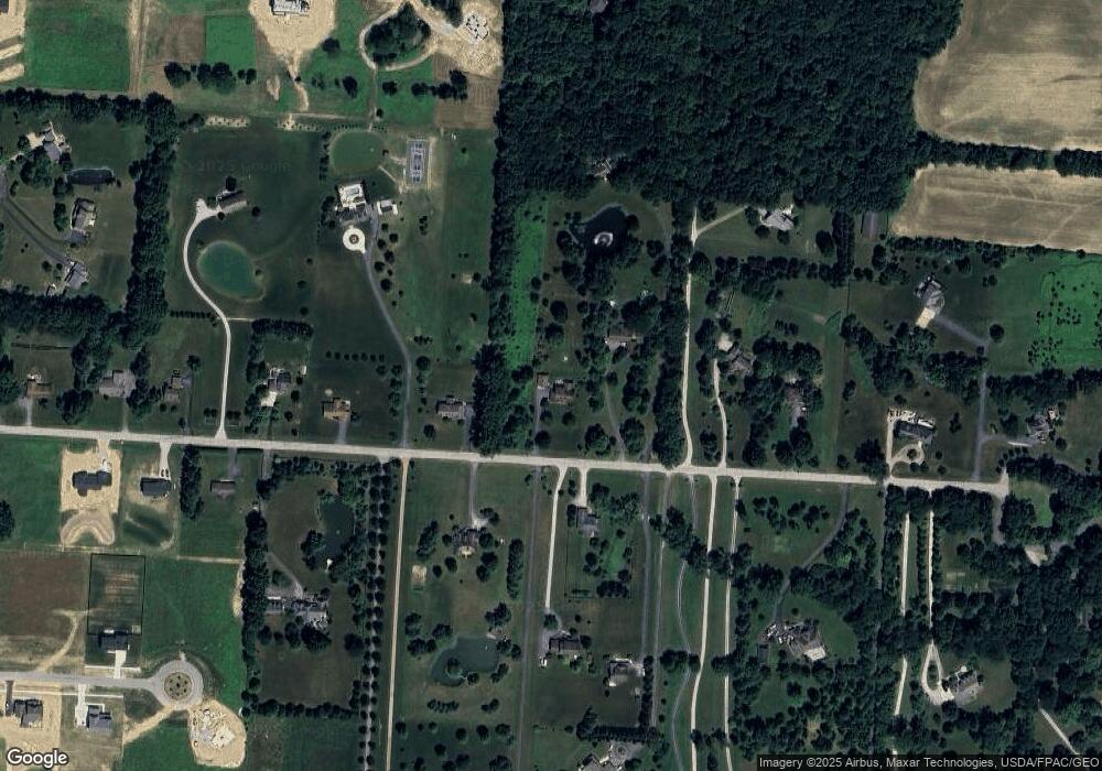
1930 Hardin Ln Powell, OH 43065
Liberty Township NeighborhoodEstimated Value: $496,000 - $593,000
4
Beds
3
Baths
2,272
Sq Ft
$247/Sq Ft
Est. Value
About This Home
This home is located at 1930 Hardin Ln, Powell, OH 43065 and is currently estimated at $561,786, approximately $247 per square foot. 1930 Hardin Ln is a home located in Delaware County with nearby schools including Liberty Tree Elementary School, Hyatts Middle School, and Olentangy Berlin High School.
Ownership History
Date
Name
Owned For
Owner Type
Purchase Details
Closed on
Feb 25, 2011
Sold by
Mcdonald Marva E and Mcdonald Pauline A
Bought by
Callicotte Michael A and Callicotte Kimberly P
Current Estimated Value
Home Financials for this Owner
Home Financials are based on the most recent Mortgage that was taken out on this home.
Original Mortgage
$180,000
Interest Rate
4.78%
Mortgage Type
Purchase Money Mortgage
Purchase Details
Closed on
Nov 22, 2005
Sold by
Lorton Michael D and Lorton Michelle R
Bought by
Mcdonald Marva E and Mcdonald Pauline A
Home Financials for this Owner
Home Financials are based on the most recent Mortgage that was taken out on this home.
Original Mortgage
$202,000
Interest Rate
6.48%
Mortgage Type
Fannie Mae Freddie Mac
Purchase Details
Closed on
Sep 30, 2004
Sold by
Steiger Philip H and Steiger Karen
Bought by
Lorton Michael D and Lorton Michele R
Home Financials for this Owner
Home Financials are based on the most recent Mortgage that was taken out on this home.
Original Mortgage
$278,000
Interest Rate
5.93%
Mortgage Type
Purchase Money Mortgage
Purchase Details
Closed on
Sep 12, 1994
Sold by
Towers Kenneth E
Bought by
Steiger Philip H and Stailey Karen R
Home Financials for this Owner
Home Financials are based on the most recent Mortgage that was taken out on this home.
Original Mortgage
$167,000
Interest Rate
8.65%
Mortgage Type
New Conventional
Create a Home Valuation Report for This Property
The Home Valuation Report is an in-depth analysis detailing your home's value as well as a comparison with similar homes in the area
Home Values in the Area
Average Home Value in this Area
Purchase History
| Date | Buyer | Sale Price | Title Company |
|---|---|---|---|
| Callicotte Michael A | $225,000 | Real Living Title | |
| Mcdonald Marva E | $302,000 | Chicago Title | |
| Lorton Michael D | $278,000 | -- | |
| Steiger Philip H | $217,000 | -- |
Source: Public Records
Mortgage History
| Date | Status | Borrower | Loan Amount |
|---|---|---|---|
| Previous Owner | Callicotte Michael A | $180,000 | |
| Previous Owner | Mcdonald Marva E | $202,000 | |
| Previous Owner | Lorton Michael D | $278,000 | |
| Previous Owner | Steiger Philip H | $167,000 |
Source: Public Records
Tax History Compared to Growth
Tax History
| Year | Tax Paid | Tax Assessment Tax Assessment Total Assessment is a certain percentage of the fair market value that is determined by local assessors to be the total taxable value of land and additions on the property. | Land | Improvement |
|---|---|---|---|---|
| 2024 | $8,894 | $169,260 | $50,120 | $119,140 |
| 2023 | $8,928 | $169,260 | $50,120 | $119,140 |
| 2022 | $7,068 | $106,190 | $35,910 | $70,280 |
| 2021 | $7,112 | $106,190 | $35,910 | $70,280 |
| 2020 | $7,146 | $106,190 | $35,910 | $70,280 |
| 2019 | $6,057 | $93,810 | $29,930 | $63,880 |
| 2018 | $6,086 | $93,810 | $29,930 | $63,880 |
| 2017 | $6,022 | $78,760 | $23,000 | $55,760 |
| 2016 | $5,441 | $78,760 | $23,000 | $55,760 |
| 2015 | $4,478 | $71,760 | $23,000 | $48,760 |
| 2014 | $4,540 | $71,760 | $23,000 | $48,760 |
| 2013 | $4,645 | $71,760 | $23,000 | $48,760 |
Source: Public Records
Map
Nearby Homes
- 2481 Clark Shaw Rd
- 5479 Fawnsbury Ct
- 5487 Fawnsbury Ct
- 5503 Fawnsbury Ct
- 5507 Fawnsbury Ct
- 2513 Clark Shaw Rd
- 5519 Fawnsbury Ct
- 5614 Dutch Ln
- 5618 Dutch Ln
- 5502 Dutch Ln
- 5480 Fawnsbury Ct
- 5484 Fawnsbury Ct
- 5488 Fawnsbury Ct
- 5622 Dutch Ln
- 5504 Fawnsbury Ct
- 5492 Fawnsbury Ct
- 5508 Fawnsbury Ct
- 5626 Dutch Ln
- 5512 Fawnsbury Ct
- 5516 Fawnsbury Ct
- 1910 Hardin Ln
- 2000 Hardin Ln
- 1925 Hardin Ln
- 1991 Hardin Ln
- 1840 Hardin Ln
- 2020 Hardin Ln
- 1890 Hardin Ln
- 1935 Hardin Ln
- 1800 Hardin Ln
- 2010 Hardin Ln
- 1860 Hardin Ln
- 2082 Hardin Ln
- 1891 Hardin Ln
- 2190 Thea Ln N Unit Tract 6
- 2085 Hardin Ln
- 1740 Hardin Ln
- 1783 Hardin Ln
- 2105 Hardin Ln
- 1730 Hardin Ln
- 2100 Hardin Ln
