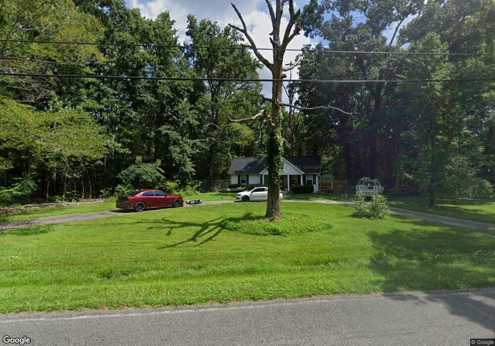
1930 Liverpool Point Rd Nanjemoy, MD 20662
Nanjemoy NeighborhoodEstimated Value: $299,000 - $342,753
--
Bed
2
Baths
1,076
Sq Ft
$301/Sq Ft
Est. Value
About This Home
This home is located at 1930 Liverpool Point Rd, Nanjemoy, MD 20662 and is currently estimated at $323,688, approximately $300 per square foot. 1930 Liverpool Point Rd is a home located in Charles County with nearby schools including Mt. Hope/Nanjemoy Elementary School, General Smallwood Middle School, and Henry E. Lackey High School.
Ownership History
Date
Name
Owned For
Owner Type
Purchase Details
Closed on
Dec 27, 2001
Sold by
Bastain David M
Bought by
Prehoda David B and Prehoda Melinda K
Current Estimated Value
Purchase Details
Closed on
Mar 27, 2000
Sold by
Goldsmith James and Goldsmith Dorrance K
Bought by
Bastain David M
Purchase Details
Closed on
Nov 23, 1999
Sold by
Federal Home Loan Mortgage Corporation
Bought by
Goldsmith James and Goldsmith Dorrance K
Purchase Details
Closed on
Nov 8, 1999
Sold by
Schlag James C and Schlag Deobrah L
Bought by
Federal Home Loan Mortgage Corporation
Create a Home Valuation Report for This Property
The Home Valuation Report is an in-depth analysis detailing your home's value as well as a comparison with similar homes in the area
Home Values in the Area
Average Home Value in this Area
Purchase History
| Date | Buyer | Sale Price | Title Company |
|---|---|---|---|
| Prehoda David B | $144,000 | -- | |
| Bastain David M | $121,500 | -- | |
| Goldsmith James | $43,000 | -- | |
| Federal Home Loan Mortgage Corporation | $50,000 | -- |
Source: Public Records
Mortgage History
| Date | Status | Borrower | Loan Amount |
|---|---|---|---|
| Closed | Bastain David M | -- |
Source: Public Records
Tax History Compared to Growth
Tax History
| Year | Tax Paid | Tax Assessment Tax Assessment Total Assessment is a certain percentage of the fair market value that is determined by local assessors to be the total taxable value of land and additions on the property. | Land | Improvement |
|---|---|---|---|---|
| 2025 | $8,190 | $247,900 | $86,000 | $161,900 |
| 2024 | $3,272 | $219,400 | $0 | $0 |
| 2023 | $2,728 | $190,900 | $0 | $0 |
| 2022 | $2,466 | $162,400 | $71,000 | $91,400 |
| 2021 | $2,420 | $162,400 | $71,000 | $91,400 |
| 2020 | $2,420 | $162,400 | $71,000 | $91,400 |
| 2019 | $2,404 | $162,500 | $66,000 | $96,500 |
| 2018 | $2,331 | $159,867 | $0 | $0 |
| 2017 | $2,289 | $157,233 | $0 | $0 |
| 2016 | -- | $154,600 | $0 | $0 |
| 2015 | $2,017 | $154,600 | $0 | $0 |
| 2014 | $2,017 | $154,600 | $0 | $0 |
Source: Public Records
Map
Nearby Homes
- 1645 Green Manor Dr
- 8905 Jacksontown Rd
- 4615 Port Tobacco Rd
- 9290 Beaverdam Rd
- 8240 Greenleek Hill Rd
- 4865 Port Tobacco Rd
- 8055 Shannon Woods Place
- 4103 Port Tobacco Rd
- 0 Sandy Point Rd Unit MDCH2033054
- 0 Poseytown Rd Unit MDCH2039212
- 7985 W Bend Place
- 3190 Poseytown Rd
- 3990 Port Tobacco Rd
- 3370 Poseytown Rd
- 3190 Mill Place
- 2844 Deer Creek Ct
- 2255 Smith Point Rd
- 4105 Hojack Place
- 7805 Hamilton Heights Place
- 0 S Side Route 224 (Chicamuxen Rd) Unit MDCH2045120
- 1960 Liverpool Point Rd
- 1940 Liverpool Point Rd
- 1885 Liverpool Point Rd
- 1950 Liverpool Point Rd
- 1980 Liverpool Point Rd
- 1970 Liverpool Point Rd
- 1875 Liverpool Point Rd
- 1965 Liverpool Point Rd
- 1835 Liverpool Point Rd
- 1985 Liverpool Point Rd
- 9250 Riverside Rd
- 2010 Liverpool Point Rd
- 2005 Liverpool Point Rd
- 2045 Liverpool Point Rd
- 9065 Riverside Rd
- 9050 Riverside Rd
- 9055 Riverside Rd
- 1782 Liverpool Point Rd
- 2105 Liverpool Point Rd
- 9030 Riverside Rd