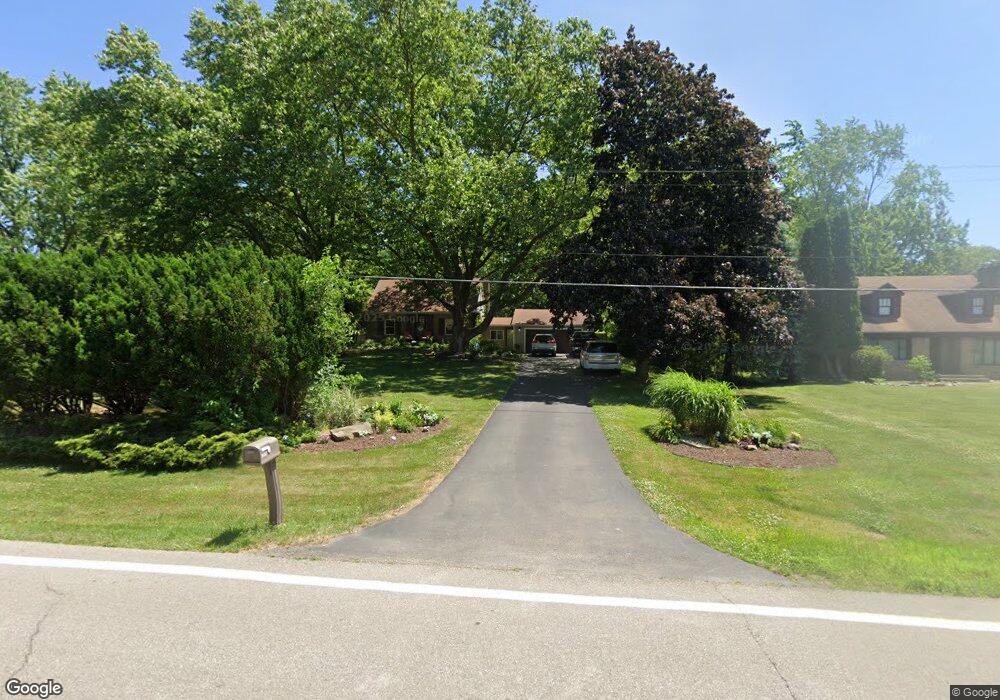
1930 Perkins Ave NE Grand Rapids, MI 49505
North East Citizens Action NeighborhoodEstimated Value: $298,516 - $356,000
3
Beds
1
Bath
1,095
Sq Ft
$310/Sq Ft
Est. Value
About This Home
This home is located at 1930 Perkins Ave NE, Grand Rapids, MI 49505 and is currently estimated at $339,379, approximately $309 per square foot. 1930 Perkins Ave NE is a home located in Kent County with nearby schools including Riverside Middle School, Union High School, and Knapp Charter Academy.
Ownership History
Date
Name
Owned For
Owner Type
Purchase Details
Closed on
Sep 29, 2006
Sold by
Carey Dianne
Bought by
Gooder Roark James and Gooder Roark Holly
Current Estimated Value
Home Financials for this Owner
Home Financials are based on the most recent Mortgage that was taken out on this home.
Original Mortgage
$123,200
Outstanding Balance
$73,638
Interest Rate
6.49%
Mortgage Type
Purchase Money Mortgage
Estimated Equity
$265,741
Purchase Details
Closed on
Apr 26, 2004
Sold by
Carey Keith
Bought by
Carey Dianne
Purchase Details
Closed on
Aug 12, 1985
Purchase Details
Closed on
Feb 29, 1980
Purchase Details
Closed on
Jan 14, 1980
Create a Home Valuation Report for This Property
The Home Valuation Report is an in-depth analysis detailing your home's value as well as a comparison with similar homes in the area
Home Values in the Area
Average Home Value in this Area
Purchase History
| Date | Buyer | Sale Price | Title Company |
|---|---|---|---|
| Gooder Roark James | $154,000 | Fatic | |
| Carey Dianne | -- | -- | |
| -- | $47,500 | -- | |
| -- | $36,000 | -- | |
| -- | $36,000 | -- |
Source: Public Records
Mortgage History
| Date | Status | Borrower | Loan Amount |
|---|---|---|---|
| Open | Gooder Roark James | $123,200 |
Source: Public Records
Tax History Compared to Growth
Tax History
| Year | Tax Paid | Tax Assessment Tax Assessment Total Assessment is a certain percentage of the fair market value that is determined by local assessors to be the total taxable value of land and additions on the property. | Land | Improvement |
|---|---|---|---|---|
| 2025 | $2,345 | $146,000 | $0 | $0 |
| 2024 | $2,345 | $136,000 | $0 | $0 |
| 2023 | $2,380 | $130,500 | $0 | $0 |
| 2022 | $2,259 | $117,800 | $0 | $0 |
| 2021 | $2,209 | $115,200 | $0 | $0 |
| 2020 | $2,112 | $106,800 | $0 | $0 |
| 2019 | $2,211 | $102,000 | $0 | $0 |
| 2018 | $2,136 | $94,000 | $0 | $0 |
| 2017 | $2,080 | $82,600 | $0 | $0 |
| 2016 | $2,104 | $79,900 | $0 | $0 |
| 2015 | $1,957 | $79,900 | $0 | $0 |
| 2013 | -- | $74,600 | $0 | $0 |
Source: Public Records
Map
Nearby Homes
- 2016 Tall Meadow St NE
- 2037 Tall Meadow St NE Unit 13
- 2041 Krislin St
- 2058 Ken Ade St NE Unit 147
- 2324 Whimbrel Ct NE
- 2112 Jo Dean Ct NE
- 1600 Cherry Hill Dr NE
- 1759 Briarcliff Dr NE
- 2151 Chelsea Rd NE
- 2753 Dean Lake Ave NE
- 1524 Sweet St NE
- 1739 Waldorn Ave NE
- 2420 Hylane Ct NE
- 1336 Banbury Ave NE
- 1455 Ball Ave NE
- 1410 Rothbury Dr NE
- 2353 Midvale St NE
- 1444 Sweet St NE
- 1261 Banbury Ave NE
- 1250 Walwood Dr NE
- 1920 Perkins Ave NE
- 1950 Perkins Ave NE
- 2020 Knapp St NE
- 1941 Perkins Ave NE
- 1888 Perkins Ave NE
- 1925 Perkins Ave NE
- 2000 Knapp St NE
- 2070 Knapp St NE
- 1909 Perkins Ave NE
- 1961 Perkins Ave NE
- 1874 Perkins Ave NE
- 1990 Perkins Ave NE
- 1885 Perkins Ave NE
- 1985 Perkins Ave NE
- 1980 Knapp St NE
- 2088 Knapp St NE
- 1950 Knapp St NE
- 1865 Perkins Ave NE
- 2076 Knapp St NE
- 2100 Knapp St NE
