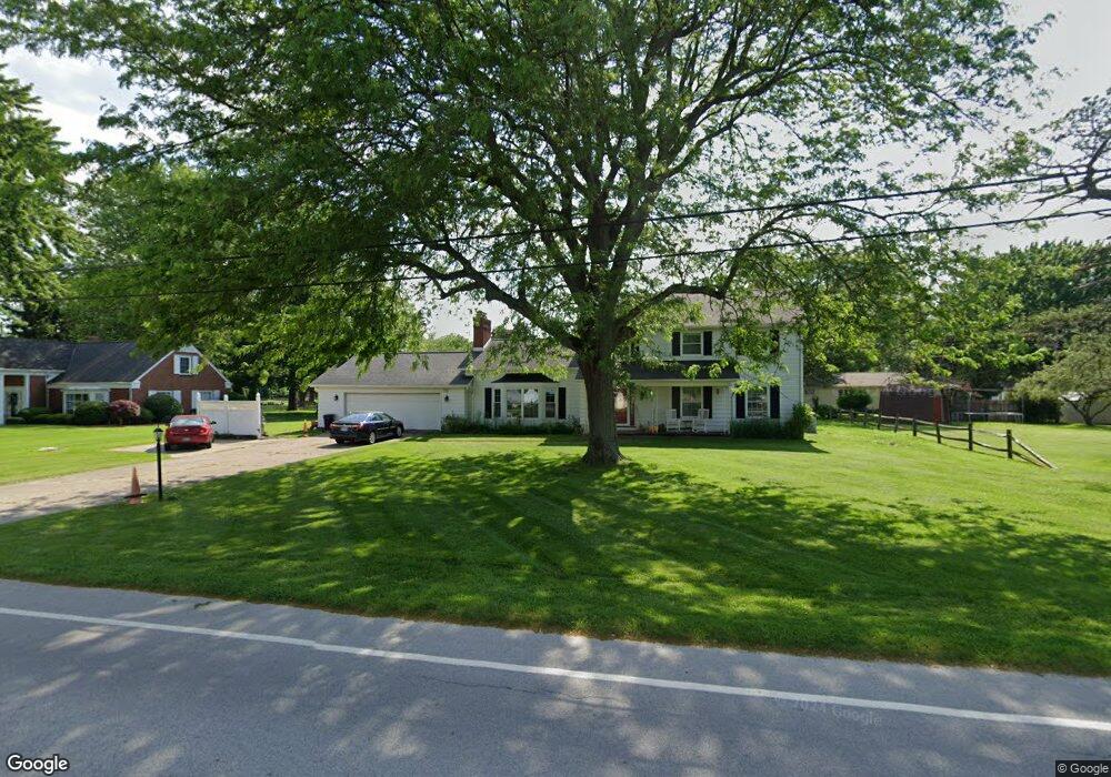
1930 Port Clinton Rd Fremont, OH 43420
Estimated Value: $320,000 - $339,533
4
Beds
3
Baths
2,979
Sq Ft
$112/Sq Ft
Est. Value
About This Home
This home is located at 1930 Port Clinton Rd, Fremont, OH 43420 and is currently estimated at $332,178, approximately $111 per square foot. 1930 Port Clinton Rd is a home located in Sandusky County with nearby schools including Fremont Ross High School, St. Ann Catholic School, and St. Joseph School.
Ownership History
Date
Name
Owned For
Owner Type
Purchase Details
Closed on
Oct 11, 2001
Sold by
Trustcorp Bank Ohio Trust
Bought by
Paulson Ross and Paulson Debra
Current Estimated Value
Home Financials for this Owner
Home Financials are based on the most recent Mortgage that was taken out on this home.
Original Mortgage
$160,000
Outstanding Balance
$63,087
Interest Rate
6.99%
Mortgage Type
New Conventional
Estimated Equity
$269,091
Purchase Details
Closed on
Sep 1, 1989
Sold by
Paulson Ross and Debra Or
Bought by
Paulson Ross and Paulson Debra
Purchase Details
Closed on
Sep 1, 1983
Bought by
Paulson Ross and Paulson Debra
Create a Home Valuation Report for This Property
The Home Valuation Report is an in-depth analysis detailing your home's value as well as a comparison with similar homes in the area
Home Values in the Area
Average Home Value in this Area
Purchase History
| Date | Buyer | Sale Price | Title Company |
|---|---|---|---|
| Paulson Ross | $188,250 | -- | |
| Paulson Ross | -- | -- | |
| Paulson Ross | $140,000 | -- |
Source: Public Records
Mortgage History
| Date | Status | Borrower | Loan Amount |
|---|---|---|---|
| Open | Paulson Ross | $160,000 |
Source: Public Records
Tax History Compared to Growth
Tax History
| Year | Tax Paid | Tax Assessment Tax Assessment Total Assessment is a certain percentage of the fair market value that is determined by local assessors to be the total taxable value of land and additions on the property. | Land | Improvement |
|---|---|---|---|---|
| 2024 | $4,115 | $109,240 | $15,790 | $93,450 |
| 2023 | $4,115 | $86,000 | $12,430 | $73,570 |
| 2022 | $3,443 | $86,000 | $12,430 | $73,570 |
| 2021 | $3,958 | $86,000 | $12,430 | $73,570 |
| 2020 | $3,420 | $71,720 | $12,430 | $59,290 |
| 2019 | $3,446 | $71,720 | $12,430 | $59,290 |
| 2018 | $3,451 | $71,720 | $12,430 | $59,290 |
| 2017 | $3,343 | $68,890 | $12,430 | $56,460 |
| 2016 | $2,997 | $68,890 | $12,430 | $56,460 |
| 2015 | $2,956 | $68,890 | $12,430 | $56,460 |
| 2014 | $3,057 | $68,250 | $14,210 | $54,040 |
| 2013 | $3,001 | $68,250 | $14,210 | $54,040 |
Source: Public Records
Map
Nearby Homes
- 1730 Port Clinton Rd Unit 41
- 1730 Port Clinton Rd
- 1730 Port Clinton Rd Unit 33
- 0 Sean Dr
- Outlot A Sean Dr
- 711 Bloom Rd
- 2100 Ohio 53
- 900 Spring St
- 612 2nd St
- 533 Sandusky Ave Unit 535
- 1441 White Ave
- 711 Rawson Ave
- 433 Sandusky Ave
- 1227 White Ave
- 340 340 Sandusky Ave
- 516 N Front St
- 1548 North St
- 2219 Oak Harbor Rd
- 224 Sandusky Ave Unit 226
- 818 Franklin Ave
- 1957 Melody Dr
- 1924 Port Clinton Rd
- 1944 Port Clinton Rd
- 1961 Melody Dr
- 1951 Melody Dr
- 1939 Port Clinton Rd
- 1929 Port Clinton Rd
- 427 Kingsgate Dr
- 1919 Port Clinton Rd
- 1945 Melody Dr
- 1900 Port Clinton Rd
- 1912 Whittaker Dr
- 1934 Whittaker Dr
- 1886 Port Clinton Rd
- 1956 Melody Dr
- 2017 Port Clinton Rd
- 416 Kingsgate Dr
- 1960 Melody Dr
- 1940 Melody Dr
- 1939 Melody Dr