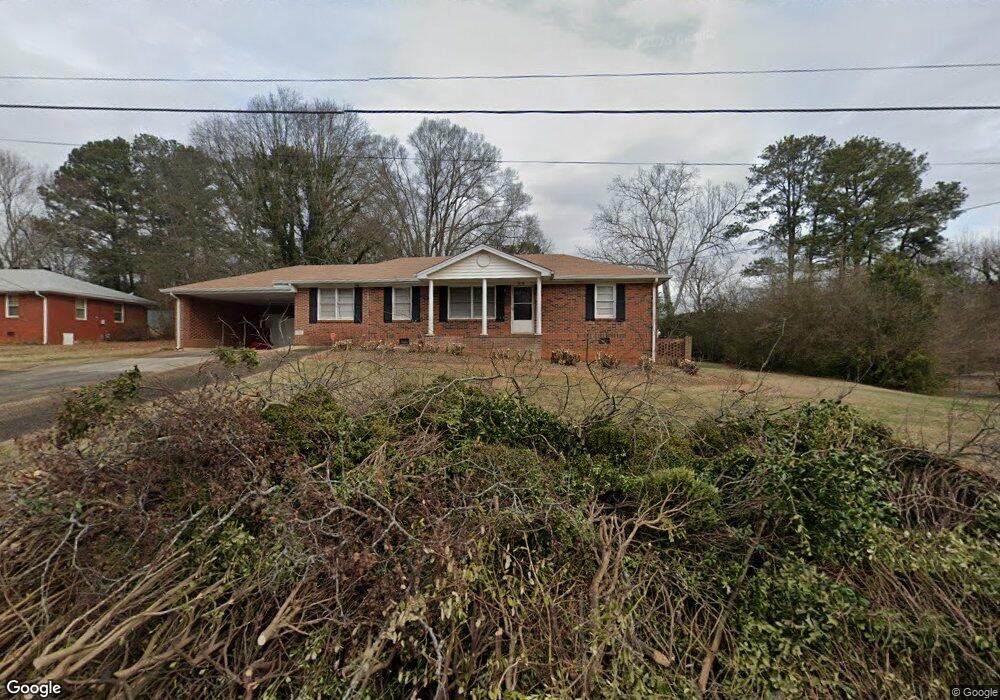
1930 Russton Dr SW Mableton, GA 30126
Estimated Value: $219,000 - $346,000
2
Beds
1
Bath
1,325
Sq Ft
$192/Sq Ft
Est. Value
About This Home
This home is located at 1930 Russton Dr SW, Mableton, GA 30126 and is currently estimated at $254,105, approximately $191 per square foot. 1930 Russton Dr SW is a home located in Cobb County with nearby schools including Deerwood Elementary School, Sunrise Elementary School, and Sanders Elementary School.
Ownership History
Date
Name
Owned For
Owner Type
Purchase Details
Closed on
Jun 9, 2016
Sold by
Dalton Diane
Bought by
Adkins Property And Investments Llc
Current Estimated Value
Purchase Details
Closed on
Oct 1, 2003
Sold by
Mcmillian Libble W
Bought by
Dalton Diane
Home Financials for this Owner
Home Financials are based on the most recent Mortgage that was taken out on this home.
Original Mortgage
$100,700
Interest Rate
6.07%
Mortgage Type
New Conventional
Create a Home Valuation Report for This Property
The Home Valuation Report is an in-depth analysis detailing your home's value as well as a comparison with similar homes in the area
Home Values in the Area
Average Home Value in this Area
Purchase History
| Date | Buyer | Sale Price | Title Company |
|---|---|---|---|
| Adkins Property And Investments Llc | $90,000 | -- | |
| Dalton Diane | $100,700 | -- |
Source: Public Records
Mortgage History
| Date | Status | Borrower | Loan Amount |
|---|---|---|---|
| Previous Owner | Dalton Diane | $100,700 |
Source: Public Records
Tax History Compared to Growth
Tax History
| Year | Tax Paid | Tax Assessment Tax Assessment Total Assessment is a certain percentage of the fair market value that is determined by local assessors to be the total taxable value of land and additions on the property. | Land | Improvement |
|---|---|---|---|---|
| 2025 | $2,644 | $87,740 | $24,000 | $63,740 |
| 2024 | $2,645 | $87,740 | $24,000 | $63,740 |
| 2023 | $2,308 | $76,556 | $14,000 | $62,556 |
| 2022 | $2,323 | $76,556 | $14,000 | $62,556 |
| 2021 | $1,553 | $51,180 | $14,000 | $37,180 |
| 2020 | $1,553 | $51,180 | $14,000 | $37,180 |
| 2019 | $1,253 | $41,284 | $16,000 | $25,284 |
| 2018 | $1,061 | $34,956 | $12,000 | $22,956 |
| 2017 | $1,005 | $34,956 | $12,000 | $22,956 |
| 2016 | $157 | $22,660 | $8,000 | $14,660 |
| 2015 | $173 | $23,112 | $9,600 | $13,512 |
| 2014 | $176 | $23,112 | $0 | $0 |
Source: Public Records
Map
Nearby Homes
- 4882 Golden Dr SW
- Bayberry Plan at Sawmill Creek - Bungalow Series
- Wisteria Plan at Sawmill Creek - Bungalow Series
- Redbud Plan at Sawmill Creek - Bungalow Series
- 5164 Medford Ln
- 5154 Medford Ln
- 2179 Warren Dr
- Laurel Plan at Avenbrook
- Rosedale Plan at Avenbrook
- Fulmont at Avenbrook Plan at Avenbrook
- Addison Plan at Avenbrook
- Conley Plan at Avenbrook
- 1943 Arnold Dr
- 1645 Fulmont Cir
- 4809 Hemlock Dr
- 1675 Huntcrest Park SW
- 1 Perkerson Mill Rd SW
- 1971 Annette Ln
- 2125 Clay Rd SW
- 2236 Clay Rd
- 1920 Russton Dr SW
- 1948 Russton Dr SW
- 1933 Clay Rd SW
- 1910 Russton Dr SW
- 1941 Russton Dr SW
- 0 Russton Dr SW Unit 7490731
- 0 Russton Dr SW Unit 7423176
- 0 Russton Dr SW
- 1913 Clay Rd SW
- 1947 Russton Dr SW
- 1862 Posten Ln SW
- 1943 Clay Rd SW
- 1894 Russton Dr SW
- 1903 Clay Rd SW
- 1903 Clay Rd SW Unit 230-434
- 1861 Posten Ln SW Unit 10
- 1861 Posten Ln SW
- 1895 Russton Dr SW
- 1880 Russton Dr SW
- 1891 Clay Rd SW