Estimated Value: $297,000 - $469,000
--
Bed
--
Bath
1
Sq Ft
$383,640/Sq Ft
Est. Value
About This Home
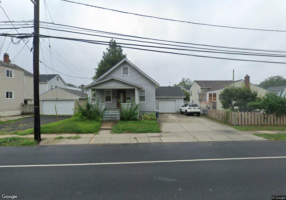
This home is located at 1930 Vauxhall Rd, Union, NJ 07083 and is currently estimated at $383,640, approximately $383,640 per square foot. 1930 Vauxhall Rd is a home located in Union County with nearby schools including Connecticut Farms Elementary School, Union High School, and St Michael Parish School.
Ownership History
Date
Name
Owned For
Owner Type
Purchase Details
Closed on
Mar 25, 2004
Sold by
Mertel Elizabeth
Bought by
Antunes Jose
Current Estimated Value
Home Financials for this Owner
Home Financials are based on the most recent Mortgage that was taken out on this home.
Original Mortgage
$185,000
Outstanding Balance
$84,823
Interest Rate
5.4%
Estimated Equity
$298,817
Create a Home Valuation Report for This Property
The Home Valuation Report is an in-depth analysis detailing your home's value as well as a comparison with similar homes in the area
Home Values in the Area
Average Home Value in this Area
Purchase History
| Date | Buyer | Sale Price | Title Company |
|---|---|---|---|
| Antunes Jose | $205,000 | -- |
Source: Public Records
Mortgage History
| Date | Status | Borrower | Loan Amount |
|---|---|---|---|
| Open | Antunes Jose | $185,000 |
Source: Public Records
Tax History Compared to Growth
Tax History
| Year | Tax Paid | Tax Assessment Tax Assessment Total Assessment is a certain percentage of the fair market value that is determined by local assessors to be the total taxable value of land and additions on the property. | Land | Improvement |
|---|---|---|---|---|
| 2025 | $8,270 | $37,000 | $20,000 | $17,000 |
| 2024 | $8,018 | $37,000 | $20,000 | $17,000 |
| 2023 | $8,018 | $37,000 | $20,000 | $17,000 |
| 2022 | $7,739 | $37,000 | $20,000 | $17,000 |
| 2021 | $7,551 | $37,000 | $20,000 | $17,000 |
| 2020 | $7,401 | $37,000 | $20,000 | $17,000 |
| 2019 | $7,301 | $37,000 | $20,000 | $17,000 |
| 2018 | $7,177 | $37,000 | $20,000 | $17,000 |
| 2017 | $7,071 | $37,000 | $20,000 | $17,000 |
| 2016 | $6,898 | $37,000 | $20,000 | $17,000 |
| 2015 | $6,784 | $37,000 | $20,000 | $17,000 |
| 2014 | $6,632 | $37,000 | $20,000 | $17,000 |
Source: Public Records
Map
Nearby Homes
- 987 Floyd Terrace
- 1244 Grandview Ave
- 152 Glenwood Ct
- 843 Boyd Ave
- 1263 Coolidge Ave
- 1239 Victor Ave
- 7 Jessica Ln
- 2010 Gless Ave
- 1249 Plane St
- 1893 Arbor Ln
- 926 Floyd Terrace
- 1287 Oxford Ln
- 1848 Portsmouth Way
- 1035 Pine Ave
- 1084 Pine Ave
- 1329 Camden Ct
- 1871 Pilgrim Way
- 937 Roosevelt Ave
- 2112 Gless Ave
- 2021 Tyler St
- 1041 Adams Ave
- 1035 Adams Ave
- 1038 Harding Ave
- 1044 Harding Ave
- 1033 Adams Ave
- 1034 Harding Ave
- 1927 Vauxhall Rd
- 1029 Adams Ave
- 1933 Vauxhall Rd
- 1028 Harding Ave
- 1027 Adams Ave
- 1038 Adams Ave
- 1939 Vauxhall Rd
- 1939 Vauxhall Rd Unit 1R
- 1939 Vauxhall Rd Unit 1-Lf
- 1939 Vauxhall Rd Unit 1L
- 1942 Vauxhall Rd
- 1034 Adams Ave
- 1024 Harding Ave
- 1023 Adams Ave