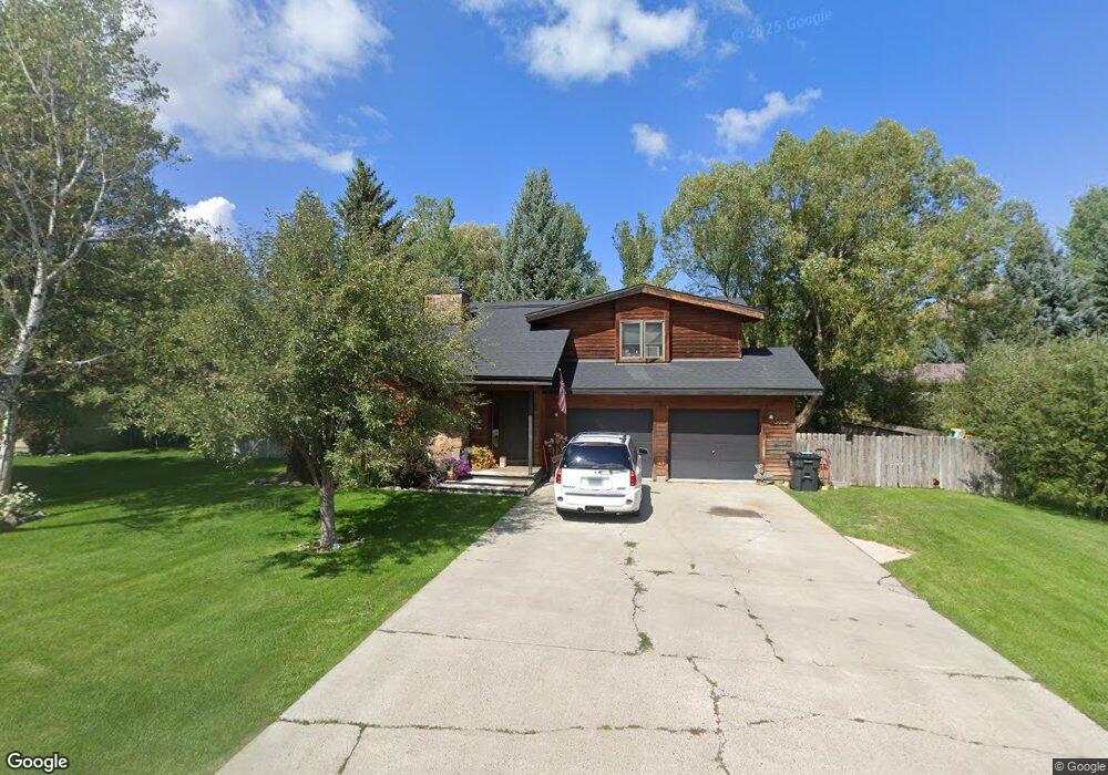
1930 W Buck Rail Rd Jackson, WY 83001
Estimated Value: $1,632,416 - $1,881,000
3
Beds
3
Baths
1,620
Sq Ft
$1,061/Sq Ft
Est. Value
About This Home
This home is located at 1930 W Buck Rail Rd, Jackson, WY 83001 and is currently estimated at $1,718,472, approximately $1,060 per square foot. 1930 W Buck Rail Rd is a home located in Teton County with nearby schools including Colter Elementary School, Jackson Hole Middle School, and Jackson Hole High School.
Ownership History
Date
Name
Owned For
Owner Type
Purchase Details
Closed on
Nov 16, 2005
Sold by
Daniels Christopher A and Daniels Sarah L
Bought by
Dutro Jerry and Dutro Christi
Current Estimated Value
Purchase Details
Closed on
Sep 22, 2005
Sold by
Cendant Mobility Services Corp
Bought by
Daniels Christopher A and Daniels Sarah L
Purchase Details
Closed on
Aug 25, 2005
Sold by
Nolan Robert J and Nolan Annica M
Bought by
Cendant Mobility Services Corp
Create a Home Valuation Report for This Property
The Home Valuation Report is an in-depth analysis detailing your home's value as well as a comparison with similar homes in the area
Home Values in the Area
Average Home Value in this Area
Purchase History
| Date | Buyer | Sale Price | Title Company |
|---|---|---|---|
| Dutro Jerry | -- | First American Title Insuran | |
| Daniels Christopher A | -- | First American Title Insuran | |
| Cendant Mobility Services Corp | -- | First American Title Insuran |
Source: Public Records
Tax History Compared to Growth
Tax History
| Year | Tax Paid | Tax Assessment Tax Assessment Total Assessment is a certain percentage of the fair market value that is determined by local assessors to be the total taxable value of land and additions on the property. | Land | Improvement |
|---|---|---|---|---|
| 2025 | $9,784 | $124,430 | $41,722 | $82,708 |
| 2024 | $9,784 | $158,960 | $49,685 | $109,275 |
| 2023 | $9,687 | $158,413 | $39,900 | $118,513 |
| 2022 | $8,186 | $132,930 | $39,900 | $93,030 |
| 2021 | $5,857 | $89,722 | $39,900 | $49,822 |
| 2020 | $4,935 | $80,012 | $29,230 | $50,782 |
| 2019 | $4,469 | $70,428 | $29,230 | $41,198 |
| 2018 | $4,319 | $68,519 | $29,230 | $39,289 |
| 2017 | $4,371 | $64,616 | $28,497 | $36,119 |
| 2016 | $3,980 | $57,921 | $20,813 | $37,108 |
| 2015 | $2,553 | $53,768 | $20,813 | $32,955 |
| 2014 | $2,553 | $43,754 | $28,842 | $14,912 |
| 2013 | $2,553 | $43,754 | $28,842 | $14,912 |
Source: Public Records
Map
Nearby Homes
- 3150 W King Eider Rd
- 1655 W Big Trail Dr Unit 603
- 3055 S Bridle Dr
- 120 Rd
- 1275 W Bull Rake Dr
- 1160 W Brangus Dr
- 1185 W Hay Sled Dr
- 1312 Melody Creek Ln
- 3755 Trail Dr
- 4150,4200 S Hufsmith Hill Rd
- 4215 S Kestrel Ln
- 2655 3 Creek Dr
- 4120 Sandy Creek Ln
- 3900 S Trail Dr
- 2700 W Peregrine Ln
- 1115 Melody Creek Ln
- 3850 S Meadow Dr
- 2780 Raptor View Ln
- 4255 Polo Pony Rd
- 2340 S Blue Crane Dr
- 1940 W Buck Rail Rd
- 1920 W Buck Rail Rd
- 1920 W Homestead Dr
- 1930 W Homestead Dr
- 1945 W Buck Rail Rd
- 1910 W Homestead Dr
- 1950 W Buck Rail Rd
- 1940 W Homestead Dr
- 1910 W Buck Rail Rd
- 1915 W Buck Rail Rd
- 1900 W Homestead Dr
- 3425 S Hay Loft Dr
- 1960 W Buck Rail Rd
- 1955 W Buck Rail Rd
- 1950 W Homestead Dr
- 1925 W Homestead Dr
- 1900 W Buck Rail Rd
- 3435 S Hay Loft Dr
- 1900 W Buck Rail Dr
- 1935 W Homestead Dr