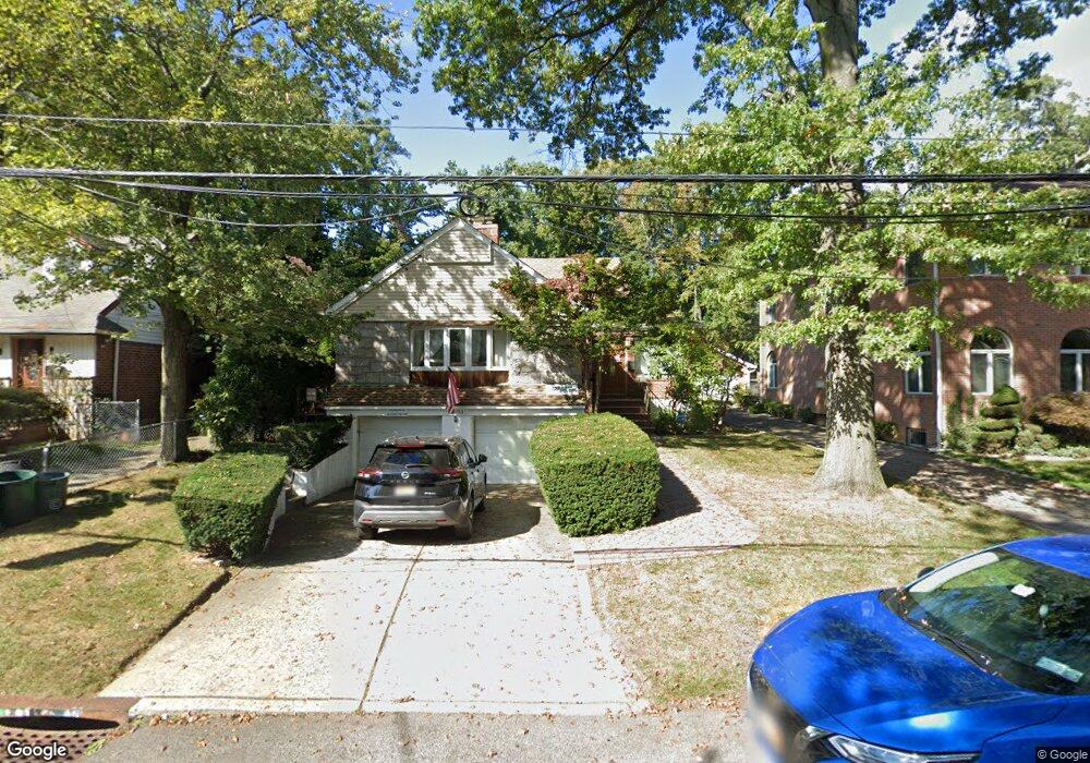
19303 85th Rd Hollis, NY 11423
Holliswood NeighborhoodEstimated Value: $1,423,000 - $1,475,000
--
Bed
--
Bath
2,318
Sq Ft
$626/Sq Ft
Est. Value
About This Home
This home is located at 19303 85th Rd, Hollis, NY 11423 and is currently estimated at $1,451,612, approximately $626 per square foot. 19303 85th Rd is a home located in Queens County with nearby schools including P.S. I.S. 178 The Holliswood School, George J. Ryan Middle School 216, and The Wellspring Schools.
Ownership History
Date
Name
Owned For
Owner Type
Purchase Details
Closed on
Dec 31, 2009
Sold by
Ben-Levi Nili and Ben-Levi Yacov
Bought by
Shai Llc
Current Estimated Value
Purchase Details
Closed on
Nov 5, 2008
Sold by
Saxon Mortgage Services Inc
Bought by
Ben Levi Nili and Ben Levi Yocov
Purchase Details
Closed on
Jul 25, 2008
Sold by
Gary C Di Leonardo Esq Referee
Bought by
Saxon Mortgage Services Inc
Purchase Details
Closed on
Jan 18, 2007
Sold by
St Fleur Laura
Bought by
Powerhouse Holdings Corp
Create a Home Valuation Report for This Property
The Home Valuation Report is an in-depth analysis detailing your home's value as well as a comparison with similar homes in the area
Home Values in the Area
Average Home Value in this Area
Purchase History
| Date | Buyer | Sale Price | Title Company |
|---|---|---|---|
| Shai Llc | -- | -- | |
| Ben Levi Nili | $461,000 | -- | |
| Saxon Mortgage Services Inc | $967,084 | -- | |
| Powerhouse Holdings Corp | -- | -- |
Source: Public Records
Tax History Compared to Growth
Tax History
| Year | Tax Paid | Tax Assessment Tax Assessment Total Assessment is a certain percentage of the fair market value that is determined by local assessors to be the total taxable value of land and additions on the property. | Land | Improvement |
|---|---|---|---|---|
| 2025 | $9,823 | $50,458 | $12,392 | $38,066 |
| 2024 | $9,823 | $48,905 | $14,386 | $34,519 |
| 2023 | $9,267 | $46,138 | $13,171 | $32,967 |
| 2022 | $8,445 | $70,080 | $20,880 | $49,200 |
| 2021 | $8,849 | $58,080 | $20,880 | $37,200 |
| 2020 | $8,900 | $61,560 | $20,880 | $40,680 |
| 2019 | $8,525 | $67,800 | $20,880 | $46,920 |
| 2018 | $7,838 | $38,448 | $15,704 | $22,744 |
| 2017 | $7,571 | $37,142 | $16,786 | $20,356 |
| 2016 | $7,005 | $37,142 | $16,786 | $20,356 |
| 2015 | $4,317 | $35,999 | $20,279 | $15,720 |
| 2014 | $4,317 | $33,962 | $20,504 | $13,458 |
Source: Public Records
Map
Nearby Homes
- 193-03 85th Rd
- 195-12 Mclaughlin Ave
- 193-55 85th Rd
- 19346 Mclaughlin Ave
- 19512 Mclaughlin Ave
- 195-22 Mclaughlin Ave
- 190-22 Nero Ave
- 19615 Como Ave
- 18631 Radnor Rd
- 186-31 Radnor Rd
- 81-51 189th St
- 19703 Mclaughlin Ave
- 8601 Marengo St
- 86-55 Santiago St
- 184-51 Hovenden Rd
- 8702 Chevy Chase St
- 8714 Santiago St
- 8684 188th St
- 8716 Palo Alto St
- 198-16 Mclaughlin Ave