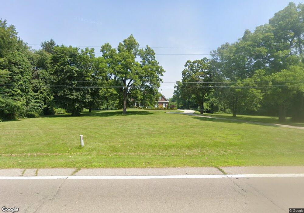
19305 Savage Rd Belleville, MI 48111
Estimated Value: $543,000 - $660,000
--
Bed
1
Bath
3,222
Sq Ft
$191/Sq Ft
Est. Value
About This Home
This home is located at 19305 Savage Rd, Belleville, MI 48111 and is currently estimated at $614,946, approximately $190 per square foot. 19305 Savage Rd is a home located in Wayne County with nearby schools including Huron High School, St John's Lutheran School, and St. Stephen Elementary School.
Ownership History
Date
Name
Owned For
Owner Type
Purchase Details
Closed on
Mar 7, 2016
Sold by
Summitt Gregory S and Summitt Charmion M
Bought by
Gregory S Summitt Trust
Current Estimated Value
Purchase Details
Closed on
Jul 1, 2005
Sold by
Koren Carey Dan S and Koren Carey
Bought by
Harris George A
Purchase Details
Closed on
Dec 2, 2004
Sold by
Carey Robert and Carey Mary Lou
Bought by
Carey Dan and Carey Koren
Purchase Details
Closed on
Aug 4, 2003
Sold by
Estate Of Janet Michalik
Bought by
Carey Robert and Carey Mary Lou
Create a Home Valuation Report for This Property
The Home Valuation Report is an in-depth analysis detailing your home's value as well as a comparison with similar homes in the area
Home Values in the Area
Average Home Value in this Area
Purchase History
| Date | Buyer | Sale Price | Title Company |
|---|---|---|---|
| Gregory S Summitt Trust | $1,002 | Attorney | |
| Harris George A | $110,000 | None Available | |
| Carey Dan | -- | 1St Security Title Agency In | |
| Carey Robert | $190,000 | Stewart Title |
Source: Public Records
Tax History Compared to Growth
Tax History
| Year | Tax Paid | Tax Assessment Tax Assessment Total Assessment is a certain percentage of the fair market value that is determined by local assessors to be the total taxable value of land and additions on the property. | Land | Improvement |
|---|---|---|---|---|
| 2025 | $3,939 | $329,500 | $0 | $0 |
| 2024 | $3,939 | $305,000 | $0 | $0 |
| 2023 | $3,757 | $292,700 | $0 | $0 |
| 2022 | $6,449 | $245,200 | $0 | $0 |
| 2021 | $6,253 | $229,300 | $0 | $0 |
| 2020 | $6,177 | $226,400 | $0 | $0 |
| 2019 | $5,903 | $201,800 | $0 | $0 |
| 2018 | $3,283 | $202,800 | $0 | $0 |
| 2017 | $4,856 | $185,900 | $0 | $0 |
| 2016 | $5,366 | $179,600 | $0 | $0 |
| 2015 | $13,574 | $171,000 | $0 | $0 |
| 2013 | $13,150 | $131,500 | $0 | $0 |
| 2012 | -- | $131,500 | $24,200 | $107,300 |
Source: Public Records
Map
Nearby Homes
- 17978 Tall Oaks Ct
- 18736 Huron River Dr
- 18460 Savage Rd
- 17966 Tall Oaks Ct
- 17401 Hannan Rd
- 37459 N Dianne Ln
- 36928 Ellis St
- 17452 Ava Ct Unit 105
- 37419 Theresa Ln
- Peninsula Plan at Hawthorne Woods
- Larch II Plan at Hawthorne Woods
- Nantucket Plan at Hawthorne Woods
- Enclave II Plan at Hawthorne Woods
- Enclave Plan at Hawthorne Woods
- Greenwich Plan at Hawthorne Woods
- Larch Plan at Hawthorne Woods
- Columbia Plan at Hawthorne Woods
- Madison Plan at Hawthorne Woods
- Townsend Plan at Hawthorne Woods
- Oakhurst Plan at Hawthorne Woods
- 19275 Savage Rd
- 19255 Savage Rd
- 19225 Savage Rd
- 19250 Savage Rd
- 19280 Savage Rd
- 19383 Savage Rd
- 00000 Willis Rd
- 00 Willis Rd
- 000 Willis Rd
- 0000 Willis Rd
- 19260 Savage Rd
- 19270 Savage Rd
- 19407 Savage Rd
- 19240 Savage Rd
- 19208 Savage Rd
- 19230 Savage Rd
- 19190 Savage Rd
- 19439 Savage Rd
- 19176 Savage Rd
- 19480 Savage Rd