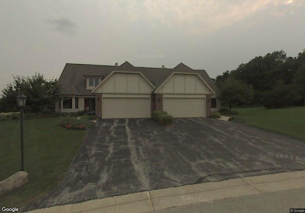
19305 W Mc Allister Ln Unit B Brookfield, WI 53045
Estimated Value: $460,000 - $536,000
3
Beds
3
Baths
2,327
Sq Ft
$209/Sq Ft
Est. Value
About This Home
This home is located at 19305 W Mc Allister Ln Unit B, Brookfield, WI 53045 and is currently estimated at $487,474, approximately $209 per square foot. 19305 W Mc Allister Ln Unit B is a home located in Waukesha County with nearby schools including Hillcrest Elementary School, Horning Middle School, and South High School.
Ownership History
Date
Name
Owned For
Owner Type
Purchase Details
Closed on
Dec 2, 2021
Sold by
Schmitt Trust
Bought by
Sullivan Aimee L
Current Estimated Value
Home Financials for this Owner
Home Financials are based on the most recent Mortgage that was taken out on this home.
Original Mortgage
$296,000
Outstanding Balance
$272,169
Interest Rate
3.09%
Mortgage Type
New Conventional
Estimated Equity
$215,305
Purchase Details
Closed on
May 14, 2018
Sold by
Schmitt James J
Bought by
Schmitt James J and The Schmitt Revocable Trust
Purchase Details
Closed on
Aug 11, 2000
Sold by
Matchette Joanne V
Bought by
Schmitt James J and Schmitt Marcella M
Home Financials for this Owner
Home Financials are based on the most recent Mortgage that was taken out on this home.
Original Mortgage
$170,000
Interest Rate
8.24%
Create a Home Valuation Report for This Property
The Home Valuation Report is an in-depth analysis detailing your home's value as well as a comparison with similar homes in the area
Home Values in the Area
Average Home Value in this Area
Purchase History
| Date | Buyer | Sale Price | Title Company |
|---|---|---|---|
| Sullivan Aimee L | $370,000 | None Available | |
| Schmitt James J | -- | None Available | |
| Schmitt James J | $282,000 | -- |
Source: Public Records
Mortgage History
| Date | Status | Borrower | Loan Amount |
|---|---|---|---|
| Open | Sullivan Aimee L | $296,000 | |
| Previous Owner | Schmitt James J | $170,000 |
Source: Public Records
Tax History Compared to Growth
Tax History
| Year | Tax Paid | Tax Assessment Tax Assessment Total Assessment is a certain percentage of the fair market value that is determined by local assessors to be the total taxable value of land and additions on the property. | Land | Improvement |
|---|---|---|---|---|
| 2024 | $4,351 | $437,700 | $100,000 | $337,700 |
| 2023 | $4,344 | $437,700 | $100,000 | $337,700 |
| 2022 | $4,600 | $343,800 | $90,000 | $253,800 |
| 2021 | $4,655 | $343,800 | $90,000 | $253,800 |
| 2020 | $4,779 | $343,800 | $90,000 | $253,800 |
| 2019 | $4,693 | $343,800 | $90,000 | $253,800 |
| 2018 | $4,257 | $311,300 | $70,000 | $241,300 |
| 2017 | $5,018 | $311,300 | $70,000 | $241,300 |
| 2016 | $4,573 | $311,300 | $70,000 | $241,300 |
| 2015 | $4,354 | $311,300 | $70,000 | $241,300 |
| 2014 | $4,723 | $311,300 | $70,000 | $241,300 |
| 2013 | $4,723 | $311,300 | $70,000 | $241,300 |
Source: Public Records
Map
Nearby Homes
- 19450 Whitehall Dr
- 655 Mac Henry Cir Unit B
- 935 Auburn Ct
- Lt1 Davidson Rd
- 18740 Emerald Cir Unit E
- 18525 Emerald Cir
- 1405 S Westwoods Rd
- 165 Aerie Cir Unit 104
- 165 Aerie Cir Unit 106
- 165 Aerie Cir Unit 105
- 165 Aerie Cir Unit 102
- 18600 Brookfield Lake Dr Unit 53
- 17900 Anthony Ln
- 745 Hi Ridge Ave
- 19000 Toldt Woods Dr Unit 39
- 18415 W Wisconsin Ave Unit 18415
- 17525 Tremont St
- 1650 S Lilly Ln
- 730 Lois Ave
- 890 Janacek Rd
- 19305 W Mc Allister Ln Unit A
- 19305 Mcallister Ln Unit B
- 19315 W Mc Allister Ln Unit B
- 19315 W Mc Allister Ln Unit A
- 19300 W Mc Allister Ln Unit A
- 19300 W Mc Allister Ln Unit B
- 19295 W Mc Allister Ln Unit A
- 19295 W Mc Allister Ln Unit B
- 19325 W Mc Allister Ln Unit A
- 19325 W Mc Allister Ln Unit B
- 725 Weston Hills Dr
- 19255 W Mc Allister Ln Unit A
- 19255 W Mc Allister Ln
- 19255 Mcallister Ln Unit A
- 19255 Mcallister Ln Unit B
- 19330 W Mc Allister Ln Unit A
- 19330 W Mc Allister Ln Unit B
- 19260 W Mc Allister Ln Unit A
- 19260 W Mc Allister Ln Unit B
- 19260 W Mcallister Ln Unit B