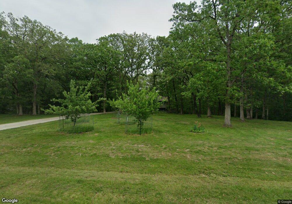
19308 Orrick Trail Kirksville, MO 63501
Estimated Value: $266,000 - $285,000
3
Beds
3
Baths
2,160
Sq Ft
$128/Sq Ft
Est. Value
About This Home
This home is located at 19308 Orrick Trail, Kirksville, MO 63501 and is currently estimated at $276,159, approximately $127 per square foot. 19308 Orrick Trail is a home located in Adair County with nearby schools including Kirksville Primary School, Ray Miller Elementary School, and William Matthew Middle School.
Ownership History
Date
Name
Owned For
Owner Type
Purchase Details
Closed on
Feb 28, 2014
Sold by
Robert D Robert D and Shepard Terra
Bought by
Lukefahr David P and Lukefahr Robin J
Current Estimated Value
Home Financials for this Owner
Home Financials are based on the most recent Mortgage that was taken out on this home.
Original Mortgage
$158,650
Outstanding Balance
$44,634
Interest Rate
3.44%
Estimated Equity
$231,525
Purchase Details
Closed on
Mar 18, 2010
Sold by
Shepard Robert D and Shepard Terra
Bought by
Marrs Klingsmith Rebecca Kay and Klingsmith Shuan
Home Financials for this Owner
Home Financials are based on the most recent Mortgage that was taken out on this home.
Original Mortgage
$122,735
Interest Rate
5.5%
Mortgage Type
FHA
Purchase Details
Closed on
Oct 25, 2007
Sold by
Crouse Gary V and Crouse Linda R
Bought by
Shepard Robert D and Shepard Terra
Create a Home Valuation Report for This Property
The Home Valuation Report is an in-depth analysis detailing your home's value as well as a comparison with similar homes in the area
Home Values in the Area
Average Home Value in this Area
Purchase History
| Date | Buyer | Sale Price | Title Company |
|---|---|---|---|
| Lukefahr David P | -- | -- | |
| Marrs Klingsmith Rebecca Kay | -- | -- | |
| Shepard Robert D | -- | -- |
Source: Public Records
Mortgage History
| Date | Status | Borrower | Loan Amount |
|---|---|---|---|
| Open | Lukefahr David P | $158,650 | |
| Previous Owner | Marrs Klingsmith Rebecca Kay | $122,735 |
Source: Public Records
Tax History Compared to Growth
Tax History
| Year | Tax Paid | Tax Assessment Tax Assessment Total Assessment is a certain percentage of the fair market value that is determined by local assessors to be the total taxable value of land and additions on the property. | Land | Improvement |
|---|---|---|---|---|
| 2024 | $1,419 | $26,110 | $4,230 | $21,880 |
| 2023 | $1,414 | $26,110 | $4,230 | $21,880 |
| 2022 | $1,414 | $26,110 | $4,230 | $21,880 |
| 2021 | $1,395 | $26,110 | $4,230 | $21,880 |
| 2020 | $1,519 | $27,810 | $2,800 | $25,010 |
| 2019 | $1,458 | $27,810 | $2,800 | $25,010 |
| 2018 | $1,131 | $21,720 | $2,070 | $19,650 |
| 2017 | $1,123 | $21,720 | $2,070 | $19,650 |
| 2016 | -- | $21,720 | $2,070 | $19,650 |
| 2015 | -- | $21,720 | $2,070 | $19,650 |
| 2011 | -- | $0 | $0 | $0 |
Source: Public Records
Map
Nearby Homes
- 19074 Whispering Woods Trail
- 22621 Rye Creek Rd
- 1516 W Missouri St
- 19077 Oak Ridge Trail
- 513 W Porter St
- 20858 Oak View Trail
- 1001 N Edgar St
- 107 W Mary Ave
- 914 W Sundown Dr
- 18511 Lost Trail
- 101 E Burton St
- 1220 N Franklin St
- 616 N Elson St
- 709 N Franklin St
- 711 S Osteopathy Ave
- 602 N Franklin St
- 1304 Green St
- 802 S Fifth St
- 1305 N Mulanix St
- 1102 W George St
- 19258 Orrick Trail
- 19341 Orrick Trail
- 19285 Orrick Trail
- 19425 Orrick Trail
- 19190 Orrick Trail
- 19233 Orrick Trail
- 19454 Orrick Trail
- 19439 Sunset Trail
- 22678 Harrison Trail
- 19168 Orrick Trail
- 22655 Harrison Trail
- 19491 Sunset Trail
- 19473 Orrick Trail
- 19163 Tamarack Trail
- 19132 Orrick Trail
- 19153 Tamarack Trail
- 22380 Rustic Court Trail
- 19097 Orrick Trail
- 19514 Orrick Trail
- 19248 Holly Court Trail
