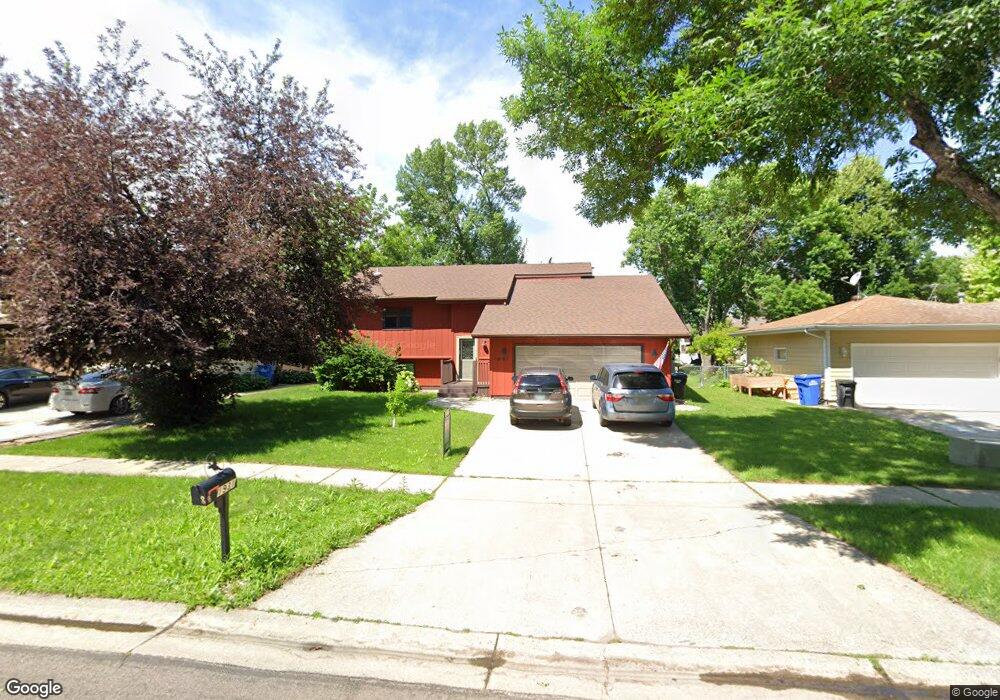
1931 19th St S Fargo, ND 58103
South High NeighborhoodEstimated Value: $307,000 - $385,006
4
Beds
2
Baths
2,262
Sq Ft
$156/Sq Ft
Est. Value
About This Home
This home is located at 1931 19th St S, Fargo, ND 58103 and is currently estimated at $352,752, approximately $155 per square foot. 1931 19th St S is a home located in Cass County with nearby schools including Lewis & Clark Elementary School, Carl Ben Eielson Middle School, and South High School.
Ownership History
Date
Name
Owned For
Owner Type
Purchase Details
Closed on
Sep 23, 2021
Sold by
Tschider Alexander M and Tschider Jenna
Bought by
Cummings Spencer and Cummings Julianna
Current Estimated Value
Home Financials for this Owner
Home Financials are based on the most recent Mortgage that was taken out on this home.
Original Mortgage
$266,000
Outstanding Balance
$242,040
Interest Rate
2.8%
Mortgage Type
New Conventional
Estimated Equity
$110,712
Purchase Details
Closed on
Nov 14, 2017
Sold by
Dockter Cameron J and Mehlisch Dockter Shannon M
Bought by
Tschider Alexander M and Tschider Jenna
Home Financials for this Owner
Home Financials are based on the most recent Mortgage that was taken out on this home.
Original Mortgage
$220,675
Interest Rate
3.85%
Mortgage Type
New Conventional
Create a Home Valuation Report for This Property
The Home Valuation Report is an in-depth analysis detailing your home's value as well as a comparison with similar homes in the area
Home Values in the Area
Average Home Value in this Area
Purchase History
| Date | Buyer | Sale Price | Title Company |
|---|---|---|---|
| Cummings Spencer | $280,000 | Fm Title | |
| Tschider Alexander M | $227,500 | Title Co |
Source: Public Records
Mortgage History
| Date | Status | Borrower | Loan Amount |
|---|---|---|---|
| Open | Cummings Spencer | $266,000 | |
| Previous Owner | Tschider Alexander M | $220,675 |
Source: Public Records
Tax History Compared to Growth
Tax History
| Year | Tax Paid | Tax Assessment Tax Assessment Total Assessment is a certain percentage of the fair market value that is determined by local assessors to be the total taxable value of land and additions on the property. | Land | Improvement |
|---|---|---|---|---|
| 2024 | $3,724 | $154,350 | $30,200 | $124,150 |
| 2023 | $3,919 | $139,050 | $30,200 | $108,850 |
| 2022 | $3,583 | $124,150 | $30,200 | $93,950 |
| 2021 | $3,293 | $115,550 | $30,100 | $85,450 |
| 2020 | $2,976 | $105,050 | $30,100 | $74,950 |
| 2019 | $2,979 | $105,050 | $18,800 | $86,250 |
| 2018 | $2,941 | $105,050 | $18,800 | $86,250 |
| 2017 | $2,833 | $102,000 | $18,800 | $83,200 |
| 2016 | $2,484 | $99,050 | $18,800 | $80,250 |
| 2015 | $2,484 | $92,850 | $12,800 | $80,050 |
| 2014 | $2,365 | $85,950 | $12,800 | $73,150 |
| 2013 | $2,282 | $85,950 | $12,800 | $73,150 |
Source: Public Records
Map
Nearby Homes
- 1943 19th St S
- 2320 20th Ave S Unit 7
- 2326 20th Ave S Unit 9
- 1917 16 1 2 St S
- 1737 Park Blvd S
- 2402 18th St S Unit 3
- 1725 Whitestone Cir S
- 2301 23rd Ave S
- 1543 25th Ave S
- 1834 14 1 2 St S
- 1718 15th St S
- 2440 15th St S Unit B14
- 1405 25th Ave S Unit A201
- 2419 25 1 2 Ave S Unit 205
- 1545 15th St S
- 2202 15th Ave S
- 1710 14th St S
- 2507 25th St S Unit 201K
- 2535 25th St S Unit 203
- 2535 25th St S Unit 204B
- 1925 19th St S
- 1919 19th St S
- 1926 23rd St S
- 1920 23rd St S
- 1932 23rd St S
- 1932 19th St S
- 1926 19th St S
- 1914 23rd St S
- 1913 19th St S
- 1938 19th St S
- 1920 19th St S
- 1914 19th St S
- 1944 19th St S
- 1920 20th Ave S
- 1907 19th St S
- 1909 18th St S
- 1905 18th St S
- 1908 19th St S
- 1913 18th St S
- 1902 23rd St S