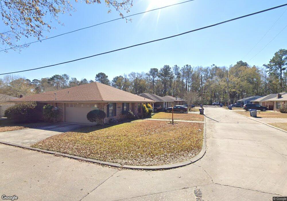
1931 Byron Dr Deridder, LA 70634
Estimated Value: $130,309 - $196,000
--
Bed
--
Bath
--
Sq Ft
7,405
Sq Ft Lot
About This Home
This home is located at 1931 Byron Dr, Deridder, LA 70634 and is currently estimated at $161,077. 1931 Byron Dr is a home.
Ownership History
Date
Name
Owned For
Owner Type
Purchase Details
Closed on
Feb 7, 2017
Sold by
Engelmann David Paul and Engelmann Amber Rennae
Bought by
Garcia Karla Katrina
Current Estimated Value
Purchase Details
Closed on
Mar 3, 2009
Sold by
Blankenbaker John David and Blankenbaker Rose Mary James
Bought by
Engelmann David Paul and Engelmann Amber
Home Financials for this Owner
Home Financials are based on the most recent Mortgage that was taken out on this home.
Original Mortgage
$104,193
Interest Rate
5.06%
Mortgage Type
VA
Create a Home Valuation Report for This Property
The Home Valuation Report is an in-depth analysis detailing your home's value as well as a comparison with similar homes in the area
Home Values in the Area
Average Home Value in this Area
Purchase History
| Date | Buyer | Sale Price | Title Company |
|---|---|---|---|
| Garcia Karla Katrina | $110,000 | None Available | |
| Engelmann David Paul | $102,000 | -- |
Source: Public Records
Mortgage History
| Date | Status | Borrower | Loan Amount |
|---|---|---|---|
| Previous Owner | Engelmann David Paul | $104,193 | |
| Previous Owner | Engelmann David Paul | $102,000 |
Source: Public Records
Tax History Compared to Growth
Tax History
| Year | Tax Paid | Tax Assessment Tax Assessment Total Assessment is a certain percentage of the fair market value that is determined by local assessors to be the total taxable value of land and additions on the property. | Land | Improvement |
|---|---|---|---|---|
| 2024 | $1,322 | $10,800 | $700 | $10,100 |
| 2023 | $1,231 | $10,800 | $700 | $10,100 |
| 2022 | $1,362 | $10,800 | $700 | $10,100 |
| 2021 | $1,407 | $10,800 | $700 | $10,100 |
| 2020 | $1,415 | $10,800 | $700 | $10,100 |
| 2019 | $1,431 | $10,800 | $700 | $10,100 |
| 2018 | $1,416 | $10,800 | $700 | $10,100 |
| 2017 | $1,417 | $10,800 | $700 | $10,100 |
| 2015 | $490 | $3,700 | $700 | $3,000 |
| 2014 | $459 | $3,700 | $700 | $3,000 |
| 2013 | $484 | $3,700 | $700 | $3,000 |
Source: Public Records
Map
Nearby Homes
- 6628 Bailey Rd
- 6616 Bailey Rd
- 0 Lake Charles Hwy Unit SWL24003728
- 7 Woodland Pkwy
- 245 Ambler Rd
- 510 Woodland Pkwy
- 8983 Main St
- 551 Ambler Rd
- 0 Johnnie B Hall Memorial Hwy
- 0 0 Us-171 Hwy Unit 51-174
- 2107 Peach St
- 2108 Pear St Unit Street
- 2108 Pear St
- 305 Greenbriar St
- 810 Greenbriar St
- 629 Parish Line Rd
- 0 N Pine St
- 1844 Woodlawn St
- 695 Bears Rd
- 191 Delia Dr
- 1903 Byron Dr
- 1932 Carol St
- 1975 Byron Dr
- 1932 Byron Dr
- 1952 Carol St
- 1954 Byron Dr
- 1902 Byron Dr
- 1968 Carol St
- 1868 Byron Dr
- 1996 Louisiana Ave
- 1868 Byron
- 1958 Louisiana Ave
- 1931 Charlotte St
- 1931 Carol St
- 1850 Byron Dr
- 1967 Carol St
- 1826 Byron Dr
- 7263 Virginia St
- 7243 Par Road 7160
- 1932 Charlotte St