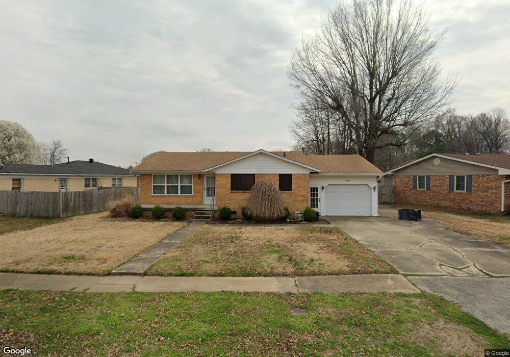
1931 Hillcrest Dr Paragould, AR 72450
Estimated Value: $109,406 - $142,000
--
Bed
1
Bath
1,140
Sq Ft
$111/Sq Ft
Est. Value
About This Home
This home is located at 1931 Hillcrest Dr, Paragould, AR 72450 and is currently estimated at $126,852, approximately $111 per square foot. 1931 Hillcrest Dr is a home located in Greene County with nearby schools including Paragould High School and St. Mary's Catholic School & Preschool.
Ownership History
Date
Name
Owned For
Owner Type
Purchase Details
Closed on
Sep 27, 2010
Sold by
Holder Bennett Darrell and Holder Patricia J
Bought by
Jones Casonya Dawn and Jones Kevin W
Current Estimated Value
Home Financials for this Owner
Home Financials are based on the most recent Mortgage that was taken out on this home.
Original Mortgage
$66,500
Outstanding Balance
$43,695
Interest Rate
4.42%
Mortgage Type
Future Advance Clause Open End Mortgage
Estimated Equity
$83,157
Purchase Details
Closed on
Jul 14, 2010
Sold by
Holder Janis R and Estate Of Charles Richard Hold
Bought by
Holder Bennett Darrell
Home Financials for this Owner
Home Financials are based on the most recent Mortgage that was taken out on this home.
Original Mortgage
$39,000
Interest Rate
4.76%
Mortgage Type
Future Advance Clause Open End Mortgage
Purchase Details
Closed on
Aug 6, 1970
Bought by
Holder Charles D and Holder Betty L
Create a Home Valuation Report for This Property
The Home Valuation Report is an in-depth analysis detailing your home's value as well as a comparison with similar homes in the area
Home Values in the Area
Average Home Value in this Area
Purchase History
| Date | Buyer | Sale Price | Title Company |
|---|---|---|---|
| Jones Casonya Dawn | $65,000 | None Available | |
| Holder Bennett Darrell | $34,000 | None Available | |
| Holder Charles D | -- | -- |
Source: Public Records
Mortgage History
| Date | Status | Borrower | Loan Amount |
|---|---|---|---|
| Open | Jones Casonya Dawn | $66,500 | |
| Previous Owner | Holder Bennett Darrell | $39,000 |
Source: Public Records
Tax History Compared to Growth
Tax History
| Year | Tax Paid | Tax Assessment Tax Assessment Total Assessment is a certain percentage of the fair market value that is determined by local assessors to be the total taxable value of land and additions on the property. | Land | Improvement |
|---|---|---|---|---|
| 2025 | $835 | $21,160 | $5,000 | $16,160 |
| 2024 | $775 | $21,160 | $5,000 | $16,160 |
| 2023 | $656 | $16,380 | $3,400 | $12,980 |
| 2022 | $282 | $16,380 | $3,400 | $12,980 |
| 2021 | $252 | $16,380 | $3,400 | $12,980 |
| 2020 | $596 | $12,950 | $3,400 | $9,550 |
| 2019 | $222 | $12,950 | $3,400 | $9,550 |
| 2018 | $247 | $12,950 | $3,400 | $9,550 |
| 2017 | $571 | $12,950 | $3,400 | $9,550 |
| 2016 | $196 | $12,950 | $3,400 | $9,550 |
| 2015 | $523 | $11,630 | $3,000 | $8,630 |
| 2014 | $523 | $11,630 | $3,000 | $8,630 |
Source: Public Records
Map
Nearby Homes
- 1811 Magnolia Ln
- 2001 W Kingshighway
- 1701 Barnhill Rd
- 1700 Barnhill Rd
- 3.65 ACRES U S 49
- 1905 Glendale St
- 2311 S 20th St
- 125 S 12th St
- 731 Greene St
- 1103 Summit Ridge Trail
- 1101 Summit Ridge Trail
- 1103 Summit Ridge Dr
- 2075 S 141 Hwy
- 4063 GRE 934 Rd
- 506 N 12th St
- 1104 Summit Ridge Dr
- 908 E Court St
- 1105 W Thompson St
- 1203 Michael St
- 612 N 12th St
- 1820 Magnolia Ln
- 1929 Hillcrest Dr
- 1818 Magnolia Ln
- 1927 Hillcrest Dr
- 1936 Hillcrest Dr
- 1932 Hillcrest Dr
- 1934 Hillcrest Dr
- 1816 Magnolia Ln
- 1821 Magnolia Ln
- 1930 Hillcrest Dr
- 1815 Woodland Dr
- 1811 Woodland Dr
- 1928 Hillcrest Dr
- 1809 Woodland Dr
- 0 Woodland
- 1819 Magnolia Ln
- 1945 Hillcrest Dr
- 1817 Magnolia Ln
- 1926 Hillcrest Dr
- 1805 Woodland Dr