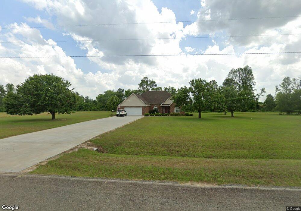
1931 Lindsey Merritt Rd Broxton, GA 31519
Estimated Value: $303,110 - $467,000
3
Beds
3
Baths
2,338
Sq Ft
$152/Sq Ft
Est. Value
About This Home
This home is located at 1931 Lindsey Merritt Rd, Broxton, GA 31519 and is currently estimated at $356,528, approximately $152 per square foot. 1931 Lindsey Merritt Rd is a home located in Coffee County with nearby schools including Broxton-Mary Hayes Elementary School, Coffee Middle School, and Coffee County High School.
Ownership History
Date
Name
Owned For
Owner Type
Purchase Details
Closed on
Oct 29, 2012
Sold by
Pridgen Eddie C
Bought by
Paulk Deanna M
Current Estimated Value
Home Financials for this Owner
Home Financials are based on the most recent Mortgage that was taken out on this home.
Original Mortgage
$144,000
Outstanding Balance
$99,648
Interest Rate
3.42%
Mortgage Type
New Conventional
Estimated Equity
$256,880
Create a Home Valuation Report for This Property
The Home Valuation Report is an in-depth analysis detailing your home's value as well as a comparison with similar homes in the area
Home Values in the Area
Average Home Value in this Area
Purchase History
| Date | Buyer | Sale Price | Title Company |
|---|---|---|---|
| Paulk Deanna M | $180,000 | -- |
Source: Public Records
Mortgage History
| Date | Status | Borrower | Loan Amount |
|---|---|---|---|
| Open | Paulk Deanna M | $144,000 |
Source: Public Records
Tax History Compared to Growth
Tax History
| Year | Tax Paid | Tax Assessment Tax Assessment Total Assessment is a certain percentage of the fair market value that is determined by local assessors to be the total taxable value of land and additions on the property. | Land | Improvement |
|---|---|---|---|---|
| 2024 | $1,878 | $85,537 | $8,243 | $77,294 |
| 2023 | $1,895 | $85,537 | $8,243 | $77,294 |
| 2022 | $2,076 | $85,537 | $8,243 | $77,294 |
| 2021 | $2,076 | $85,537 | $8,243 | $77,294 |
| 2020 | $2,077 | $85,537 | $8,243 | $77,294 |
| 2019 | $2,077 | $85,537 | $8,243 | $77,294 |
| 2018 | $2,078 | $85,537 | $8,243 | $77,294 |
| 2017 | $2,085 | $85,537 | $8,243 | $77,294 |
| 2016 | $2,087 | $85,537 | $8,243 | $77,294 |
| 2015 | $2,098 | $85,537 | $8,243 | $77,294 |
| 2014 | $2,108 | $85,537 | $8,243 | $77,294 |
Source: Public Records
Map
Nearby Homes
- 1020 Alabama St N
- 171 Sparrow Rd
- 126 Oscar Patton Estates
- 504 Miller Ave
- 699 Twin Lakes Dr
- 744 Lotts Crossing
- 4653 Douglas Braxton Hwy
- 407 Broxton West Green Hwy
- 197 Mobley Bluff Rd
- 00 Ambrose Rd
- 1671 Warren Carter Rd
- 441 U S 319
- 0 E River Rd Unit 1646569
- 0 E River Rd Unit 20927603
- 0 E River Rd Unit 154466
- 0 E River Rd Unit 10297440
- 0 E River Rd Unit 20291894
- 0 Us-441 S
- 57 E Dogwood Dr
- 5495 Cross Rd
- 00 Lindsey Merritt Rd
- 0 Lindsey Merritt Rd Unit 192271
- 1631 Lindsey Merritt Rd
- 1570 Lindsey Merritt Rd
- 112 Bill Kight Rd
- 1617 Roses Creek Rd
- 1383 Lindsey Merritt Rd
- 1391 Roses Creek Rd
- 505 Turkey Hill Rd
- 2587 Lindsey Merritt Rd
- 721 Bill Kight Rd
- 0 Rose Creek Rd Unit none
- 1180 Lindsey Merritt Rd
- 1181 Lindsey Merritt Rd
- 2507 Lindsey Merritt Rd
- 1245 Ernest Pridgen Rd
- 1095 Rose Creek Rd
- 2851 Lindsey Merritt Rd
- 1441 Ernest Pridgen Rd
- 1095 Roses Creek Rd