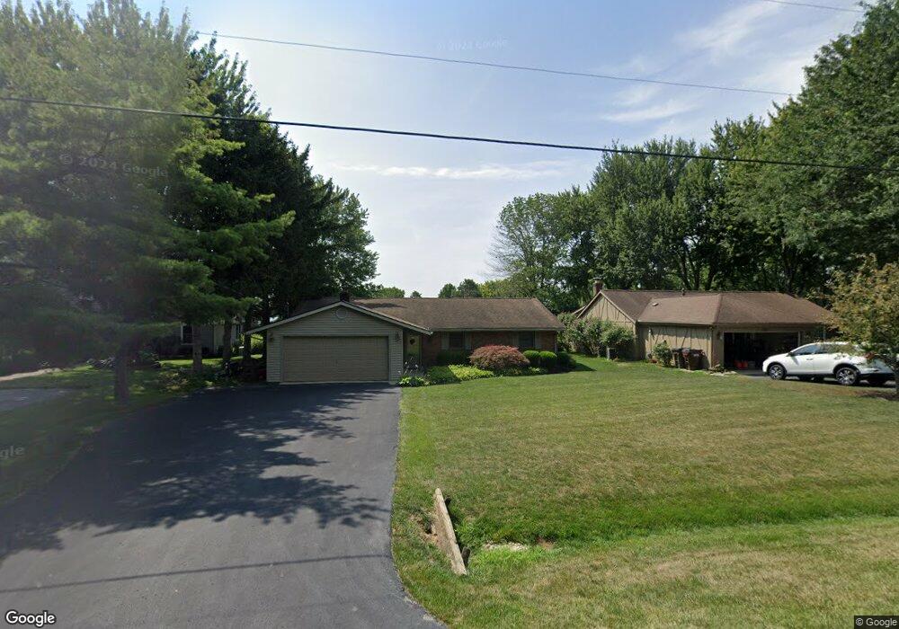
1931 Palouse Dr London, OH 43140
Estimated Value: $411,000 - $759,000
4
Beds
3
Baths
1,856
Sq Ft
$341/Sq Ft
Est. Value
About This Home
This home is located at 1931 Palouse Dr, London, OH 43140 and is currently estimated at $631,979, approximately $340 per square foot. 1931 Palouse Dr is a home located in Madison County with nearby schools including London Elementary School, London Middle School, and London High School.
Ownership History
Date
Name
Owned For
Owner Type
Purchase Details
Closed on
Jun 19, 2006
Sold by
Yates James T and Yates Leah C
Bought by
Stewart J Mark and Stewart Susan L
Current Estimated Value
Home Financials for this Owner
Home Financials are based on the most recent Mortgage that was taken out on this home.
Original Mortgage
$265,600
Outstanding Balance
$157,545
Interest Rate
6.73%
Mortgage Type
Purchase Money Mortgage
Estimated Equity
$474,434
Purchase Details
Closed on
Aug 1, 1997
Sold by
Mayes Helene S
Bought by
Yates James T and Yates Leah C
Home Financials for this Owner
Home Financials are based on the most recent Mortgage that was taken out on this home.
Original Mortgage
$155,500
Interest Rate
7.71%
Mortgage Type
New Conventional
Create a Home Valuation Report for This Property
The Home Valuation Report is an in-depth analysis detailing your home's value as well as a comparison with similar homes in the area
Home Values in the Area
Average Home Value in this Area
Purchase History
| Date | Buyer | Sale Price | Title Company |
|---|---|---|---|
| Stewart J Mark | $332,000 | Midland Title | |
| Yates James T | $164,000 | -- |
Source: Public Records
Mortgage History
| Date | Status | Borrower | Loan Amount |
|---|---|---|---|
| Open | Stewart J Mark | $265,600 | |
| Previous Owner | Yates James T | $155,500 |
Source: Public Records
Tax History Compared to Growth
Tax History
| Year | Tax Paid | Tax Assessment Tax Assessment Total Assessment is a certain percentage of the fair market value that is determined by local assessors to be the total taxable value of land and additions on the property. | Land | Improvement |
|---|---|---|---|---|
| 2024 | $7,415 | $188,740 | $70,410 | $118,330 |
| 2023 | $7,415 | $188,740 | $70,410 | $118,330 |
| 2022 | $6,500 | $142,970 | $53,340 | $89,630 |
| 2021 | $6,231 | $142,970 | $53,340 | $89,630 |
| 2020 | $6,232 | $142,970 | $53,340 | $89,630 |
| 2019 | $5,765 | $121,630 | $55,010 | $66,620 |
| 2018 | $5,192 | $121,630 | $55,010 | $66,620 |
| 2017 | $5,093 | $121,630 | $55,010 | $66,620 |
| 2016 | $4,242 | $99,250 | $55,010 | $44,240 |
| 2015 | $4,221 | $99,250 | $55,010 | $44,240 |
| 2014 | $4,221 | $99,250 | $55,010 | $44,240 |
| 2013 | -- | $104,540 | $52,500 | $52,040 |
Source: Public Records
Map
Nearby Homes
- 1865 Huron Dr
- 2086 Palouse Dr
- 2020 Cherokee Dr
- 1730 W Choctaw Dr
- 1855 E Choctaw Dr
- 2460 Cherokee Dr
- 1495 W Choctaw Dr
- 1490 Itawamba Trail
- 1435 E Choctaw Dr
- 1405 Chickasaw Dr
- 1427 Itawamba Trail
- 1340 W Choctaw Dr
- 3211 Old Columbus Rd
- 2425 Old Us Highway 40 NW
- 2725 Old Us Highway 40 NW
- 4070 Tradersville-Brighton Rd
- 108 Markley Rd
- 2367 N Houston Pike
- 2321 N Houston
- 2206 State Route 56 SW
- 1935 Palouse Dr
- 1927 Chickasaw Dr
- 1945 Palouse Dr
- 1945 Palouse Dr Unit L706
- 1955 Palouse Dr
- 1921 Chickasaw Dr
- 1940 Palouse Dr
- 1965 Palouse Dr
- 1915 Chickasaw Dr
- 1922 Chickasaw Dr
- 2025 Chickasaw Dr
- 1975 Palouse Dr
- 1960 Palouse Dr
- 2895 Twana Dr
- 1995 Palouse Dr
- 1911 Chickasaw Dr
- 1889 Shoshone Dr
- 1905 Shoshone Dr
- 2001 Palouse Dr
- 2031 Chickasaw Dr