Estimated Value: $166,000 - $205,000
3
Beds
1
Bath
1,772
Sq Ft
$101/Sq Ft
Est. Value
About This Home
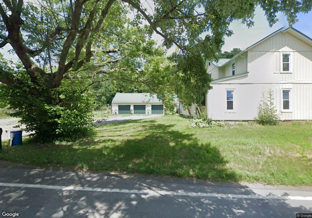
This home is located at 1931 State Route 39, Lucas, OH 44843 and is currently estimated at $179,642, approximately $101 per square foot. 1931 State Route 39 is a home located in Richland County with nearby schools including Lucas Elementary School, Lucas Heritage Middle School, and Lucas High School.
Ownership History
Date
Name
Owned For
Owner Type
Purchase Details
Closed on
Feb 28, 2018
Sold by
Nephew Bion F and Nephew Lillian
Bought by
Nephew Lillian and Kurtzman Carrie M
Current Estimated Value
Purchase Details
Closed on
Sep 22, 2015
Sold by
Nephew Bion F and Nephew Lillian
Bought by
Nephew Bion F and Nephew Lillian
Create a Home Valuation Report for This Property
The Home Valuation Report is an in-depth analysis detailing your home's value as well as a comparison with similar homes in the area
Home Values in the Area
Average Home Value in this Area
Purchase History
| Date | Buyer | Sale Price | Title Company |
|---|---|---|---|
| Nephew Lillian | -- | None Available | |
| Nephew Bion F | -- | Attorney |
Source: Public Records
Tax History Compared to Growth
Tax History
| Year | Tax Paid | Tax Assessment Tax Assessment Total Assessment is a certain percentage of the fair market value that is determined by local assessors to be the total taxable value of land and additions on the property. | Land | Improvement |
|---|---|---|---|---|
| 2024 | $1,012 | $33,830 | $13,400 | $20,430 |
| 2023 | $1,012 | $33,830 | $13,400 | $20,430 |
| 2022 | $894 | $27,690 | $11,980 | $15,710 |
| 2021 | $896 | $27,690 | $11,980 | $15,710 |
| 2020 | $1,328 | $27,690 | $11,980 | $15,710 |
| 2019 | $1,213 | $23,770 | $10,150 | $13,620 |
| 2018 | $791 | $23,770 | $10,150 | $13,620 |
| 2017 | $796 | $23,770 | $10,150 | $13,620 |
| 2016 | $747 | $23,010 | $9,200 | $13,810 |
| 2015 | $747 | $22,710 | $9,200 | $13,510 |
| 2014 | $735 | $22,710 | $9,200 | $13,510 |
| 2012 | $362 | $22,710 | $9,200 | $13,510 |
Source: Public Records
Map
Nearby Homes
- 174 W Main St
- 1679 Pulver Rd
- 0 Moffett Rd
- 2061 Washington North Rd
- 1135 E Hanley Rd
- 1875 Mansfield Lucas Rd
- 0 State Route 39 & I-71 Northeast Quadrant
- 0 State Route 39 & I-71 Southeast Quadrant
- 2905 Tucker Rd
- 929 Antionette Dr
- 0 Garver Rd Washington Rd S Unit 20253648
- 0 Garver Washington Rd S
- 0 Mount Zion Rd Unit 9069748
- 0 Tucker Rd
- 3261 Moffett Rd
- 2221 Pleasant Valley Rd
- 0 Peterson Rd
- 0 Woodville Rd Unit Lot 14952, 14953
- 0 Woodville Rd Unit Lot 14954, 14955
- 0 Woodville Rd Unit Lot 14956, 14957,
- 1958 Ohio 39
- 1958 State Route 39
- 1883 State Route 39
- 1978 State Route 39
- 1977 State Route 39
- 2035 State Route 39
- 1867 State Route 39
- 2035 Ohio 39
- 2021 State Route 39
- 1933 Cemetery Rd
- 2089 State Route 39
- 1845 Cemetery Rd
- 1987 Cemetery Rd
- 1851 State Route 39
- 2822 Mansfield Lucas Rd
- 2850 Mansfield Lucas Rd
- 1848 Cemetery Rd
- 2025 Cemetery Rd
- 1994 Cemetery Rd
- 1847 State Route 39