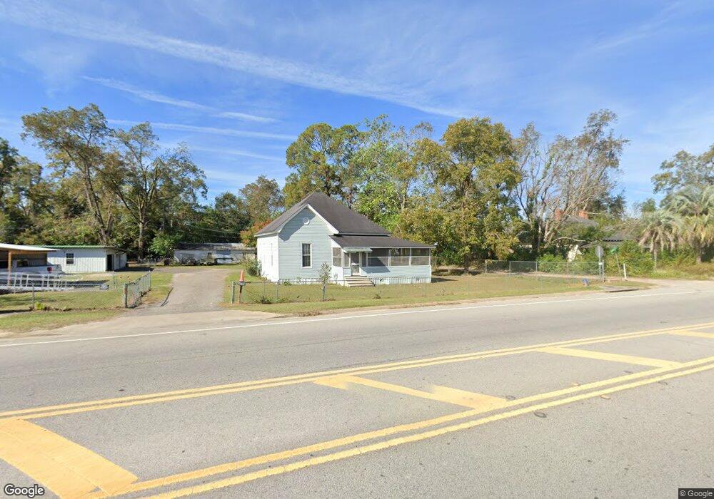
1931 State St Waycross, GA 31501
Estimated Value: $87,000 - $136,000
3
Beds
1
Bath
1,477
Sq Ft
$76/Sq Ft
Est. Value
About This Home
This home is located at 1931 State St, Waycross, GA 31501 and is currently estimated at $112,174, approximately $75 per square foot. 1931 State St is a home located in Ware County with nearby schools including Wacona Elementary School, Ware County Middle School, and Ware County High School.
Ownership History
Date
Name
Owned For
Owner Type
Purchase Details
Closed on
Dec 9, 2021
Sold by
Pittman Glynn S
Bought by
Sweat Abby Pittman
Current Estimated Value
Purchase Details
Closed on
Dec 4, 2006
Sold by
Landrum Robert L
Bought by
Pittman Glynn S
Purchase Details
Closed on
Jan 5, 2006
Sold by
Landrum Mildred D
Bought by
Landrum Robert L and Landrum Bishop Nannette
Purchase Details
Closed on
Aug 1, 1997
Sold by
Hebard D L
Bought by
Landrum Lee Roy
Create a Home Valuation Report for This Property
The Home Valuation Report is an in-depth analysis detailing your home's value as well as a comparison with similar homes in the area
Home Values in the Area
Average Home Value in this Area
Purchase History
| Date | Buyer | Sale Price | Title Company |
|---|---|---|---|
| Sweat Abby Pittman | -- | -- | |
| Pittman Glynn S | $50,000 | -- | |
| Landrum Robert L | -- | -- | |
| Landrum Lee Roy | $1,500 | -- |
Source: Public Records
Tax History Compared to Growth
Tax History
| Year | Tax Paid | Tax Assessment Tax Assessment Total Assessment is a certain percentage of the fair market value that is determined by local assessors to be the total taxable value of land and additions on the property. | Land | Improvement |
|---|---|---|---|---|
| 2024 | $924 | $33,826 | $2,832 | $30,994 |
| 2023 | $871 | $26,808 | $1,912 | $24,896 |
| 2022 | $774 | $26,808 | $1,912 | $24,896 |
| 2021 | $618 | $19,716 | $2,074 | $17,642 |
| 2020 | $525 | $16,550 | $2,074 | $14,476 |
| 2019 | $517 | $15,985 | $2,074 | $13,911 |
| 2018 | $522 | $15,985 | $2,074 | $13,911 |
| 2017 | $453 | $13,890 | $2,074 | $11,816 |
| 2016 | $453 | $13,890 | $2,074 | $11,816 |
| 2015 | $457 | $13,890 | $2,074 | $11,816 |
| 2014 | $456 | $13,890 | $2,074 | $11,816 |
| 2013 | -- | $13,890 | $2,073 | $11,816 |
Source: Public Records
Map
Nearby Homes
- 1937 State St
- 1927 State St
- 1937 Ossie Davis Pkwy
- 1941 State St
- 2150 Monroe Ave
- 1925 State St
- 1932 Abc Ave
- 1930 Kirkland St
- 1934 Kirkland St
- 1940 Abc Ave
- 1924 Kirkland St
- 1945 Ossie Davis Pkwy
- 1945 State St
- 1936 Abc Ave
- 1920 Kirkland St
- 1935 Mcclure St
- 1910 Kirkland St
- 1944 Abc Ave
- 1916 Abc Ave
- 1937 Kirkland St