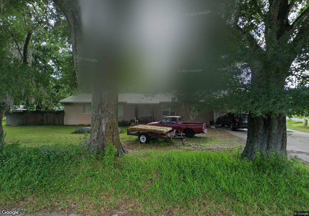
1931 W Airport Blvd Sanford, FL 32771
Goldsboro NeighborhoodEstimated Value: $255,000 - $322,000
3
Beds
2
Baths
2,442
Sq Ft
$122/Sq Ft
Est. Value
About This Home
This home is located at 1931 W Airport Blvd, Sanford, FL 32771 and is currently estimated at $298,824, approximately $122 per square foot. 1931 W Airport Blvd is a home located in Seminole County with nearby schools including Idyllwilde Elementary School, Bentley Elementary School, and Wilson Elementary School.
Ownership History
Date
Name
Owned For
Owner Type
Purchase Details
Closed on
Oct 16, 2012
Sold by
Deutsche Bank National Trust Company
Bought by
Vinson Denise D
Current Estimated Value
Purchase Details
Closed on
Feb 13, 2012
Sold by
Mastrapa Daniel
Bought by
Deutsche Bank National Trust Company
Purchase Details
Closed on
Feb 1, 2012
Bought by
Vinson Denise D
Purchase Details
Closed on
May 17, 2004
Sold by
Mastrapa Daniel
Bought by
Mastrapa Daniel M and Mastrapa Bethza
Home Financials for this Owner
Home Financials are based on the most recent Mortgage that was taken out on this home.
Original Mortgage
$116,000
Interest Rate
5.88%
Mortgage Type
New Conventional
Purchase Details
Closed on
May 12, 2004
Sold by
Mastrapa Daniel
Bought by
Mastrapa Daniel M and Mastrapa Bethza
Home Financials for this Owner
Home Financials are based on the most recent Mortgage that was taken out on this home.
Original Mortgage
$116,000
Interest Rate
5.88%
Mortgage Type
New Conventional
Purchase Details
Closed on
May 1, 2004
Bought by
Vinson Denise D
Home Financials for this Owner
Home Financials are based on the most recent Mortgage that was taken out on this home.
Original Mortgage
$116,000
Interest Rate
5.88%
Mortgage Type
New Conventional
Purchase Details
Closed on
Jan 17, 2003
Sold by
Kochak Mansour
Bought by
Mastrapa Daniel
Purchase Details
Closed on
Jul 26, 2002
Sold by
Imc Hm Equity Loan Trust 1998 & 3 C
Bought by
Kochak Mansour
Purchase Details
Closed on
Jun 1, 2002
Bought by
Vinson Denise D
Purchase Details
Closed on
Apr 1, 2002
Bought by
Vinson Denise D
Purchase Details
Closed on
Dec 31, 2001
Sold by
Benjamin A E Coc I
Bought by
Imc Home Equity Loan 1998 Trust
Purchase Details
Closed on
Dec 1, 2001
Bought by
Vinson Denise D
Purchase Details
Closed on
Apr 23, 1998
Sold by
Holt Willie G and Holt Einora
Bought by
Doe Benjamin A and Doe Bernice R
Home Financials for this Owner
Home Financials are based on the most recent Mortgage that was taken out on this home.
Original Mortgage
$71,200
Interest Rate
7.09%
Mortgage Type
Balloon
Purchase Details
Closed on
Feb 1, 1998
Bought by
Vinson Denise D
Create a Home Valuation Report for This Property
The Home Valuation Report is an in-depth analysis detailing your home's value as well as a comparison with similar homes in the area
Home Values in the Area
Average Home Value in this Area
Purchase History
| Date | Buyer | Sale Price | Title Company |
|---|---|---|---|
| Vinson Denise D | $30,100 | Servicelink | |
| Deutsche Bank National Trust Company | -- | None Available | |
| Vinson Denise D | $100 | -- | |
| Mastrapa Daniel M | -- | First American Title Ins Co | |
| Mastrapa Daniel M | -- | First American Title Ins Co | |
| Vinson Denise D | $100 | -- | |
| Mastrapa Daniel | $59,900 | Lawyers Advantage Title Grou | |
| Kochak Mansour | $32,857 | -- | |
| Vinson Denise D | $40,000 | -- | |
| Vinson Denise D | $100 | -- | |
| Imc Home Equity Loan 1998 Trust | -- | -- | |
| Vinson Denise D | $100 | -- | |
| Doe Benjamin A | $80,000 | -- | |
| Vinson Denise D | $80,000 | -- |
Source: Public Records
Mortgage History
| Date | Status | Borrower | Loan Amount |
|---|---|---|---|
| Previous Owner | Mastrapa Daniel M | $116,000 | |
| Previous Owner | Doe Benjamin A | $71,200 |
Source: Public Records
Tax History Compared to Growth
Tax History
| Year | Tax Paid | Tax Assessment Tax Assessment Total Assessment is a certain percentage of the fair market value that is determined by local assessors to be the total taxable value of land and additions on the property. | Land | Improvement |
|---|---|---|---|---|
| 2024 | $784 | $74,722 | -- | -- |
| 2023 | $777 | $72,546 | $0 | $0 |
| 2021 | $710 | $68,382 | $0 | $0 |
| 2020 | $699 | $67,438 | $0 | $0 |
| 2019 | $674 | $65,922 | $0 | $0 |
| 2018 | $669 | $64,693 | $0 | $0 |
| 2017 | $673 | $63,362 | $0 | $0 |
| 2016 | $690 | $62,493 | $0 | $0 |
| 2015 | $698 | $61,628 | $0 | $0 |
| 2014 | $480 | $61,641 | $0 | $0 |
Source: Public Records
Map
Nearby Homes
- 2854 Bungalow Blvd
- 2606 Country Club Rd
- 2218 Southwest Rd
- 2661 W 22nd St
- 2700 W 25th St Unit Parcel B
- 1811 Alexander Ave
- TBD W Airport Blvd
- 2513 W 25th St
- 2451 W 18th St
- 3364 Character Ct
- 141 Bob Thomas Cir
- 431 Brightview Dr
- 1726 Pine Ridge Rd Unit F2
- 127 Bob Thomas Cir
- 202 Yale Dr
- 928 S Pine Ridge Cir
- 101 Vihlen Rd
- 1707 Merthie Dr
- 1022 S Pine Ridge Cir Unit 1022
- 1022 S Pine Ridge Cir Unit B2
- 1912 W Airport Blvd
- 1911 W Airport Blvd
- 2911 W 23rd St
- 2921 W 23rd St
- 1936 W Airport Blvd
- 2922 Bungalow Blvd
- 1901 W Airport Blvd
- 2910 W 23rd St
- 2931 W 23rd St
- 0 Bungalow Blvd
- 1980 W Airport Blvd
- 2920 W 23rd St
- 2941 W 23rd St
- 2930 W 23rd St
- 2210 Hawkins Ave
- 2200 Hawkins Ave
- 2878 Bungalow Blvd
- 2188 Hawkins Ave
- 2940 W 23rd St
- 2005 W Airport Blvd