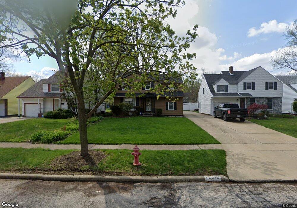
19312 Lanbury Ave Warrensville Heights, OH 44122
Estimated Value: $129,380 - $160,000
3
Beds
1
Bath
1,386
Sq Ft
$104/Sq Ft
Est. Value
About This Home
This home is located at 19312 Lanbury Ave, Warrensville Heights, OH 44122 and is currently estimated at $144,345, approximately $104 per square foot. 19312 Lanbury Ave is a home located in Cuyahoga County with nearby schools including John Dewey Elementary School, Warrensville Heights Middle School, and Warrensville Heights High School.
Ownership History
Date
Name
Owned For
Owner Type
Purchase Details
Closed on
May 16, 2002
Sold by
Douglas Henry
Bought by
Bailey Alton
Current Estimated Value
Home Financials for this Owner
Home Financials are based on the most recent Mortgage that was taken out on this home.
Original Mortgage
$89,594
Outstanding Balance
$38,205
Interest Rate
7.07%
Mortgage Type
FHA
Estimated Equity
$106,140
Purchase Details
Closed on
Aug 16, 1982
Sold by
Douglas Eugene and Douglas Lois
Bought by
Douglas Eugene
Purchase Details
Closed on
Jan 1, 1975
Bought by
Douglas Eugene and Douglas Lois
Create a Home Valuation Report for This Property
The Home Valuation Report is an in-depth analysis detailing your home's value as well as a comparison with similar homes in the area
Home Values in the Area
Average Home Value in this Area
Purchase History
| Date | Buyer | Sale Price | Title Company |
|---|---|---|---|
| Bailey Alton | $91,000 | Equity Title Agency Inc | |
| Douglas Eugene | -- | -- | |
| Douglas Eugene | -- | -- |
Source: Public Records
Mortgage History
| Date | Status | Borrower | Loan Amount |
|---|---|---|---|
| Open | Bailey Alton | $89,594 |
Source: Public Records
Tax History Compared to Growth
Tax History
| Year | Tax Paid | Tax Assessment Tax Assessment Total Assessment is a certain percentage of the fair market value that is determined by local assessors to be the total taxable value of land and additions on the property. | Land | Improvement |
|---|---|---|---|---|
| 2024 | $2,899 | $45,290 | $7,910 | $37,380 |
| 2023 | $2,278 | $27,590 | $6,060 | $21,530 |
| 2022 | $2,293 | $27,580 | $6,055 | $21,525 |
| 2021 | $2,254 | $27,580 | $6,060 | $21,530 |
| 2020 | $2,197 | $23,590 | $5,180 | $18,410 |
| 2019 | $2,146 | $67,400 | $14,800 | $52,600 |
| 2018 | $2,042 | $23,590 | $5,180 | $18,410 |
| 2017 | $1,963 | $21,110 | $3,680 | $17,430 |
| 2016 | $1,936 | $21,110 | $3,680 | $17,430 |
| 2015 | $2,156 | $21,110 | $3,680 | $17,430 |
| 2014 | $2,156 | $24,540 | $4,270 | $20,270 |
Source: Public Records
Map
Nearby Homes
- 19302 Shakerwood Rd
- 19110 Lanbury Ave
- 19901 Lanbury Ave
- 19912 Lanbury Ave
- 3696 Tolland Rd
- 3676 Rawnsdale Rd
- 19112 Kings Hwy
- 3651 Rawnsdale Rd
- 3635 Tolland Rd
- 19615 Harvard Ave
- 3905 Warrensville Center Rd
- 19819 Harvard Ave
- 3609 Stoer Rd
- 20511 Balfour Rd
- 20516 Amherst Rd
- 3717 Gridley Rd
- 19024 Lomond Blvd
- 3656 Latimore Rd
- 18515 Lomond Blvd
- 20614 Kings Hwy
- 19316 Lanbury Ave
- 19306 Lanbury Ave
- 19400 Lanbury Ave
- 19302 Lanbury Ave
- 19406 Lanbury Ave
- 19218 Lanbury Ave
- 19313 Shakerwood Rd
- 19317 Shakerwood Rd
- 19307 Shakerwood Rd
- 19401 Shakerwood Rd
- 19303 Shakerwood Rd
- 19410 Lanbury Ave
- 19212 Lanbury Ave
- 19313 Lanbury Ave
- 19307 Lanbury Ave
- 19317 Lanbury Ave
- 19407 Shakerwood Rd
- 19219 Shakerwood Rd
- 19303 Lanbury Ave
- 19401 Lanbury Ave