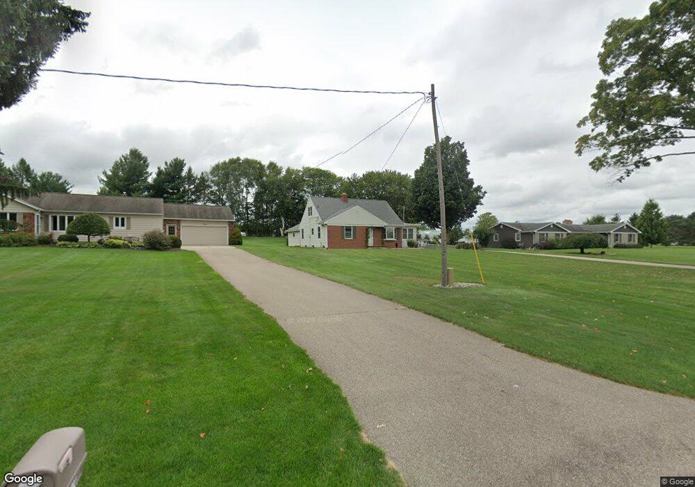
1932 72nd St SW Byron Center, MI 49315
Estimated Value: $415,683 - $507,000
4
Beds
2
Baths
2,000
Sq Ft
$232/Sq Ft
Est. Value
About This Home
This home is located at 1932 72nd St SW, Byron Center, MI 49315 and is currently estimated at $464,421, approximately $232 per square foot. 1932 72nd St SW is a home located in Kent County with nearby schools including Marshall Elementary School, Robert L. Nickels Intermediate School, and Byron Center West Middle School.
Ownership History
Date
Name
Owned For
Owner Type
Purchase Details
Closed on
Feb 15, 2024
Sold by
Nichols Robert J and Nichols Cynthia J
Bought by
Nichols Robert J and Nichols Cynthia J
Current Estimated Value
Purchase Details
Closed on
Aug 20, 2007
Sold by
Bruursema Alvin and Bruursema Eunice
Bought by
Nichols Robert J and Nichols Cynthia J
Home Financials for this Owner
Home Financials are based on the most recent Mortgage that was taken out on this home.
Original Mortgage
$38,570
Interest Rate
6.79%
Mortgage Type
Purchase Money Mortgage
Create a Home Valuation Report for This Property
The Home Valuation Report is an in-depth analysis detailing your home's value as well as a comparison with similar homes in the area
Home Values in the Area
Average Home Value in this Area
Purchase History
| Date | Buyer | Sale Price | Title Company |
|---|---|---|---|
| Nichols Robert J | -- | None Listed On Document | |
| Nichols Robert J | $167,000 | Metropolitan Title Company |
Source: Public Records
Mortgage History
| Date | Status | Borrower | Loan Amount |
|---|---|---|---|
| Previous Owner | Nichols Robert J | $38,570 |
Source: Public Records
Tax History Compared to Growth
Tax History
| Year | Tax Paid | Tax Assessment Tax Assessment Total Assessment is a certain percentage of the fair market value that is determined by local assessors to be the total taxable value of land and additions on the property. | Land | Improvement |
|---|---|---|---|---|
| 2025 | $2,006 | $181,900 | $0 | $0 |
| 2024 | $2,006 | $172,500 | $0 | $0 |
| 2023 | $1,919 | $153,500 | $0 | $0 |
| 2022 | $2,674 | $128,200 | $0 | $0 |
| 2021 | $1,781 | $116,200 | $0 | $0 |
| 2020 | $1,766 | $114,300 | $0 | $0 |
| 2019 | $2,487 | $107,900 | $0 | $0 |
| 2018 | $2,487 | $101,100 | $18,700 | $82,400 |
| 2017 | $2,428 | $90,900 | $0 | $0 |
| 2016 | $2,333 | $86,100 | $0 | $0 |
| 2015 | $2,293 | $86,100 | $0 | $0 |
| 2013 | -- | $73,700 | $0 | $0 |
Source: Public Records
Map
Nearby Homes
- 1752 Springwind Dr SW
- 1645 Springwind Dr SW
- 1568 Bogey St SW Unit 1
- 1557 Marksbury Ct
- 6617 Northfield St SW
- 1818 Northfield Ct SW
- 6840 Burlingame Ave SW
- 1531 Dexter Dr SW Unit 37
- 1501 Dexter St SW Unit 35
- 7074 Nantucket Dr SW
- 1493 Dexter Dr SW Unit 34
- 2245 Pleasant Pond Dr SW
- Whitby Plan at Kuiper's Meadow - Cottage Series
- Pentwater Plan at Kuiper's Meadow - Landmark Series
- Harbor Springs Plan at Kuiper's Meadow - Landmark Series
- Sequoia Plan at Kuiper's Meadow - Woodland Series
- Bay Harbor Plan at Kuiper's Meadow - Landmark Series
- Elmwood Plan at Kuiper's Meadow - Woodland Series
- Maplewood Plan at Kuiper's Meadow - Woodland Series
- Camden Plan at Kuiper's Meadow - Cottage Series
- 1950 72nd St SW
- 7187 Cattail SW
- 1927 72nd St SW
- 1878 72nd St SW
- 1907 72nd St SW
- 1891 72nd St SW
- 7179 Cattail SW
- 1961 72nd St SW
- 1856 72nd St SW
- 1871 72nd St SW
- 7170 Cattail SW
- 1991 72nd St SW
- 1870 72nd St SW
- 1946 Lilypad Dr SW
- 1946 Lillypad Dr SW
- 1934 Lillypad Dr SW
- 1861 72nd St SW
- 1960 Lillypad Dr SW
- 2015 72nd St SW
- 7285 Winter View Dr SW