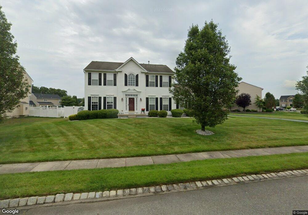
1932 Apache Ct Vineland, NJ 08361
Estimated Value: $410,472 - $502,000
--
Bed
--
Bath
2,337
Sq Ft
$199/Sq Ft
Est. Value
About This Home
This home is located at 1932 Apache Ct, Vineland, NJ 08361 and is currently estimated at $464,118, approximately $198 per square foot. 1932 Apache Ct is a home located in Cumberland County with nearby schools including Anthony Rossi Elementary School, John H. Winslow Elementary School, and Vineland Senior High School.
Ownership History
Date
Name
Owned For
Owner Type
Purchase Details
Closed on
Sep 4, 2025
Sold by
Moskowitz Steven G and Sese Elizabeth
Bought by
Sese Elizabeth
Current Estimated Value
Purchase Details
Closed on
May 17, 2007
Sold by
Nvr Inc
Bought by
Moskowitz Steven and Moskowitz Elizabeth Sese
Purchase Details
Closed on
Jan 16, 2007
Sold by
Spring Hollow No 1 Llc
Bought by
Nvr Inc
Create a Home Valuation Report for This Property
The Home Valuation Report is an in-depth analysis detailing your home's value as well as a comparison with similar homes in the area
Home Values in the Area
Average Home Value in this Area
Purchase History
| Date | Buyer | Sale Price | Title Company |
|---|---|---|---|
| Sese Elizabeth | -- | None Listed On Document | |
| Moskowitz Steven | $301,715 | -- | |
| -- | $301,700 | -- | |
| Nvr Inc | $97,000 | -- |
Source: Public Records
Tax History Compared to Growth
Tax History
| Year | Tax Paid | Tax Assessment Tax Assessment Total Assessment is a certain percentage of the fair market value that is determined by local assessors to be the total taxable value of land and additions on the property. | Land | Improvement |
|---|---|---|---|---|
| 2025 | $7,107 | $223,200 | $41,100 | $182,100 |
| 2024 | $7,107 | $223,200 | $41,100 | $182,100 |
| 2023 | $7,060 | $223,200 | $41,100 | $182,100 |
| 2022 | $6,850 | $223,200 | $41,100 | $182,100 |
| 2021 | $6,725 | $223,200 | $41,100 | $182,100 |
| 2020 | $6,533 | $223,200 | $41,100 | $182,100 |
| 2019 | $6,444 | $223,200 | $41,100 | $182,100 |
| 2018 | $6,274 | $223,200 | $41,100 | $182,100 |
| 2017 | $5,959 | $223,200 | $41,100 | $182,100 |
| 2016 | $5,750 | $223,200 | $41,100 | $182,100 |
| 2015 | $5,538 | $223,200 | $41,100 | $182,100 |
| 2014 | $5,236 | $223,200 | $41,100 | $182,100 |
Source: Public Records
Map
Nearby Homes
- 1550 S Lincoln Ave
- 2319 S Lincoln Ave
- 1775 Roosevelt Blvd
- 1599 Cherokee Ln
- 2354 Dante Ave
- 1417 Rogers Ave
- 1730 Junior Dr
- 1244 Garry Ave
- 1243 Garry Ave
- 2800 Perna Ln
- 1731 Magnolia Rd
- 2551 Edna Dr
- 1170 Rogers Ave
- 2564 Edna Dr
- 1466 E Sherman Ave
- 2769 Dante Ave
- 1390 E Sherman Ave
- 2603 Valhalla Rd
- 1737 Pats Ln
- 2676 Medina St
- 1944 Apache Ct
- 1922 Apache Ct
- 1962 Apache Ct
- 1916 Apache Ct
- 1931 Arrowhead Trail
- 1931 Apache Ct
- 1921 Apache Ct
- 1951 Arrowhead Trail
- 1935 Apache Ct
- 1941 Apache Ct
- 1911 Apache Ct
- 1961 Apache Ct
- 1897 Arrowhead Trail
- 1973 Arrowhead Trail
- 1982 Apache Ct
- 1843 Arrowhead Trail
- 2190 S Lincoln Ave
- 1983 Apache Ct
- 1979 Apache Ct
- 2001 Arrowhead Trail