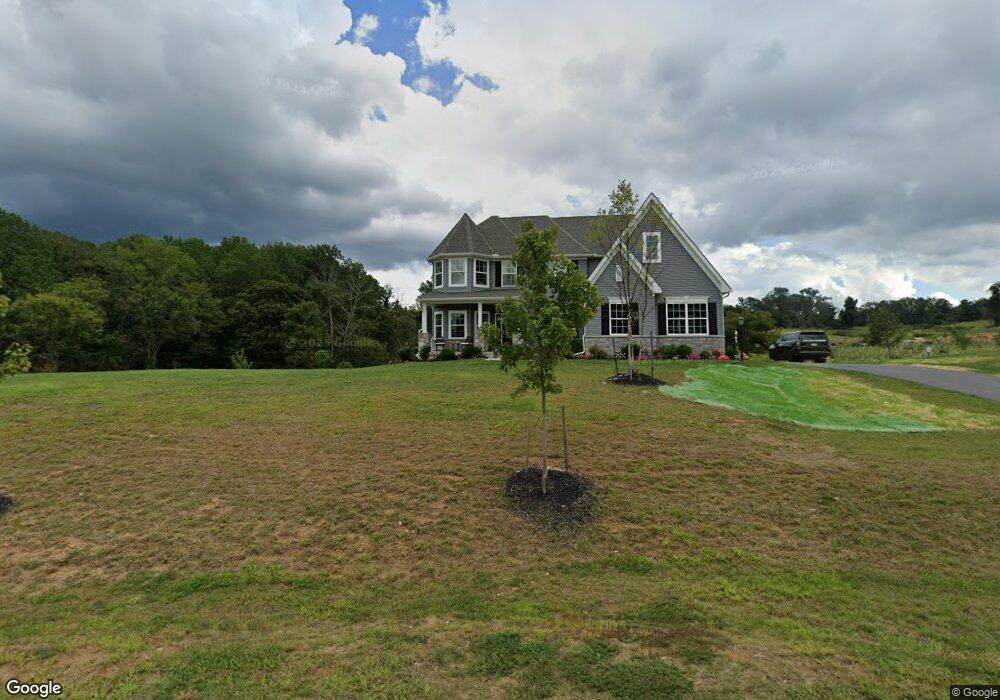
1932 Davis Branch Rd Woodstock, MD 21163
Woodstock NeighborhoodEstimated Value: $1,208,000 - $1,331,000
--
Bed
1
Bath
3,772
Sq Ft
$335/Sq Ft
Est. Value
About This Home
This home is located at 1932 Davis Branch Rd, Woodstock, MD 21163 and is currently estimated at $1,264,462, approximately $335 per square foot. 1932 Davis Branch Rd is a home located in Howard County with nearby schools including Waverly Elementary School, Mount View Middle School, and Marriotts Ridge High School.
Ownership History
Date
Name
Owned For
Owner Type
Purchase Details
Closed on
Mar 30, 2021
Sold by
Sonshine Md Lp
Bought by
Kneller Matthew and Kneller Lori Austin
Current Estimated Value
Home Financials for this Owner
Home Financials are based on the most recent Mortgage that was taken out on this home.
Original Mortgage
$895,719
Outstanding Balance
$802,067
Interest Rate
2.5%
Mortgage Type
New Conventional
Estimated Equity
$462,395
Purchase Details
Closed on
Nov 16, 2018
Sold by
Davis Branch Estates Llc
Bought by
Sonshine Md Lp
Home Financials for this Owner
Home Financials are based on the most recent Mortgage that was taken out on this home.
Original Mortgage
$7,500,000
Interest Rate
4.8%
Mortgage Type
Commercial
Create a Home Valuation Report for This Property
The Home Valuation Report is an in-depth analysis detailing your home's value as well as a comparison with similar homes in the area
Home Values in the Area
Average Home Value in this Area
Purchase History
| Date | Buyer | Sale Price | Title Company |
|---|---|---|---|
| Kneller Matthew | $1,119,649 | None Available | |
| Sonshine Md Lp | $4,285,000 | None Available |
Source: Public Records
Mortgage History
| Date | Status | Borrower | Loan Amount |
|---|---|---|---|
| Open | Kneller Matthew | $895,719 | |
| Previous Owner | Sonshine Md Lp | $7,500,000 |
Source: Public Records
Tax History Compared to Growth
Tax History
| Year | Tax Paid | Tax Assessment Tax Assessment Total Assessment is a certain percentage of the fair market value that is determined by local assessors to be the total taxable value of land and additions on the property. | Land | Improvement |
|---|---|---|---|---|
| 2025 | $12,557 | $929,933 | $0 | $0 |
| 2024 | $12,557 | $876,800 | $223,200 | $653,600 |
| 2023 | $11,897 | $839,900 | $0 | $0 |
| 2022 | $11,356 | $803,000 | $0 | $0 |
| 2021 | $11,135 | $766,100 | $207,000 | $559,100 |
| 2020 | $1,235 | $101,133 | $0 | $0 |
| 2019 | $1,410 | $97,767 | $0 | $0 |
| 2018 | $1,224 | $94,400 | $94,400 | $0 |
| 2017 | $1,224 | $94,400 | $0 | $0 |
| 2016 | -- | $94,400 | $0 | $0 |
| 2015 | -- | $94,400 | $0 | $0 |
| 2014 | -- | $94,400 | $0 | $0 |
Source: Public Records
Map
Nearby Homes
- 10225 Green Clover Dr
- 1575 Grooms Ln
- 10604 Ashford Way
- 10655 Breezewood Dr
- 10209 Wetherburn Rd
- 10715 Taylor Farm Rd
- 2208 Merion Pond
- 10311 Winstead Ct
- 10101 Bracken Dr
- 2133 Bexley Dr
- 10203 Raleigh Tavern Ln
- 10816 Acme Ave
- 1800 Mount Denali Dr
- 2111 Ganton Green
- 2130 Ganton Green Unit 101
- 2115 Ganton Green Unit G106
- 2115 Ganton Green Unit G209
- 10234 Raleigh Tavern Ln
- 1 Pine Hill Ct
- 2634 Queensland Dr
- 1936 Davis Branch Rd
- 1933 Davis Branch Rd
- 1916 Davis Branch Rd
- 1927 Davis Branch Rd
- 1921 Davis Branch Rd Unit DEVONSHIRE
- 1921 Davis Branch Rd
- 1942 Davis Branch Rd
- 1910 Davis Branch Rd
- 1939 Davis Branch Rd
- 1948 Davis Branch Rd
- 1945 Davis Branch Rd
- 1904 Davis Branch Rd
- 1951 Davis Branch Rd
- 1954 Davis Branch Rd
- 1957 Davis Branch Rd
- 1886 Davis Branch Rd
- 1880 Davis Branch Rd
- 1859 Davis Branch Rd
- 1841 Davis Branch Rd
- 1853 Davis Branch Rd