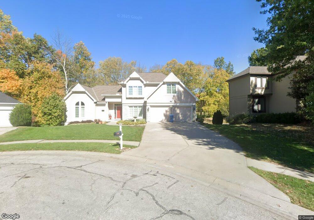
1932 High Dr Liberty, MO 64068
Estimated Value: $401,797 - $421,000
4
Beds
3
Baths
2,218
Sq Ft
$185/Sq Ft
Est. Value
About This Home
This home is located at 1932 High Dr, Liberty, MO 64068 and is currently estimated at $409,949, approximately $184 per square foot. 1932 High Dr is a home located in Clay County with nearby schools including Alexander Doniphan Elementary School, Discovery Middle School, and Liberty High School.
Ownership History
Date
Name
Owned For
Owner Type
Purchase Details
Closed on
Sep 21, 2018
Sold by
Carr David J and Carr Amy S
Bought by
Carr David J and Carr Amy S
Current Estimated Value
Purchase Details
Closed on
Mar 26, 2009
Sold by
Carr Leanne
Bought by
Carr David J and Carr Amy S
Home Financials for this Owner
Home Financials are based on the most recent Mortgage that was taken out on this home.
Original Mortgage
$242,000
Interest Rate
5.21%
Mortgage Type
Purchase Money Mortgage
Purchase Details
Closed on
Jul 31, 2006
Sold by
Carr Daniel K and Carr Leanne
Bought by
Carr Leanne and Leanne Carr Trust
Create a Home Valuation Report for This Property
The Home Valuation Report is an in-depth analysis detailing your home's value as well as a comparison with similar homes in the area
Home Values in the Area
Average Home Value in this Area
Purchase History
| Date | Buyer | Sale Price | Title Company |
|---|---|---|---|
| Carr David J | -- | None Available | |
| Carr David J | $290,000 | None Available | |
| Carr Leanne | -- | None Available |
Source: Public Records
Mortgage History
| Date | Status | Borrower | Loan Amount |
|---|---|---|---|
| Closed | Carr David J | $242,000 |
Source: Public Records
Tax History
| Year | Tax Paid | Tax Assessment Tax Assessment Total Assessment is a certain percentage of the fair market value that is determined by local assessors to be the total taxable value of land and additions on the property. | Land | Improvement |
|---|---|---|---|---|
| 2025 | $4,488 | $63,630 | -- | -- |
| 2024 | $4,488 | $58,350 | -- | -- |
| 2023 | $4,564 | $58,350 | $0 | $0 |
| 2022 | $4,132 | $52,160 | $0 | $0 |
| 2021 | $4,100 | $52,155 | $7,600 | $44,555 |
| 2020 | $3,939 | $47,060 | $0 | $0 |
| 2019 | $3,938 | $47,060 | $0 | $0 |
Source: Public Records
Map
Nearby Homes
- 509 Belmont St
- 407 Glendale Rd
- 607 Glendale Rd
- 429 Pershing St
- 1601 Dunwich Dr
- 405 Wherritt Ln
- 1561 Parkside Dr
- 1232 Old Manor Rd
- 253 S Stewart Rd
- 1209 Liberty Drive Terrace
- Lot 2 Bent Oaks Dr
- 2116 Winding Woods Dr
- 53 Fulkerson Cir
- Lot 2A Oak Crest Dr
- 1114 W Liberty Dr
- 1768 Homestead Dr
- 8816 NE 73rd Terrace
- 9008 NE 80th St
- 7503 N Lewis Ave
- 8915 NE 80th Terrace
- 1928 High Dr
- 1936 High Dr
- 1924 High Dr
- 1940 High Dr
- 1925 High Dr
- 1302 Old Trail Rd
- 1920 High Dr
- 1921 High Dr
- 429 Wilshire Blvd
- 425 Wilshire Blvd
- 1306 Old Trail Rd
- 437 Wilshire Blvd
- 1917 High Dr
- 433 Wilshire Blvd
- 441 Wilshire Blvd
- 421 Wilshire Blvd
- 421 Wilshire Blvd
- 1311 Old Trail Rd
- 1912 High Dr
- 1913 High Dr
Your Personal Tour Guide
Ask me questions while you tour the home.