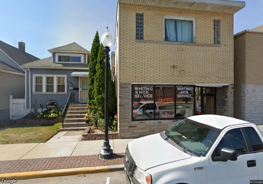
1932 Indianapolis Blvd Unit 2 Whiting, IN 46394
Estimated Value: $255,786 - $442,000
6
Beds
3
Baths
3,984
Sq Ft
$87/Sq Ft
Est. Value
About This Home
This home is located at 1932 Indianapolis Blvd Unit 2, Whiting, IN 46394 and is currently estimated at $348,595, approximately $87 per square foot. 1932 Indianapolis Blvd Unit 2 is a home located in Lake County with nearby schools including Nathan Hale Elementary School, Whiting Middle School, and Whiting High School.
Ownership History
Date
Name
Owned For
Owner Type
Purchase Details
Closed on
Mar 8, 2021
Sold by
Lhr Property Group Llc
Bought by
Calleros Angelica
Current Estimated Value
Purchase Details
Closed on
Feb 27, 2021
Sold by
Lhr Property Group Llc
Bought by
Calleros Angelica
Purchase Details
Closed on
May 16, 2016
Sold by
Hernandez Luis N and Hernandez Alicia
Bought by
Lhr Property Group Llc
Home Financials for this Owner
Home Financials are based on the most recent Mortgage that was taken out on this home.
Original Mortgage
$129,539
Interest Rate
3.71%
Mortgage Type
Seller Take Back
Create a Home Valuation Report for This Property
The Home Valuation Report is an in-depth analysis detailing your home's value as well as a comparison with similar homes in the area
Home Values in the Area
Average Home Value in this Area
Purchase History
| Date | Buyer | Sale Price | Title Company |
|---|---|---|---|
| Calleros Angelica | -- | Greater Indiana Title Company | |
| Calleros Angelica | -- | Greater Indiana Title Co | |
| Lhr Property Group Llc | -- | None Available |
Source: Public Records
Mortgage History
| Date | Status | Borrower | Loan Amount |
|---|---|---|---|
| Previous Owner | Lhr Property Group Llc | $129,539 |
Source: Public Records
Tax History Compared to Growth
Tax History
| Year | Tax Paid | Tax Assessment Tax Assessment Total Assessment is a certain percentage of the fair market value that is determined by local assessors to be the total taxable value of land and additions on the property. | Land | Improvement |
|---|---|---|---|---|
| 2024 | $8,890 | $206,300 | $36,100 | $170,200 |
| 2023 | $4,421 | $201,800 | $36,100 | $165,700 |
| 2022 | $4,421 | $185,400 | $34,700 | $150,700 |
| 2021 | $3,790 | $158,600 | $34,700 | $123,900 |
| 2020 | $3,666 | $153,300 | $34,700 | $118,600 |
| 2019 | $3,760 | $157,300 | $34,700 | $122,600 |
| 2018 | $3,249 | $135,100 | $34,700 | $100,400 |
| 2017 | $3,137 | $130,200 | $34,700 | $95,500 |
| 2016 | $2,792 | $115,300 | $34,700 | $80,600 |
| 2014 | $2,925 | $114,200 | $35,500 | $78,700 |
| 2013 | $2,881 | $112,700 | $35,500 | $77,200 |
Source: Public Records
Map
Nearby Homes
- 2036 Atchison Ave
- 1314 121st St
- 2019 Davidson Place
- 1828 Oliver St
- 2027 1/2 Davidson Place
- 1813 Sheridan Ave
- 2033 Davidson Place
- 1014 Reese Ave
- 1916 Wespark Ave
- 1704 Central Ave
- 1710 Atchison Ave
- 2134 Lincoln Ave
- 2140 Indianapolis Blvd
- 1631 Cleveland Ave
- 1630 Cleveland Ave
- 2024 Lake Ave
- 1663 Center St
- 1651 Center St
- 1643 Roberts Ave
- 1726 Davis Ave
- 1932 Indianapolis Blvd
- 1932 Indianapolis Blvd Unit 3
- 1934 Indianapolis Blvd
- 1930 Indianapolis Blvd
- 1936 Indianapolis Blvd
- 1928 Indianapolis Blvd
- 1938 Indianapolis Blvd
- 1942 Indianapolis Blvd
- 1733 Indianapolis Blvd
- 1525-27 Indianapolis Blvd
- 1719-1733 Indianapolis Blvd
- 1944 Indianapolis Blvd
- 1224 Euclid Ave
- 1222 Euclid Ave
- 1918 Indianapolis Blvd
- 1946 Indianapolis Blvd
- 1220 Euclid Ave
- 1233 120th St
- 1231 120th St
- 1218 Euclid Ave
