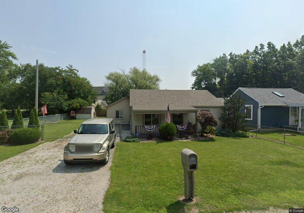
1932 Lagundovie Rd Oregon, OH 43616
Estimated Value: $143,147 - $171,000
2
Beds
2
Baths
1,190
Sq Ft
$127/Sq Ft
Est. Value
About This Home
This home is located at 1932 Lagundovie Rd, Oregon, OH 43616 and is currently estimated at $150,787, approximately $126 per square foot. 1932 Lagundovie Rd is a home located in Lucas County.
Ownership History
Date
Name
Owned For
Owner Type
Purchase Details
Closed on
Nov 28, 2005
Sold by
Dickens Earnie L and Dickens Lisa A
Bought by
Boros Matthew C and Boros Kristina S
Current Estimated Value
Home Financials for this Owner
Home Financials are based on the most recent Mortgage that was taken out on this home.
Original Mortgage
$107,200
Outstanding Balance
$59,551
Interest Rate
6.17%
Mortgage Type
Fannie Mae Freddie Mac
Estimated Equity
$91,236
Purchase Details
Closed on
Aug 6, 1996
Sold by
Est June M Goldstein
Bought by
Dickens Earnie L and Dickens Lisa A
Home Financials for this Owner
Home Financials are based on the most recent Mortgage that was taken out on this home.
Original Mortgage
$25,143
Interest Rate
8.33%
Mortgage Type
New Conventional
Create a Home Valuation Report for This Property
The Home Valuation Report is an in-depth analysis detailing your home's value as well as a comparison with similar homes in the area
Home Values in the Area
Average Home Value in this Area
Purchase History
| Date | Buyer | Sale Price | Title Company |
|---|---|---|---|
| Boros Matthew C | $117,200 | Louisville Title Agency For | |
| Dickens Earnie L | $25,000 | -- |
Source: Public Records
Mortgage History
| Date | Status | Borrower | Loan Amount |
|---|---|---|---|
| Open | Boros Matthew C | $107,200 | |
| Closed | Dickens Earnie L | $25,143 |
Source: Public Records
Tax History Compared to Growth
Tax History
| Year | Tax Paid | Tax Assessment Tax Assessment Total Assessment is a certain percentage of the fair market value that is determined by local assessors to be the total taxable value of land and additions on the property. | Land | Improvement |
|---|---|---|---|---|
| 2024 | $992 | $41,755 | $10,150 | $31,605 |
| 2023 | $1,790 | $32,060 | $9,310 | $22,750 |
| 2022 | $1,803 | $32,060 | $9,310 | $22,750 |
| 2021 | $1,818 | $32,060 | $9,310 | $22,750 |
| 2020 | $1,844 | $28,910 | $8,470 | $20,440 |
| 2019 | $1,791 | $28,910 | $8,470 | $20,440 |
| 2018 | $1,742 | $28,910 | $8,470 | $20,440 |
| 2017 | $1,734 | $26,250 | $4,970 | $21,280 |
| 2016 | $1,712 | $75,000 | $14,200 | $60,800 |
| 2015 | $1,701 | $75,000 | $14,200 | $60,800 |
| 2014 | $1,568 | $25,730 | $4,870 | $20,860 |
| 2013 | $1,568 | $25,730 | $4,870 | $20,860 |
Source: Public Records
Map
Nearby Homes
- 1830 Lilias Dr
- 2057 Blanche Dr
- 5911 Plympton Cir
- 5243 Eagles Landing Dr
- 5305 Cedar Point Rd
- 1633 Grand Bay Dr
- 8800 Cedar Point Rd
- 6530 Corduroy Rd
- 2079 Arkansas St
- 140 N Wynn Rd
- 234 Avilyn Ln
- 4263 Corduroy Rd
- 5054 Magnolia Dr
- 5065 Magnolia Dr
- 8740 Cedar Point Rd
- 5047 Noah Ln
- 5037 Easton Dr
- 5033 Easton Dr
- 5029 Easton Dr
- 5040 Easton Dr
- 1926 Lagundovie Rd
- 1942 Lagundovie Rd
- 1922 Lagundovie Rd
- 1940 Seaford
- 1940 Seaford Dr
- 1927 Lagundovie Rd
- 1952 Lagundovie Rd
- 1912 Lagundovie Rd
- 1932 Seaford Dr
- 1917 Lagundovie Rd
- 1956 Lagundovie Rd
- 1926 Seaford Dr
- 1935 Seaford Dr
- 1962 Lagundovie Rd
- 1907 Lagundovie Rd
- 1961 Lagundovie Rd
- 1931 Seaford Dr
- 1916 Seaford Dr
- 1902 Lagundovie Rd
- 1925 Seaford Dr