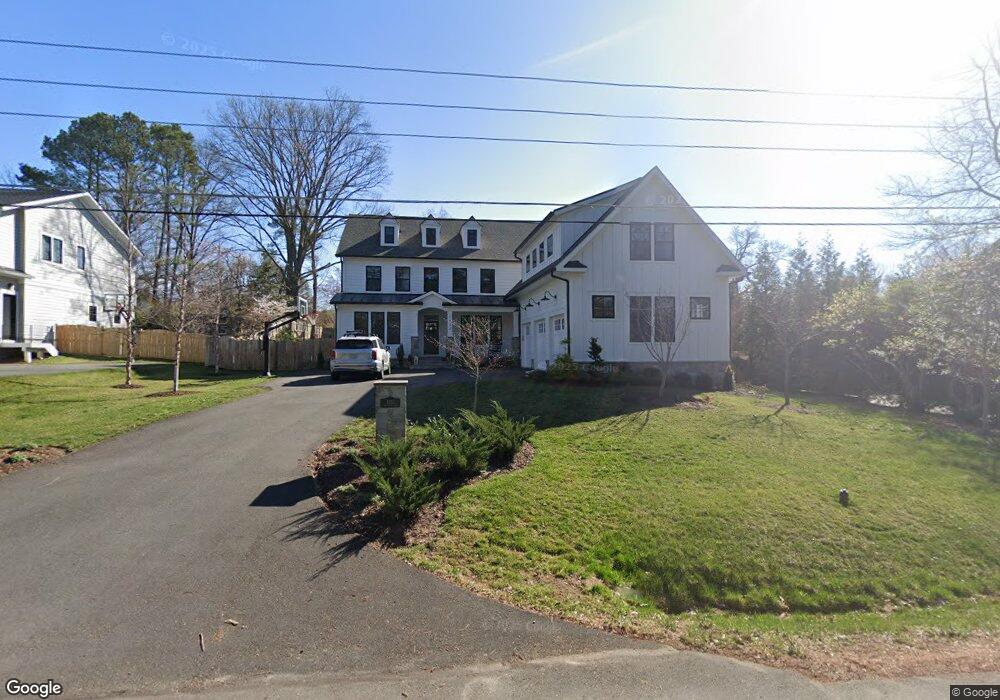
1932 Macarthur Dr McLean, VA 22101
Estimated Value: $2,239,000 - $2,648,000
4
Beds
3
Baths
4,718
Sq Ft
$524/Sq Ft
Est. Value
About This Home
This home is located at 1932 Macarthur Dr, McLean, VA 22101 and is currently estimated at $2,470,705, approximately $523 per square foot. 1932 Macarthur Dr is a home located in Fairfax County with nearby schools including Chesterbrook Elementary School, Longfellow Middle School, and McLean High School.
Ownership History
Date
Name
Owned For
Owner Type
Purchase Details
Closed on
Dec 13, 2010
Sold by
Smith Trustee Robert P
Bought by
Staloch Michael A
Current Estimated Value
Home Financials for this Owner
Home Financials are based on the most recent Mortgage that was taken out on this home.
Original Mortgage
$708,000
Outstanding Balance
$468,238
Interest Rate
4.24%
Mortgage Type
New Conventional
Estimated Equity
$2,002,467
Create a Home Valuation Report for This Property
The Home Valuation Report is an in-depth analysis detailing your home's value as well as a comparison with similar homes in the area
Home Values in the Area
Average Home Value in this Area
Purchase History
| Date | Buyer | Sale Price | Title Company |
|---|---|---|---|
| Staloch Michael A | $885,000 | -- |
Source: Public Records
Mortgage History
| Date | Status | Borrower | Loan Amount |
|---|---|---|---|
| Open | Staloch Michael A | $708,000 |
Source: Public Records
Tax History
| Year | Tax Paid | Tax Assessment Tax Assessment Total Assessment is a certain percentage of the fair market value that is determined by local assessors to be the total taxable value of land and additions on the property. | Land | Improvement |
|---|---|---|---|---|
| 2025 | $26,812 | $2,287,710 | $605,000 | $1,682,710 |
| 2024 | $26,812 | $2,222,330 | $603,000 | $1,619,330 |
| 2023 | $25,815 | $2,199,330 | $580,000 | $1,619,330 |
| 2022 | $8,221 | $2,029,440 | $564,000 | $1,465,440 |
| 2021 | $13,546 | $1,098,680 | $564,000 | $534,680 |
| 2020 | $13,392 | $1,079,330 | $564,000 | $515,330 |
| 2019 | $11,528 | $923,570 | $470,000 | $453,570 |
| 2018 | $11,118 | $966,810 | $470,000 | $496,810 |
| 2017 | $11,792 | $966,810 | $470,000 | $496,810 |
| 2016 | $11,653 | $957,070 | $470,000 | $487,070 |
Source: Public Records
Map
Nearby Homes
- 1917 Kenbar Ct
- 6446 Tucker Ave
- 1806 Lansing Ct
- 6514 Byrnes Dr
- 1904 Lamson Place
- 1730 Barbee St
- 1955 Kirby Rd
- 6501 Divine St
- 1712 Strine Dr
- 6620 Rosecroft Place
- 1843 Rhode Island Ave
- 6526 Dryden Dr
- 2115 Natahoa Ct
- 6607 Midhill Place
- 1853 Massachusetts Ave
- 6539 Fairlawn Dr
- 1705 East Ave
- 6504 Dryden Dr
- 6330 Cross St
- 6304 Old Dominion Dr
- 1936 Macarthur Dr
- 1928 Macarthur Dr
- 1916 Macarthur Dr
- 1902 Bargo Ct
- 1944 Macarthur Dr
- 1900 Bargo Ct
- 1906 Bargo Ct
- 1939 Macarthur Dr
- 1935 Macarthur Dr
- 1943 Macarthur Dr
- 1857 Kirby Rd
- 1931 Macarthur Dr
- 1946 Macarthur Dr
- 1945 Macarthur Dr
- 1917 Macarthur Dr
- 1806 Franklin Ave
- 1921 Macarthur Dr
- 1901 Bargo Ct
- 1925 Macarthur Dr
- 1927 Macarthur Dr
Your Personal Tour Guide
Ask me questions while you tour the home.