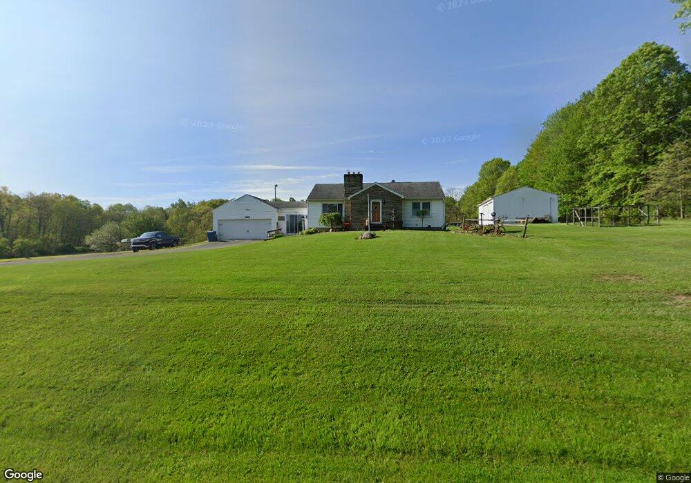
1932 Ohltown McDonald Rd Mc Donald, OH 44437
Estimated Value: $244,000 - $284,000
3
Beds
1
Bath
1,344
Sq Ft
$196/Sq Ft
Est. Value
About This Home
This home is located at 1932 Ohltown McDonald Rd, Mc Donald, OH 44437 and is currently estimated at $264,096, approximately $196 per square foot. 1932 Ohltown McDonald Rd is a home located in Trumbull County with nearby schools including Seaborn Elementary School, Mineral Ridge High School, and Niles Preparatory Academy.
Ownership History
Date
Name
Owned For
Owner Type
Purchase Details
Closed on
Dec 28, 2005
Sold by
Barney Anna
Bought by
Fisher Michael A and Fisher Debra L
Current Estimated Value
Home Financials for this Owner
Home Financials are based on the most recent Mortgage that was taken out on this home.
Original Mortgage
$148,824
Outstanding Balance
$84,686
Interest Rate
6.48%
Mortgage Type
FHA
Estimated Equity
$179,410
Purchase Details
Closed on
Dec 22, 2005
Sold by
Barney Anna
Bought by
Fisher Michael A and Fisher Debra L
Home Financials for this Owner
Home Financials are based on the most recent Mortgage that was taken out on this home.
Original Mortgage
$148,824
Outstanding Balance
$84,686
Interest Rate
6.48%
Mortgage Type
FHA
Estimated Equity
$179,410
Purchase Details
Closed on
Jan 1, 1990
Bought by
Anna Barney
Create a Home Valuation Report for This Property
The Home Valuation Report is an in-depth analysis detailing your home's value as well as a comparison with similar homes in the area
Home Values in the Area
Average Home Value in this Area
Purchase History
| Date | Buyer | Sale Price | Title Company |
|---|---|---|---|
| Fisher Michael A | $150,000 | -- | |
| Fisher Michael A | $150,000 | -- | |
| Anna Barney | -- | -- |
Source: Public Records
Mortgage History
| Date | Status | Borrower | Loan Amount |
|---|---|---|---|
| Open | Fisher Michael A | $148,824 | |
| Closed | Fisher Michael A | $148,824 |
Source: Public Records
Tax History Compared to Growth
Tax History
| Year | Tax Paid | Tax Assessment Tax Assessment Total Assessment is a certain percentage of the fair market value that is determined by local assessors to be the total taxable value of land and additions on the property. | Land | Improvement |
|---|---|---|---|---|
| 2024 | $3,123 | $65,670 | $17,120 | $48,550 |
| 2023 | $3,123 | $65,670 | $17,120 | $48,550 |
| 2022 | $2,649 | $51,600 | $17,120 | $34,480 |
| 2021 | $2,648 | $51,600 | $17,120 | $34,480 |
| 2020 | $2,653 | $51,600 | $17,120 | $34,480 |
| 2019 | $2,742 | $49,640 | $17,120 | $32,520 |
| 2018 | $2,730 | $49,640 | $17,120 | $32,520 |
| 2017 | $2,727 | $49,640 | $17,120 | $32,520 |
| 2016 | $2,612 | $45,330 | $17,120 | $28,210 |
| 2015 | $2,608 | $45,330 | $17,120 | $28,210 |
| 2014 | $2,616 | $45,330 | $17,120 | $28,210 |
| 2013 | $2,573 | $45,330 | $17,120 | $28,210 |
Source: Public Records
Map
Nearby Homes
- 2957 Greenfield Ave
- 1721 Ohltown McDonald Rd
- 3050 Trumbull Ave
- 0 Arlington St Unit 5080704
- 3114 Youngstown Ave
- 14 Olive St
- 3117 Youngstown Ave
- 2169 Salt Springs Rd
- 804 Texas Ave
- 0 Summit
- 3328 Main St
- 522 Illinois Ave
- 328 Scott Ave
- 3474 S Main St
- 412 Ohio Ave
- 611 Mason St
- 561 Ward Ave
- 304 Ohio Ave
- 934 Mason St
- 1684 Morris St
- 1931 Ohltown McDonald Rd
- 1915 Ohltown McDonald Rd
- 1974 Ohltown McDonald Rd
- 1895 Ohltown McDonald Rd
- 1984 Ohltown McDonald Rd
- 1875 Ohltown McDonald Rd
- 1983 Ohltown McDonald Rd
- 1886 James B Dr
- 3007 Niles Carver Rd
- 2024 Ohltown McDonald Rd
- 3005 Niles Carver Rd
- 2027 Ohltown McDonald Rd
- 1866 James B Dr
- 2038 Ohltown McDonald Rd
- 2943 Niles Carver Rd
- 1852 James B Dr
- 3040 Niles Carver Rd
- 3008 Clearfield St
- 2927 Niles Carver Rd
- 2050 Ohltown McDonald Rd