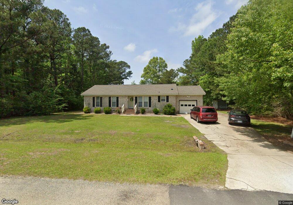
1932 Old Colony Rd Kinston, NC 28504
Estimated Value: $188,000 - $233,000
3
Beds
2
Baths
1,569
Sq Ft
$138/Sq Ft
Est. Value
About This Home
This home is located at 1932 Old Colony Rd, Kinston, NC 28504 and is currently estimated at $216,826, approximately $138 per square foot. 1932 Old Colony Rd is a home located in Lenoir County with nearby schools including Banks Elementary School, E.B. Frink Middle School, and North Lenoir High School.
Ownership History
Date
Name
Owned For
Owner Type
Purchase Details
Closed on
May 13, 2005
Sold by
Federal National Mortgage Association
Bought by
Minshew Delmas E
Current Estimated Value
Home Financials for this Owner
Home Financials are based on the most recent Mortgage that was taken out on this home.
Original Mortgage
$82,875
Outstanding Balance
$42,822
Interest Rate
5.8%
Mortgage Type
Purchase Money Mortgage
Estimated Equity
$174,004
Purchase Details
Closed on
Apr 4, 2005
Sold by
Blair Nathan E and Blair Sharon C
Bought by
Federal National Mortgage Association
Home Financials for this Owner
Home Financials are based on the most recent Mortgage that was taken out on this home.
Original Mortgage
$82,875
Outstanding Balance
$42,822
Interest Rate
5.8%
Mortgage Type
Purchase Money Mortgage
Estimated Equity
$174,004
Purchase Details
Closed on
Dec 30, 2004
Sold by
Blair Nathan E and Blair Sharon C
Bought by
Federal National Mortgage Association
Create a Home Valuation Report for This Property
The Home Valuation Report is an in-depth analysis detailing your home's value as well as a comparison with similar homes in the area
Home Values in the Area
Average Home Value in this Area
Purchase History
| Date | Buyer | Sale Price | Title Company |
|---|---|---|---|
| Minshew Delmas E | -- | None Available | |
| Federal National Mortgage Association | $113,074 | None Available | |
| Federal National Mortgage Association | $108,559 | None Available |
Source: Public Records
Mortgage History
| Date | Status | Borrower | Loan Amount |
|---|---|---|---|
| Open | Minshew Delmas E | $82,875 |
Source: Public Records
Tax History Compared to Growth
Tax History
| Year | Tax Paid | Tax Assessment Tax Assessment Total Assessment is a certain percentage of the fair market value that is determined by local assessors to be the total taxable value of land and additions on the property. | Land | Improvement |
|---|---|---|---|---|
| 2025 | $1,222 | $168,644 | $12,677 | $155,967 |
| 2024 | $1,234 | $136,773 | $12,500 | $124,273 |
| 2023 | $1,234 | $136,773 | $12,500 | $124,273 |
| 2022 | $1,324 | $136,773 | $12,500 | $124,273 |
| 2021 | $1,231 | $136,773 | $12,500 | $124,273 |
| 2020 | $1,231 | $136,773 | $12,500 | $124,273 |
| 2019 | $1,234 | $136,773 | $12,500 | $124,273 |
| 2018 | $1,214 | $136,773 | $12,500 | $124,273 |
| 2017 | $1,305 | $136,773 | $12,500 | $124,273 |
| 2014 | $1,120 | $127,220 | $12,500 | $114,720 |
| 2013 | -- | $127,220 | $12,500 | $114,720 |
| 2011 | -- | $127,220 | $12,500 | $114,720 |
Source: Public Records
Map
Nearby Homes
- 1957 Country Squire Rd
- 0 Hwy 258 N Unit LotWP001 22409279
- 2671 Brookwood Rd
- 3100 Wheat Swamp Rd
- 2321 Fred Everett Rd
- 3178 Alton Phillips Rd
- 2443 Creekside Rd
- 2100 Hwy 258 N
- 2445 Tammy Dr
- Lot 3 Branchwood Dr
- Lot 2 Branchwood Dr
- 3379 Danfield Dr
- 3494 Danfield Dr
- 2193 Dogwood Ln
- 2526 Moulton Dr
- 2886 Fox Run Cir
- 2912 Fox Run Cir
- 3128 Kelly Rd
- 2277 Hull Rd
- 2673 Stokes Cir
- 1903 Country Squire Rd
- 94 Old Colony Rd
- 95 Old Colony Rd
- 93 Old Colony Rd
- 92 Old Colony Rd
- 91 Old Colony Rd
- 90 Old Colony Rd
- 89 Old Colony Rd
- 1909 Country Squire Rd
- 1933 Old Colony Rd
- 1901 Country Squire Rd
- 1919 Country Squire Rd
- 1904 Country Squire Rd
- 99 Old Jamestown Rd
- 35 Old Jamestown Rd
- 34 Old Jamestown Rd
- 33 Old Jamestown Rd
- 32 Old Jamestown Rd
- 31 Old Jamestown Rd
- 107 Old Jamestown Rd