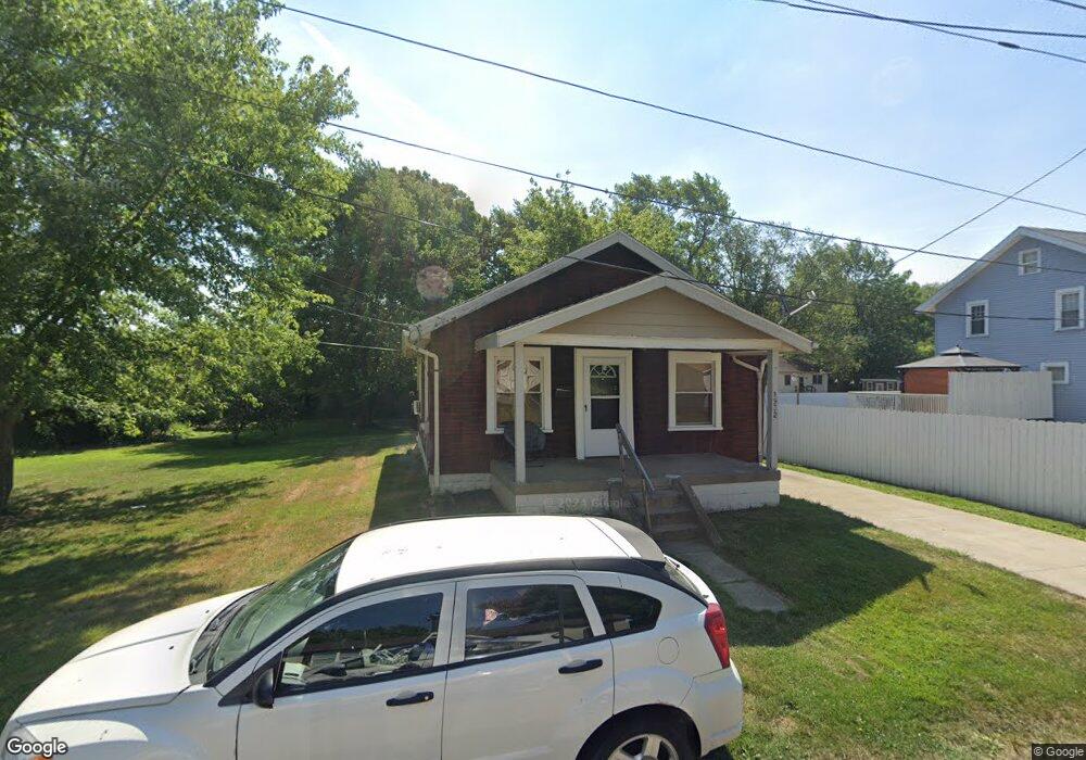
1932 Root Ave NE Canton, OH 44705
Fairmount NeighborhoodEstimated Value: $51,000 - $77,000
2
Beds
1
Bath
768
Sq Ft
$88/Sq Ft
Est. Value
About This Home
This home is located at 1932 Root Ave NE, Canton, OH 44705 and is currently estimated at $67,536, approximately $87 per square foot. 1932 Root Ave NE is a home located in Stark County with nearby schools including Belle Stone Elementary School, Early Learning Center @ Schreiber, and Youtz Intermediate School.
Ownership History
Date
Name
Owned For
Owner Type
Purchase Details
Closed on
Oct 13, 2021
Sold by
Oxbridge Holdings Llc
Bought by
Sapphfre Properties Of Ohio Llc
Current Estimated Value
Home Financials for this Owner
Home Financials are based on the most recent Mortgage that was taken out on this home.
Original Mortgage
$653,360
Outstanding Balance
$552,450
Interest Rate
2.8%
Mortgage Type
Future Advance Clause Open End Mortgage
Estimated Equity
-$484,914
Purchase Details
Closed on
Aug 29, 2014
Sold by
Schlabach Johannes
Bought by
Oxbridge Holdings Llc
Home Financials for this Owner
Home Financials are based on the most recent Mortgage that was taken out on this home.
Original Mortgage
$40,000
Interest Rate
4.1%
Mortgage Type
Future Advance Clause Open End Mortgage
Purchase Details
Closed on
Sep 27, 2013
Sold by
Schlabach Donna Marie
Bought by
Schlabach Johannes
Purchase Details
Closed on
Feb 7, 2008
Sold by
Schlabach Johannes E and Schlabach Donna Marie
Bought by
Long Debra
Home Financials for this Owner
Home Financials are based on the most recent Mortgage that was taken out on this home.
Original Mortgage
$44,500
Interest Rate
6.11%
Mortgage Type
Seller Take Back
Purchase Details
Closed on
Feb 24, 2006
Sold by
Howard Wendy and Kennedy Wendy L
Bought by
Schlabach Johannes E and Schlabach Donna Marie
Home Financials for this Owner
Home Financials are based on the most recent Mortgage that was taken out on this home.
Original Mortgage
$20,800
Interest Rate
6.2%
Mortgage Type
Purchase Money Mortgage
Purchase Details
Closed on
Aug 19, 1999
Sold by
Mayle Franklin D
Bought by
Kennedy Wendy L and Mayle Wendy
Purchase Details
Closed on
Mar 13, 1997
Sold by
Moore Fred J
Bought by
Mayle Wendy
Home Financials for this Owner
Home Financials are based on the most recent Mortgage that was taken out on this home.
Original Mortgage
$26,227
Interest Rate
7.95%
Mortgage Type
FHA
Create a Home Valuation Report for This Property
The Home Valuation Report is an in-depth analysis detailing your home's value as well as a comparison with similar homes in the area
Home Values in the Area
Average Home Value in this Area
Purchase History
| Date | Buyer | Sale Price | Title Company |
|---|---|---|---|
| Sapphfre Properties Of Ohio Llc | $694,200 | None Available | |
| Oxbridge Holdings Llc | $49,000 | None Available | |
| Schlabach Johannes | $10,000 | None Available | |
| Long Debra | $56,000 | Attorney | |
| Schlabach Johannes E | $25,000 | None Available | |
| Kennedy Wendy L | -- | -- | |
| Mayle Wendy | $25,800 | -- |
Source: Public Records
Mortgage History
| Date | Status | Borrower | Loan Amount |
|---|---|---|---|
| Open | Sapphfre Properties Of Ohio Llc | $653,360 | |
| Previous Owner | Oxbridge Holdings Llc | $40,000 | |
| Previous Owner | Long Debra | $44,500 | |
| Previous Owner | Schlabach Johannes E | $20,800 | |
| Previous Owner | Mayle Wendy | $26,227 |
Source: Public Records
Tax History
| Year | Tax Paid | Tax Assessment Tax Assessment Total Assessment is a certain percentage of the fair market value that is determined by local assessors to be the total taxable value of land and additions on the property. | Land | Improvement |
|---|---|---|---|---|
| 2025 | -- | $15,680 | $3,150 | $12,530 |
| 2024 | -- | $15,680 | $3,150 | $12,530 |
| 2023 | $641 | $10,500 | $2,310 | $8,190 |
| 2022 | $621 | $10,500 | $2,310 | $8,190 |
| 2021 | $627 | $10,500 | $2,310 | $8,190 |
| 2020 | $572 | $8,580 | $1,930 | $6,650 |
| 2019 | $501 | $8,590 | $1,930 | $6,660 |
Source: Public Records
Map
Nearby Homes
- 1824 Root Ave NE
- 2322 21st St NE
- 1742 Taft Ave NE
- 2529 17th St NE
- 2438 Indiana Way NE
- 2211 17th St NE
- 2111 21st St NE
- 2216 17th St NE
- 2328 26th St NE
- 2010 18th St NE
- 1820 Midway Ave NE
- 2102 16th St NE
- 2012 Endrow Ave NE
- 2102 Endrow Ave NE
- 2402 14th St NE
- 0 Dover Ave NE
- 3106 22nd St NE
- 2208 Willowrow Ave NE
- 2103 Bollinger Ave NE
- 1417 Harrisburg Rd NE
- 1920 Root Ave NE
- 1920 Root Ave NE
- 1931 Royal Ave NE
- 1929 Root Ave NE
- 1921 Royal Ave NE
- 1923 Root Ave NE
- 2431 20th St NE
- 2435 20th St NE
- 1910 Root Ave NE
- 1917 Root Ave NE
- 2419 20th St NE
- 1915 Royal Ave NE
- 2447 20th St NE
- 2449 20th St NE
- 1913 Root Ave NE
- 2415 20th St NE
- 1907 Royal Ave NE
- 2451 20th St NE
- 1902 Root Ave NE
- 1934 Superior Ave NE
Your Personal Tour Guide
Ask me questions while you tour the home.