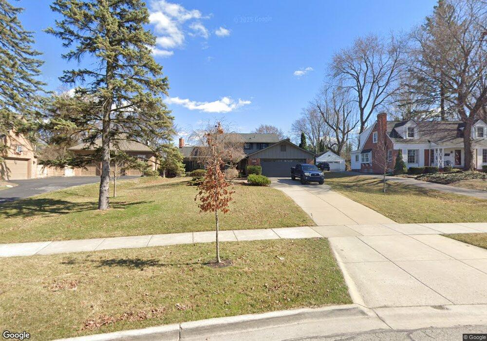
1932 Vinsetta Blvd Royal Oak, MI 48073
Estimated Value: $564,000 - $829,000
4
Beds
3
Baths
2,709
Sq Ft
$260/Sq Ft
Est. Value
About This Home
This home is located at 1932 Vinsetta Blvd, Royal Oak, MI 48073 and is currently estimated at $703,788, approximately $259 per square foot. 1932 Vinsetta Blvd is a home located in Oakland County with nearby schools including Northwood Elementary School, Royal Oak Middle School, and Royal Oak High School.
Ownership History
Date
Name
Owned For
Owner Type
Purchase Details
Closed on
Feb 10, 2012
Sold by
Knight John B and Knight Whitney C
Bought by
Cerone Shane M and Cerone Sarah A
Current Estimated Value
Home Financials for this Owner
Home Financials are based on the most recent Mortgage that was taken out on this home.
Original Mortgage
$280,000
Outstanding Balance
$191,553
Interest Rate
3.86%
Mortgage Type
New Conventional
Estimated Equity
$512,235
Purchase Details
Closed on
Sep 28, 2009
Sold by
Jones Leonard L and Jones Joan W
Bought by
Knight John B and Knight Whitney C
Create a Home Valuation Report for This Property
The Home Valuation Report is an in-depth analysis detailing your home's value as well as a comparison with similar homes in the area
Home Values in the Area
Average Home Value in this Area
Purchase History
| Date | Buyer | Sale Price | Title Company |
|---|---|---|---|
| Cerone Shane M | $350,000 | Title Connect Llc | |
| Knight John B | -- | None Available |
Source: Public Records
Mortgage History
| Date | Status | Borrower | Loan Amount |
|---|---|---|---|
| Open | Cerone Shane M | $280,000 |
Source: Public Records
Tax History Compared to Growth
Tax History
| Year | Tax Paid | Tax Assessment Tax Assessment Total Assessment is a certain percentage of the fair market value that is determined by local assessors to be the total taxable value of land and additions on the property. | Land | Improvement |
|---|---|---|---|---|
| 2024 | $7,041 | $296,120 | $0 | $0 |
| 2022 | $8,320 | $239,550 | $0 | $0 |
| 2020 | $6,842 | $217,510 | $0 | $0 |
| 2018 | $8,320 | $197,300 | $0 | $0 |
| 2017 | $7,995 | $197,300 | $0 | $0 |
| 2015 | -- | $192,470 | $0 | $0 |
| 2014 | -- | $190,000 | $0 | $0 |
| 2011 | -- | $182,260 | $0 | $0 |
Source: Public Records
Map
Nearby Homes
- 2015 Alicia Ln
- 719 W 12 Mile Rd
- 1721 Forestdale Ct
- 629 W Houstonia Ave
- 1507 Roseland Ave
- 817 Magnolia Ave
- 1211 Smith Ave
- 1319 Woodsboro Dr
- 508 W Houstonia Ave
- 2115 Marywood Dr
- 1630 W 12 Mile Rd
- 1828 N Lafayette Ave
- 1718 W 12 Mile Rd
- 1833 N Washington Ave
- 1821 N Washington Ave
- 2438 Evergreen Dr
- 1808 W 12 Mile Rd
- 227 W Houstonia Ave
- 2422 Oliver Rd
- 214 W 12 Mile Rd
- 1926 Vinsetta Blvd
- 1920 Vinsetta Blvd
- 1946 Vinsetta Blvd
- 1909 McDonald Ave
- 1903 McDonald Ave
- 1915 McDonald Ave
- 1841 McDonald Ave
- 1914 Vinsetta Blvd
- 1921 McDonald Ave
- 1829 McDonald Ave
- 1908 Vinsetta Blvd
- 1927 McDonald Ave
- 1935 Vinsetta Blvd
- 1925 Vinsetta Blvd
- 1935 McDonald Ave
- 1823 McDonald Ave
- 1902 Vinsetta Blvd
- 2002 Vinsetta Blvd
- 2007 Vinsetta Blvd
- 1884 Vinsetta Blvd