Estimated Value: $362,000 - $416,635
3
Beds
3
Baths
1,852
Sq Ft
$215/Sq Ft
Est. Value
About This Home
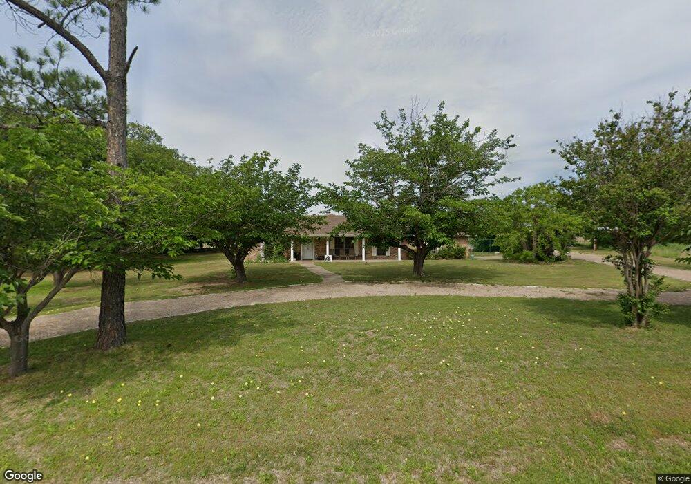
This home is located at 1932 Walter Smith Rd, Azle, TX 76020 and is currently estimated at $398,909, approximately $215 per square foot. 1932 Walter Smith Rd is a home located in Tarrant County with nearby schools including Azle Elementary School, Azle Junior High School, and Azle High School.
Ownership History
Date
Name
Owned For
Owner Type
Purchase Details
Closed on
Jul 20, 2023
Sold by
Houston Bethany Joy and Mcdonough Robert James
Bought by
Conner Carroll B
Current Estimated Value
Purchase Details
Closed on
Dec 13, 2012
Sold by
Gilliland Peggy L and Gilliland Peggy Lou
Bought by
Conner Carroll B and Conner Dawn
Home Financials for this Owner
Home Financials are based on the most recent Mortgage that was taken out on this home.
Original Mortgage
$136,000
Interest Rate
3.41%
Mortgage Type
New Conventional
Create a Home Valuation Report for This Property
The Home Valuation Report is an in-depth analysis detailing your home's value as well as a comparison with similar homes in the area
Home Values in the Area
Average Home Value in this Area
Purchase History
| Date | Buyer | Sale Price | Title Company |
|---|---|---|---|
| Conner Carroll B | -- | Stewart Title North Texas | |
| Conner Carroll B | -- | None Available |
Source: Public Records
Mortgage History
| Date | Status | Borrower | Loan Amount |
|---|---|---|---|
| Previous Owner | Conner Carroll B | $136,000 |
Source: Public Records
Tax History Compared to Growth
Tax History
| Year | Tax Paid | Tax Assessment Tax Assessment Total Assessment is a certain percentage of the fair market value that is determined by local assessors to be the total taxable value of land and additions on the property. | Land | Improvement |
|---|---|---|---|---|
| 2025 | $2,443 | $414,488 | $92,745 | $321,743 |
| 2024 | $2,443 | $414,488 | $92,745 | $321,743 |
| 2023 | $6,238 | $390,000 | $92,745 | $297,255 |
| 2022 | $4,900 | $262,170 | $52,745 | $209,425 |
| 2021 | $4,873 | $266,205 | $52,745 | $213,460 |
| 2020 | $4,430 | $266,205 | $52,075 | $214,130 |
| 2019 | $4,213 | $210,000 | $52,075 | $157,925 |
| 2018 | $4,213 | $210,000 | $52,075 | $157,925 |
| 2017 | $4,616 | $241,720 | $52,075 | $189,645 |
| 2016 | $3,389 | $177,481 | $52,175 | $125,306 |
| 2015 | $3,187 | $165,600 | $34,500 | $131,100 |
| 2014 | $3,187 | $165,600 | $34,500 | $131,100 |
Source: Public Records
Map
Nearby Homes
- 1933 Walter Smith Rd
- 1922 Walter Smith Rd
- 1917 Walter Smith Rd
- 1907 Live Oak Cir
- 1617 Florence Dr
- 11609 Hardwood Ct
- 1716 Southeast Pkwy
- 1508 Red Oak Cir
- 428 Wilshire Ave
- 432 Wilshire Ave
- 5944 Tenderfoot Trail
- 6100 Black Leaf Ct
- 7442 Cottonwood Creek Rd
- 6942 Silver Creek Azle Rd
- 120 Timberlake Dr
- 1320 Craft Farms Cir
- 620 E Columbia Dr
- 112 Ty Ln
- 532 Marquette Ave
- 621 Alameda Rd
- 1924 Walter Smith Rd
- 1521 Oakridge Ct W
- 1925 Walter Smith Rd
- 1544 Oakridge Ct W
- 1536 Oakridge Ct W
- 1528 Oakridge Ct W
- 1609 Oakridge Ct E
- 1519 Oakridge Ct W
- 2005 Walter Smith Rd
- 2001 Oakcrest Ct
- 1608 Oakridge Ct E
- 1908 Walter Smith Rd
- 1924 Live Oak Cir
- 1916 Live Oak Cir
- 1907 Walter Smith Rd
- 1616 Oakridge Ct E
- 1517 Oakridge Ct W
- 2000 Oakcrest Ct
- 1516 Oakridge Ct W
- 1540 Florence Dr