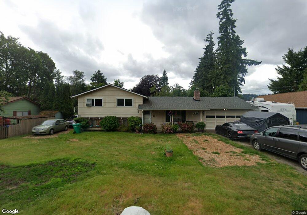
19325 SE Kay St Milwaukie, OR 97267
Estimated Value: $527,000 - $600,000
4
Beds
2
Baths
1,844
Sq Ft
$303/Sq Ft
Est. Value
About This Home
This home is located at 19325 SE Kay St, Milwaukie, OR 97267 and is currently estimated at $558,424, approximately $302 per square foot. 19325 SE Kay St is a home located in Clackamas County with nearby schools including Jennings Lodge Elementary School, Candy Lane Elementary School, and Gardiner Middle School.
Ownership History
Date
Name
Owned For
Owner Type
Purchase Details
Closed on
Sep 26, 2002
Sold by
Rollins Charles H and Rollins Barbara J
Bought by
Slye Glenn K and Slye Dawn M
Current Estimated Value
Home Financials for this Owner
Home Financials are based on the most recent Mortgage that was taken out on this home.
Original Mortgage
$142,000
Outstanding Balance
$58,409
Interest Rate
6.16%
Estimated Equity
$500,015
Create a Home Valuation Report for This Property
The Home Valuation Report is an in-depth analysis detailing your home's value as well as a comparison with similar homes in the area
Home Values in the Area
Average Home Value in this Area
Purchase History
| Date | Buyer | Sale Price | Title Company |
|---|---|---|---|
| Slye Glenn K | $177,500 | First American Title Ins Co |
Source: Public Records
Mortgage History
| Date | Status | Borrower | Loan Amount |
|---|---|---|---|
| Open | Slye Glenn K | $142,000 | |
| Closed | Slye Glenn K | $10,000 |
Source: Public Records
Tax History Compared to Growth
Tax History
| Year | Tax Paid | Tax Assessment Tax Assessment Total Assessment is a certain percentage of the fair market value that is determined by local assessors to be the total taxable value of land and additions on the property. | Land | Improvement |
|---|---|---|---|---|
| 2025 | $4,628 | $266,356 | -- | -- |
| 2024 | $4,174 | $258,599 | -- | -- |
| 2023 | $4,174 | $251,067 | $0 | $0 |
| 2022 | $3,825 | $243,755 | $0 | $0 |
| 2021 | $3,664 | $236,656 | $0 | $0 |
| 2020 | $3,560 | $229,764 | $0 | $0 |
| 2019 | $3,489 | $223,072 | $0 | $0 |
| 2018 | $3,304 | $216,575 | $0 | $0 |
| 2017 | $3,220 | $210,267 | $0 | $0 |
| 2016 | $3,149 | $204,143 | $0 | $0 |
| 2015 | $3,067 | $198,197 | $0 | $0 |
| 2014 | $2,981 | $192,424 | $0 | $0 |
Source: Public Records
Map
Nearby Homes
- 19503 SE Kay St
- 19319 SE River Rd
- 19643 SE Jay St
- 19697 SE Cottonwood St
- 19575 River Rd Unit 53
- 18515 SE River Rd
- 19605 River Rd Unit 122
- 19145 Addie St
- 441 W Gloucester St
- 700 Barton Ave Unit 1
- 5227 SE Bandon Ln
- 232 W Hereford St
- 5314 SE Jennings Ave
- 5905 SE Angel Ln
- 4622 Mapleton Dr
- 115 E Jersey St
- 117 E Jersey St
- 155 W Fairfield St
- 119 E Jersey St
- 0 0 Se Jennings Ave
- 19317 SE Kay St
- 19355 SE Kay St
- 19414 SE Marcia Ct
- 19406 SE Marcia Ct
- 19309 SE Kay St
- 4909 SE Britton Ave
- 19393 SE Kay St
- 19224 SE Kay St
- 19428 SE Marcia Ct
- 19301 SE Kay St
- 4921 SE Britton Ave
- 5006 SE Britton Ave
- 19306 SE Kay St
- 4722 SE Meldrum Ave
- 4921 SE Glen Echo Ave
- 4730 SE Meldrum Ave
- 4995 SE Glen Echo Ave
- 4921 SE Glen Echo Quiet End
- 5008 SE Britton Ave
- 4951 SE Britton Ave