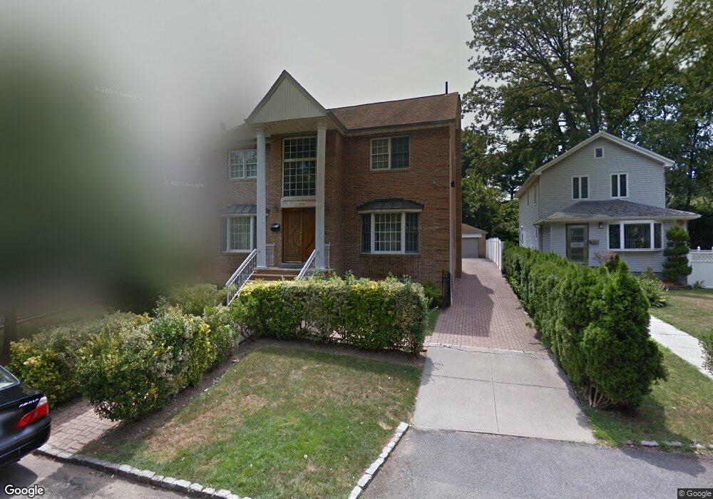
19328 Nero Ave Hollis, NY 11423
Holliswood NeighborhoodEstimated Value: $1,518,494 - $2,062,000
--
Bed
--
Bath
3,060
Sq Ft
$607/Sq Ft
Est. Value
About This Home
This home is located at 19328 Nero Ave, Hollis, NY 11423 and is currently estimated at $1,856,374, approximately $606 per square foot. 19328 Nero Ave is a home located in Queens County with nearby schools including P.S. I.S. 178 The Holliswood School, George J. Ryan Middle School 216, and The Wellspring Schools.
Ownership History
Date
Name
Owned For
Owner Type
Purchase Details
Closed on
Jun 27, 2022
Sold by
Mascoe Jessie
Bought by
Mascoe Jessie
Current Estimated Value
Purchase Details
Closed on
Dec 10, 1999
Sold by
Mascoe Henry
Bought by
Mascoe Henry and Mascoe Jessie
Purchase Details
Closed on
Feb 6, 1998
Sold by
Stack Lorene Ann
Bought by
Mascoe Henry
Create a Home Valuation Report for This Property
The Home Valuation Report is an in-depth analysis detailing your home's value as well as a comparison with similar homes in the area
Home Values in the Area
Average Home Value in this Area
Purchase History
| Date | Buyer | Sale Price | Title Company |
|---|---|---|---|
| Mascoe Jessie | -- | -- | |
| Mascoe Jessie | -- | -- | |
| Mascoe Henry | -- | Commonwealth Land Title Ins | |
| Mascoe Henry | -- | Commonwealth Land Title Ins | |
| Mascoe Henry | $170,000 | Chicago Title Insurance Co | |
| Mascoe Henry | $170,000 | Chicago Title Insurance Co |
Source: Public Records
Tax History Compared to Growth
Tax History
| Year | Tax Paid | Tax Assessment Tax Assessment Total Assessment is a certain percentage of the fair market value that is determined by local assessors to be the total taxable value of land and additions on the property. | Land | Improvement |
|---|---|---|---|---|
| 2025 | $15,427 | $81,418 | $23,659 | $57,759 |
| 2024 | $15,427 | $76,810 | $26,740 | $50,070 |
| 2023 | $15,599 | $76,810 | $24,898 | $51,912 |
| 2022 | $14,444 | $85,440 | $29,640 | $55,800 |
| 2021 | $15,135 | $80,100 | $29,640 | $50,460 |
| 2020 | $14,361 | $68,880 | $29,640 | $39,240 |
| 2019 | $13,390 | $65,700 | $29,640 | $36,060 |
| 2018 | $13,048 | $64,008 | $24,839 | $39,169 |
| 2017 | $12,950 | $63,527 | $26,845 | $36,682 |
| 2016 | $11,981 | $63,527 | $26,845 | $36,682 |
| 2015 | $7,415 | $56,540 | $29,091 | $27,449 |
| 2014 | $7,415 | $53,340 | $32,940 | $20,400 |
Source: Public Records
Map
Nearby Homes
- 19346 Mclaughlin Ave
- 19512 Mclaughlin Ave
- 195-12 Mclaughlin Ave
- 19615 Como Ave
- 195-22 Mclaughlin Ave
- 193-55 85th Rd
- 190-22 Nero Ave
- 193-03 85th Rd
- 86-55 Santiago St
- 8716 Palo Alto St
- 19922 Keno Ave
- 8714 Santiago St
- 8601 Marengo St
- 19703 Mclaughlin Ave
- 87-16 Marengo St Unit 2B
- 87-24 Marengo St Unit 2B
- 196-35 Dunton Ave Unit 1
- 8684 188th St
- 19127 Foothill Ave
- 198-31 Pompeii Ave
- 193-24 Nero Ave
- 19324 Nero Ave
- 8668 Sancho St
- 8664 Sancho St
- 8672 Sancho St
- 8676 Sancho St
- 19316 Nero Ave
- 8680 Sancho St
- 193-29 Nero Ave
- 19329 Nero Ave
- 19325 Nero Ave
- 193-21 Nero Ave
- 8621 Palermo St
- 19335 Nero Ave
- 19321 Nero Ave
- 86-29 Palermo St
- 8629 Palermo St
- 8633 Palermo St
- 19341 Nero Ave
- 8601 Palermo St