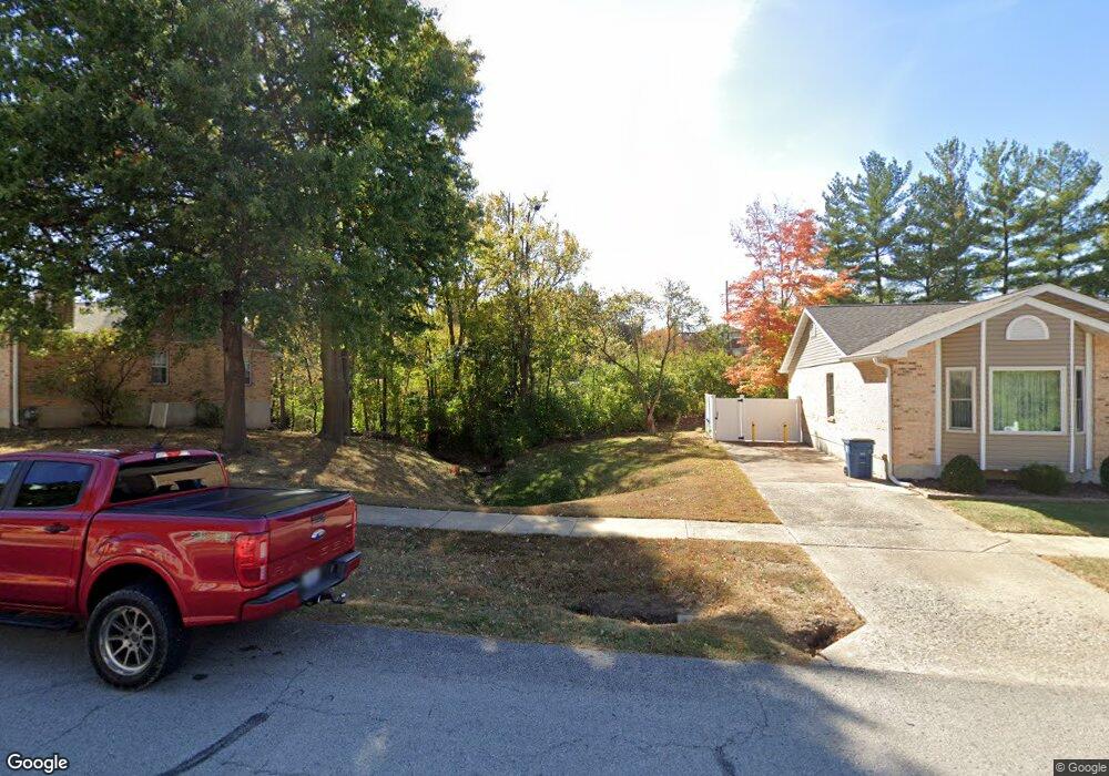
1933 Casa Dr Arnold, MO 63010
Estimated Value: $166,406 - $254,000
2
Beds
3
Baths
1,344
Sq Ft
$141/Sq Ft
Est. Value
About This Home
This home is located at 1933 Casa Dr, Arnold, MO 63010 and is currently estimated at $189,602, approximately $141 per square foot. 1933 Casa Dr is a home located in Jefferson County with nearby schools including Clyde Hamrick Elementary School, Ridgewood Middle School, and Fox Senior High School.
Ownership History
Date
Name
Owned For
Owner Type
Purchase Details
Closed on
Aug 17, 2021
Sold by
Robbins Kristin Nicole
Bought by
Tes Rithiya R and Tes Rose Ann
Current Estimated Value
Home Financials for this Owner
Home Financials are based on the most recent Mortgage that was taken out on this home.
Original Mortgage
$100,000
Outstanding Balance
$90,794
Interest Rate
2.8%
Mortgage Type
New Conventional
Estimated Equity
$98,808
Purchase Details
Closed on
Nov 7, 2008
Sold by
Daniels Rachel Huffman and Daniels Jeff
Bought by
Robbins Kristin Nicole
Home Financials for this Owner
Home Financials are based on the most recent Mortgage that was taken out on this home.
Original Mortgage
$116,303
Interest Rate
6.18%
Mortgage Type
Purchase Money Mortgage
Purchase Details
Closed on
Feb 23, 2001
Sold by
Kitchen Mark S
Bought by
Greenwalt Laura L
Create a Home Valuation Report for This Property
The Home Valuation Report is an in-depth analysis detailing your home's value as well as a comparison with similar homes in the area
Home Values in the Area
Average Home Value in this Area
Purchase History
| Date | Buyer | Sale Price | Title Company |
|---|---|---|---|
| Tes Rithiya R | -- | Investors Title Company | |
| Robbins Kristin Nicole | -- | Copper Land | |
| Greenwalt Laura L | -- | First American Title |
Source: Public Records
Mortgage History
| Date | Status | Borrower | Loan Amount |
|---|---|---|---|
| Open | Tes Rithiya R | $100,000 | |
| Previous Owner | Robbins Kristin Nicole | $116,303 |
Source: Public Records
Tax History
| Year | Tax Paid | Tax Assessment Tax Assessment Total Assessment is a certain percentage of the fair market value that is determined by local assessors to be the total taxable value of land and additions on the property. | Land | Improvement |
|---|---|---|---|---|
| 2025 | $1,497 | $23,400 | $800 | $22,600 |
| 2024 | $1,497 | $21,400 | $800 | $20,600 |
| 2023 | $1,497 | $21,400 | $800 | $20,600 |
| 2022 | $1,525 | $21,400 | $800 | $20,600 |
| 2021 | $1,527 | $21,400 | $800 | $20,600 |
| 2020 | $1,436 | $19,100 | $700 | $18,400 |
| 2019 | $1,440 | $19,100 | $700 | $18,400 |
| 2018 | $1,431 | $19,100 | $700 | $18,400 |
| 2017 | $1,453 | $19,100 | $700 | $18,400 |
| 2016 | $1,234 | $17,400 | $600 | $16,800 |
| 2015 | $1,238 | $17,400 | $600 | $16,800 |
| 2013 | -- | $17,500 | $600 | $16,900 |
Source: Public Records
Map
Nearby Homes
- 1915 Laverne Dr
- 1763 Lisa Dr
- 1956 Sonny Dr
- 1924 Jennifer Lynn Ln
- 1975 Ridgeway Dr
- 3.5 Acres - Ridge Dr
- 2061 Ridgeway Dr
- 2031 Buck Dr
- 1859 Engle Dr
- 2558 Frederitzi Ln
- 1738 E Highview Dr
- 2028 Fawn Dr
- 2268 Sunnyridge Dr
- 1 Hickory Square Pkwy
- 2872 Fox Meadow Ln
- 851 Morningside Ln
- 3368 Vine Clad Hill Dr
- 866 Sunset Dr
- 3263 Rosedale Dr
- 2287 Tenbrook Rd
- 1933 Casa Dr Unit 1
- 1935 Casa Dr Unit 2
- 1923 Casa Dr
- 1936 Casa Dr
- 1960 Casa Dr
- 1956 Casa Dr
- 1946 Casa Dr
- 1938 Casa Dr
- 1926 Casa Dr
- 1926 Casa Dr Unit 2
- 1907 Casa Dr
- 1925 Casa Dr
- 1913 Casa Dr
- 1911 Casa Dr Unit 65
- 1928 Casa Dr
- 1915 Casa Dr
- 1915 Casa Dr Unit 2
- 1948 Casa Dr
- 1964 Casa Dr
- 1964 Casa Dr Unit 3
Your Personal Tour Guide
Ask me questions while you tour the home.