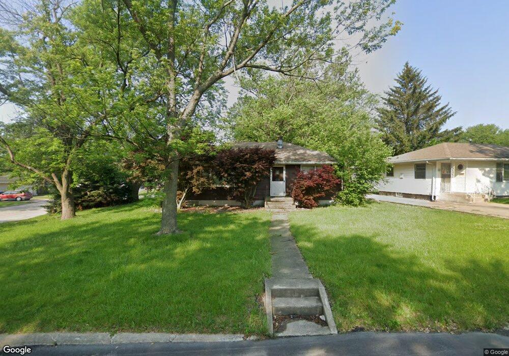
1933 Meadowview Ave Kankakee, IL 60901
Estimated Value: $99,000 - $147,000
3
Beds
1
Bath
936
Sq Ft
$130/Sq Ft
Est. Value
About This Home
This home is located at 1933 Meadowview Ave, Kankakee, IL 60901 and is currently estimated at $122,131, approximately $130 per square foot. 1933 Meadowview Ave is a home located in Kankakee County with nearby schools including Edison Primary School, King Middle Grade School, and Kankakee Junior High School.
Ownership History
Date
Name
Owned For
Owner Type
Purchase Details
Closed on
Oct 6, 2005
Sold by
Gierke Ronald L
Bought by
Stampley Priscilla A
Current Estimated Value
Home Financials for this Owner
Home Financials are based on the most recent Mortgage that was taken out on this home.
Original Mortgage
$53,975
Outstanding Balance
$20,085
Interest Rate
1.06%
Mortgage Type
New Conventional
Estimated Equity
$102,046
Create a Home Valuation Report for This Property
The Home Valuation Report is an in-depth analysis detailing your home's value as well as a comparison with similar homes in the area
Home Values in the Area
Average Home Value in this Area
Purchase History
| Date | Buyer | Sale Price | Title Company |
|---|---|---|---|
| Stampley Priscilla A | $63,500 | Standard Title |
Source: Public Records
Mortgage History
| Date | Status | Borrower | Loan Amount |
|---|---|---|---|
| Open | Stampley Priscilla A | $53,975 |
Source: Public Records
Tax History
| Year | Tax Paid | Tax Assessment Tax Assessment Total Assessment is a certain percentage of the fair market value that is determined by local assessors to be the total taxable value of land and additions on the property. | Land | Improvement |
|---|---|---|---|---|
| 2024 | $3,665 | $30,998 | $5,816 | $25,182 |
| 2023 | $3,531 | $27,615 | $5,181 | $22,434 |
| 2022 | $3,285 | $24,171 | $4,535 | $19,636 |
| 2021 | $3,100 | $21,874 | $4,104 | $17,770 |
| 2020 | $2,876 | $19,662 | $3,689 | $15,973 |
| 2019 | $2,741 | $18,291 | $3,432 | $14,859 |
| 2018 | $2,639 | $16,936 | $3,178 | $13,758 |
| 2017 | $2,956 | $16,563 | $3,108 | $13,455 |
| 2016 | $2,770 | $16,238 | $3,047 | $13,191 |
| 2015 | $2,676 | $16,569 | $3,109 | $13,460 |
| 2014 | $2,864 | $18,411 | $3,109 | $15,302 |
| 2013 | -- | $19,179 | $3,239 | $15,940 |
Source: Public Records
Map
Nearby Homes
- 1863 E Duane Blvd
- 1869 Summit Ave
- 9 Weft Rd
- 1809 E Eagle St
- 689 Country Club Dr
- 995 Justine Dr
- 1824 Cobb Blvd
- 682 S Osborn Ave
- 470 S Nelson Ave
- 540 S Osborn Ave
- 459 S Nelson Ave
- 702 S Lincoln Ave
- 261 S Longwood Dr
- 381 S Nelson Ave Unit 383
- 361 S Nelson Ave Unit 363
- 1003 S Poplar Ave
- 1257 E Sheridan St
- 550 S Poplar Ave
- 2664 Waldron Rd
- 1131 S Elm Ave
- 1955 Meadowview Ave
- 1891 Fairway Ct
- 1887 Fairway Ct
- 1894 Fairway Ct
- 1977 Meadowview Ave
- 1898 Meadowview Ave
- 1897 Meadowview Ave
- 1918 Meadowview Ave
- 1932 Meadowview Ave
- 1879 Fairway Ct
- 1910 Meadowview Ave
- 1896 E Duane Blvd
- 1950 Meadowview Ave
- 1890 E Duane Blvd
- 1880 Fairway Ct
- 1878 Fairway Ct
- 1895 Meadowview Ave
- 1964 Meadowview Ave
- 1876 Fairway Ct
- 1978 Meadowview Ave
Your Personal Tour Guide
Ask me questions while you tour the home.