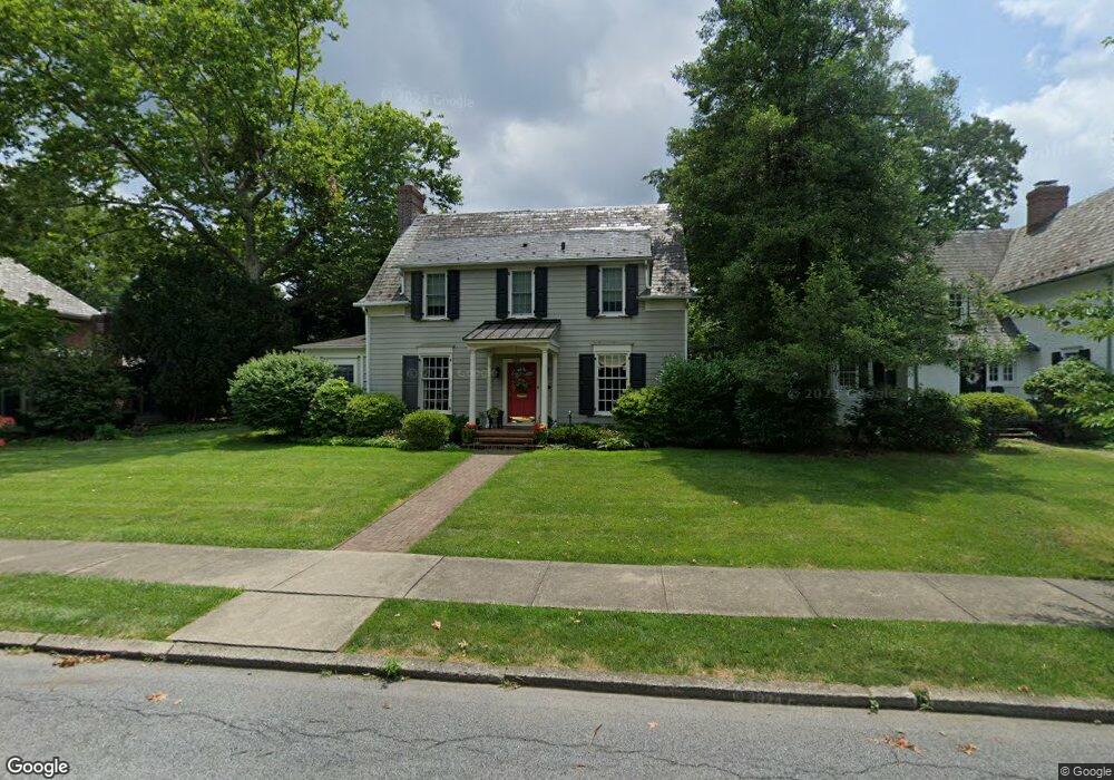
1933 Paul Ave Bethlehem, PA 18018
West Bethlehem NeighborhoodEstimated Value: $407,000 - $637,000
4
Beds
2
Baths
2,709
Sq Ft
$189/Sq Ft
Est. Value
About This Home
This home is located at 1933 Paul Ave, Bethlehem, PA 18018 and is currently estimated at $512,162, approximately $189 per square foot. 1933 Paul Ave is a home located in Lehigh County with nearby schools including Clearview Elementary School, Nitschmann Middle School, and Liberty High School.
Ownership History
Date
Name
Owned For
Owner Type
Purchase Details
Closed on
Dec 27, 1994
Sold by
Persa Daniel J and Persa Jane P
Bought by
Boor David P and Boor Alison B
Current Estimated Value
Purchase Details
Closed on
Oct 26, 1984
Sold by
Vogler Wallace P and Vogler Phyllis H
Bought by
Persa Daniel J and Persa Jane P
Create a Home Valuation Report for This Property
The Home Valuation Report is an in-depth analysis detailing your home's value as well as a comparison with similar homes in the area
Home Values in the Area
Average Home Value in this Area
Purchase History
| Date | Buyer | Sale Price | Title Company |
|---|---|---|---|
| Boor David P | $124,900 | -- | |
| Persa Daniel J | $93,000 | -- |
Source: Public Records
Tax History Compared to Growth
Tax History
| Year | Tax Paid | Tax Assessment Tax Assessment Total Assessment is a certain percentage of the fair market value that is determined by local assessors to be the total taxable value of land and additions on the property. | Land | Improvement |
|---|---|---|---|---|
| 2025 | $7,441 | $259,000 | $37,100 | $221,900 |
| 2024 | $7,356 | $259,000 | $37,100 | $221,900 |
| 2023 | $7,291 | $259,000 | $37,100 | $221,900 |
| 2022 | $6,695 | $234,000 | $196,900 | $37,100 |
| 2021 | $6,664 | $234,000 | $37,100 | $196,900 |
| 2020 | $6,451 | $234,000 | $37,100 | $196,900 |
| 2019 | $6,498 | $234,000 | $37,100 | $196,900 |
| 2018 | $6,372 | $234,000 | $37,100 | $196,900 |
| 2017 | $6,089 | $234,000 | $37,100 | $196,900 |
| 2016 | -- | $234,000 | $37,100 | $196,900 |
| 2015 | -- | $234,000 | $37,100 | $196,900 |
| 2014 | -- | $234,000 | $37,100 | $196,900 |
Source: Public Records
Map
Nearby Homes
- 922 Beverly Ave
- 1853 Richmond Ave
- 1768 W Union Blvd
- 650 Highland Ave
- 2130 Glendale Ave
- 1826 Eaton Ave
- 1198 Pennsylvania Ave
- 1209 Manchester Rd
- 328 Grandview Blvd
- 820 Club Ave Unit 822
- 1509 W Union Blvd
- 1541 Stanford Rd
- 1512 W Broad St
- 1102 N Van Buren St
- 1122 N Van Buren St
- 2030 Hanover Ave Unit 2032
- 2180 Pinehurst Rd
- 1402 Uelen Ct
- 1306 W Market St
- 1257 Troxell St
- 1941 Paul Ave
- 1925 Paul Ave
- 1933 Badger St
- 1949 Paul Ave
- 826 Pennsylvania Ave
- 1917 Paul Ave
- 1936 Paul Ave
- 822 Pennsylvania Ave
- 1926 Paul Ave
- 1944 Paul Ave
- 1953 Paul Ave
- 837 Beverly Ave
- 1932 Kenmore Ave
- 902 Pennsylvania Ave
- 827 Beverly Ave
- 1928 Kenmore Ave
- 1924 Kenmore Ave
- 1920 Kenmore Ave
- 819 Beverly Ave
- 1935 W Union Blvd