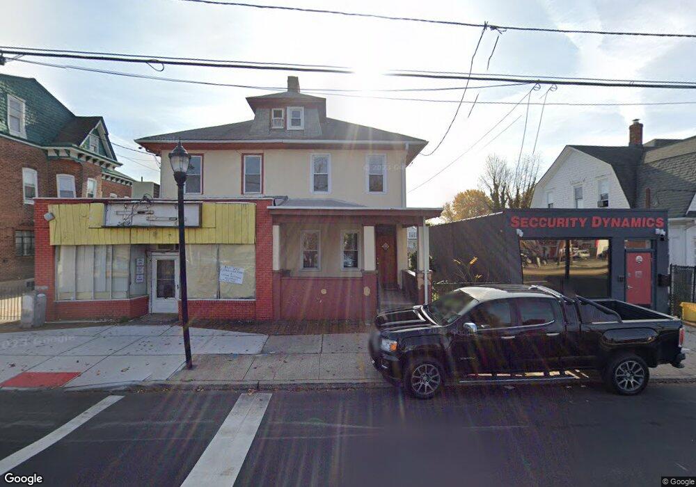
1933 S Broad St Trenton, NJ 08610
Franklin Park NeighborhoodEstimated Value: $156,000 - $296,000
--
Bed
--
Bath
1,728
Sq Ft
$126/Sq Ft
Est. Value
About This Home
This home is located at 1933 S Broad St, Trenton, NJ 08610 and is currently estimated at $217,807, approximately $126 per square foot. 1933 S Broad St is a home located in Mercer County with nearby schools including Lalor Elementary School, Richard C. Crockett Middle School, and Hamilton West-Watson High School.
Ownership History
Date
Name
Owned For
Owner Type
Purchase Details
Closed on
Jan 13, 2021
Sold by
Betros Cynthia L and Estate Of Robert Betros
Bought by
Jcd Realty Llc
Current Estimated Value
Home Financials for this Owner
Home Financials are based on the most recent Mortgage that was taken out on this home.
Original Mortgage
$50,000
Interest Rate
2.7%
Mortgage Type
Stand Alone First
Purchase Details
Closed on
Jul 5, 2011
Sold by
Estate Of Wilbur Betros
Bought by
Betros Robert
Create a Home Valuation Report for This Property
The Home Valuation Report is an in-depth analysis detailing your home's value as well as a comparison with similar homes in the area
Home Values in the Area
Average Home Value in this Area
Purchase History
| Date | Buyer | Sale Price | Title Company |
|---|---|---|---|
| Jcd Realty Llc | $85,000 | Monarch Title Agency Inc | |
| Betros Robert | -- | None Available |
Source: Public Records
Mortgage History
| Date | Status | Borrower | Loan Amount |
|---|---|---|---|
| Closed | Jcd Realty Llc | $50,000 |
Source: Public Records
Tax History Compared to Growth
Tax History
| Year | Tax Paid | Tax Assessment Tax Assessment Total Assessment is a certain percentage of the fair market value that is determined by local assessors to be the total taxable value of land and additions on the property. | Land | Improvement |
|---|---|---|---|---|
| 2025 | $3,630 | $103,000 | $25,200 | $77,800 |
| 2024 | $3,402 | $103,000 | $25,200 | $77,800 |
| 2023 | $3,402 | $103,000 | $25,200 | $77,800 |
| 2022 | $3,349 | $103,000 | $25,200 | $77,800 |
| 2021 | $4,144 | $103,000 | $25,200 | $77,800 |
| 2020 | $3,773 | $103,000 | $25,200 | $77,800 |
| 2019 | $3,662 | $103,000 | $25,200 | $77,800 |
| 2018 | $3,613 | $103,000 | $25,200 | $77,800 |
| 2017 | $3,453 | $103,000 | $25,200 | $77,800 |
| 2016 | $2,726 | $100,800 | $23,000 | $77,800 |
| 2015 | $3,474 | $66,700 | $12,400 | $54,300 |
| 2014 | $3,429 | $66,700 | $12,400 | $54,300 |
Source: Public Records
Map
Nearby Homes
- 1857 S Broad St
- 1856 S Broad St
- 1961 S Broad St
- 34 Sewell Ave
- 604 Schiller Ave
- 218 Sewell Ave
- 1816 Chambers St
- 2033 Genesee St
- 314 Joseph St
- 238 Grand Ave
- 229 Parkinson Ave
- 109 E Park Ave
- 27 Annabelle Ave
- 323 Wilfred Ave
- 229 Wilfred Ave
- 11 Panfili Ln
- 429 Wilfred Ave
- 316 W Park Ave
- 27 Westcott Ave
- 408 Berg Ave
- 1935 S Broad St
- 1929 S Broad St
- 1945 S Broad St
- 1923 S Broad St Unit 3
- 1923 S Broad St Unit 4
- 1923 S Broad St Unit 1
- 1923 S Broad St
- 1947 S Broad St
- 230 Lafayette Ave
- 238 Lafayette Ave
- 1949 S Broad St
- 242 Lafayette Ave
- 220 Lafayette Ave
- 1915 S Broad St
- 248 Lafayette Ave
- 1921 S Broad St
- 214 Lafayette Ave
- 250 Lafayette Ave
- 0 Chambers St
- 252 Lafayette Ave