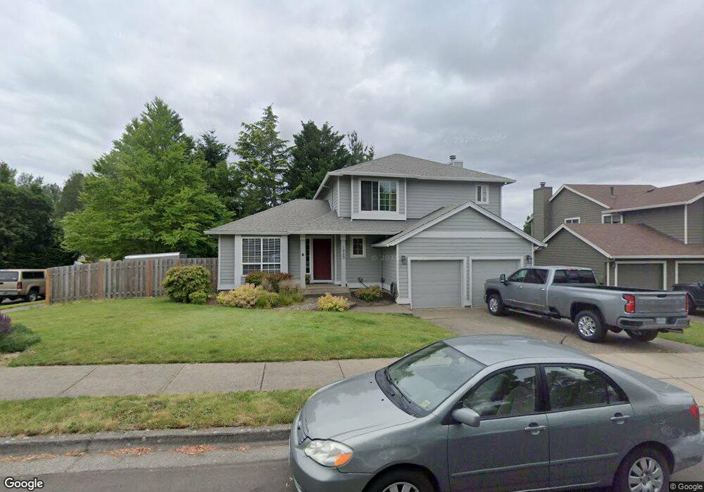
1933 SW Daybreak Way Troutdale, OR 97060
Town Center NeighborhoodEstimated Value: $481,313 - $546,000
3
Beds
3
Baths
1,621
Sq Ft
$322/Sq Ft
Est. Value
About This Home
This home is located at 1933 SW Daybreak Way, Troutdale, OR 97060 and is currently estimated at $521,828, approximately $321 per square foot. 1933 SW Daybreak Way is a home located in Multnomah County with nearby schools including Woodland Elementary School, Walt Morey Middle School, and Reynolds High School.
Ownership History
Date
Name
Owned For
Owner Type
Purchase Details
Closed on
Feb 6, 1997
Sold by
Cherry Ridge Ltd Partnership
Bought by
Tubbin Eric M and Tubbin Diane E
Current Estimated Value
Home Financials for this Owner
Home Financials are based on the most recent Mortgage that was taken out on this home.
Original Mortgage
$153,990
Outstanding Balance
$16,524
Interest Rate
7.62%
Mortgage Type
VA
Estimated Equity
$505,304
Create a Home Valuation Report for This Property
The Home Valuation Report is an in-depth analysis detailing your home's value as well as a comparison with similar homes in the area
Home Values in the Area
Average Home Value in this Area
Purchase History
| Date | Buyer | Sale Price | Title Company |
|---|---|---|---|
| Tubbin Eric M | $153,990 | Chicago Title |
Source: Public Records
Mortgage History
| Date | Status | Borrower | Loan Amount |
|---|---|---|---|
| Open | Tubbin Eric M | $153,990 |
Source: Public Records
Tax History Compared to Growth
Tax History
| Year | Tax Paid | Tax Assessment Tax Assessment Total Assessment is a certain percentage of the fair market value that is determined by local assessors to be the total taxable value of land and additions on the property. | Land | Improvement |
|---|---|---|---|---|
| 2025 | $5,296 | $287,200 | -- | -- |
| 2024 | $5,004 | $278,840 | -- | -- |
| 2023 | $4,873 | $270,720 | $0 | $0 |
| 2022 | $4,756 | $262,840 | $0 | $0 |
| 2021 | $4,646 | $255,190 | $0 | $0 |
| 2020 | $4,345 | $247,760 | $0 | $0 |
| 2019 | $4,170 | $240,550 | $0 | $0 |
| 2018 | $4,142 | $233,550 | $0 | $0 |
| 2017 | $4,133 | $226,750 | $0 | $0 |
| 2016 | $3,995 | $220,150 | $0 | $0 |
| 2015 | $3,895 | $213,740 | $0 | $0 |
| 2014 | $3,787 | $207,520 | $0 | $0 |
Source: Public Records
Map
Nearby Homes
- 1392 SW Berryessa Place
- 1953 SW Northstar Way
- 1106 SW Dottie Ct
- 1212 SW Edgefield Ave
- 24066 NE Treehill Dr Unit 12
- 24044 NE Treehill Dr Unit 6
- 821 SW 14th St
- 116 Elm Ave
- 114 Maple Blvd
- 839 SW Grant Way
- 735 SW Sunset Way
- 809 SW Crestview Way
- 2326 SW Mcginnis Ave
- 191 SW Lancaster Ct
- 23882 NE Treehill Dr Unit T3882
- 1018 SW Halsey St
- 2075 NE 240th Ave
- 125 SW Lancaster Ct
- 1427 SW 24th St
- 2511 SW 23rd Cir
- 1897 SW Daybreak Way
- 1946 SW Sturges Ln
- 1924 SW Sturges Ln
- 1302 SW Napoleon Place
- 1291 SW Napoleon Place
- 1267 SW Napoleon Place
- 1881 SW Daybreak Way
- 1892 SW Sturges Ln
- 1243 SW Napoleon Place
- 1305 SW Napoleon Place
- 1870 SW Daybreak Way
- 1314 SW Napoleon Place
- 1863 SW Daybreak Way
- 1876 SW Sturges Ln
- 1321 SW Napoleon Place
- 1322 SW Berryessa Place
- 1306 SW Berryessa Place
- 1354 SW Berryessa Place
- 1272 SW Berryessa Place
- 2012 SW Montmore Way