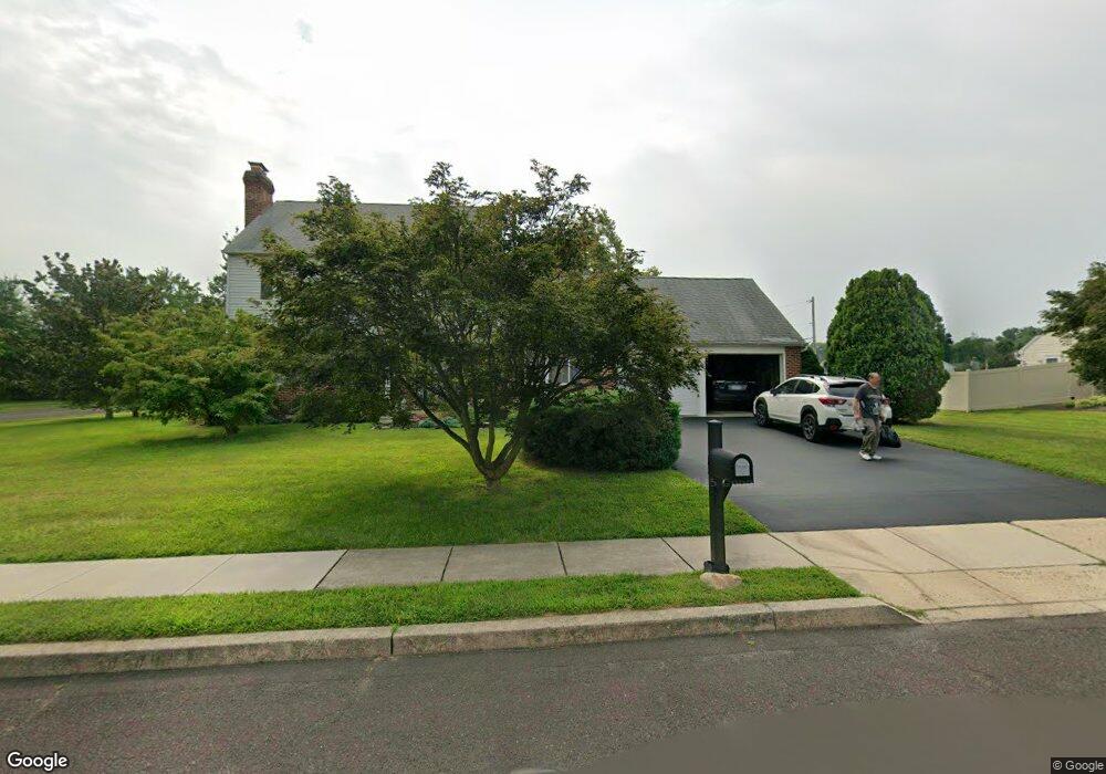
1933 Wayne Dr Norristown, PA 19403
West Norriton Township NeighborhoodEstimated Value: $429,000 - $578,000
4
Beds
2
Baths
2,034
Sq Ft
$257/Sq Ft
Est. Value
About This Home
This home is located at 1933 Wayne Dr, Norristown, PA 19403 and is currently estimated at $523,591, approximately $257 per square foot. 1933 Wayne Dr is a home located in Montgomery County with nearby schools including Whitehall Elementary School, Charles Blockson Middle School, and East Norriton Middle School.
Ownership History
Date
Name
Owned For
Owner Type
Purchase Details
Closed on
Oct 13, 2021
Sold by
Maresca Michael A
Bought by
Maresca Michael A and Maresca Cheryl
Current Estimated Value
Purchase Details
Closed on
Nov 12, 1996
Sold by
Maresca Armand J and Maresca Theresa M
Bought by
Maresca Armand J and Maresca Theresa M
Create a Home Valuation Report for This Property
The Home Valuation Report is an in-depth analysis detailing your home's value as well as a comparison with similar homes in the area
Home Values in the Area
Average Home Value in this Area
Purchase History
| Date | Buyer | Sale Price | Title Company |
|---|---|---|---|
| Maresca Michael A | -- | None Available | |
| Maresca Michael A | -- | None Listed On Document | |
| Maresca Armand J | -- | -- |
Source: Public Records
Tax History Compared to Growth
Tax History
| Year | Tax Paid | Tax Assessment Tax Assessment Total Assessment is a certain percentage of the fair market value that is determined by local assessors to be the total taxable value of land and additions on the property. | Land | Improvement |
|---|---|---|---|---|
| 2025 | $9,956 | $203,770 | $73,250 | $130,520 |
| 2024 | $9,956 | $203,770 | $73,250 | $130,520 |
| 2023 | $9,843 | $203,770 | $73,250 | $130,520 |
| 2022 | $9,779 | $203,770 | $73,250 | $130,520 |
| 2021 | $9,720 | $203,770 | $73,250 | $130,520 |
| 2020 | $9,430 | $203,770 | $73,250 | $130,520 |
| 2019 | $9,219 | $203,770 | $73,250 | $130,520 |
| 2018 | $7,523 | $203,770 | $73,250 | $130,520 |
| 2017 | $8,704 | $203,770 | $73,250 | $130,520 |
| 2016 | $8,624 | $203,770 | $73,250 | $130,520 |
| 2015 | $7,990 | $203,770 | $73,250 | $130,520 |
| 2014 | $7,990 | $203,770 | $73,250 | $130,520 |
Source: Public Records
Map
Nearby Homes
- 1104 Arden Dr Unit METHACTON SCHOOL
- 2025 Sterigere St
- 166 Hoover Ave
- 1219 Stonybrook Dr Unit 1219
- 805 Stonybrook Dr
- 501 Stonybrook Dr
- 709 Middleton Place
- 145 Colonial Ave
- 214 Oxford Cir
- 1749 W Marshall St
- 1613 Countryside Ln
- 612 Glen Ln Unit 56A
- 1448 W James St
- 511 Faith Dr
- 805 Sandra Ln
- 515 Faith Dr
- 37 Burnside Ave
- 550 Burnside Ave
- 1635 W Marshall W Marshall St
- 1506 W Marshall St
- 1931 Wayne Dr
- 1828 Wayne Dr
- 1901 Wayne Dr
- 1908 Wayne Dr
- 1914 Wayne Dr
- 219 Shepherd Ln
- 1916 Wayne Dr
- 1831 Ardin Dr
- 1826 Wayne Dr
- 1927 Wayne Dr
- 221 Shepherd Ln
- 1903 Wayne Dr
- 00 Arden Dr Unit METHACTON SCHOOL
- 1924 Wayne Dr
- 1829 Ardin Dr
- 1905 Wayne Dr
- 1824 Wayne Dr
- 1907 Wayne Dr
- 223 Shepherd Ln
- 1827 Ardin Dr