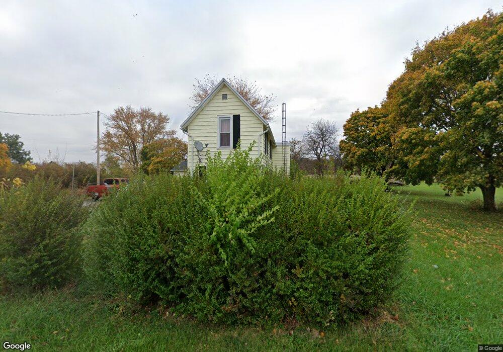
19334 Mudsock Rd Wapakoneta, OH 45895
Estimated Value: $178,699 - $305,000
3
Beds
1
Bath
1,660
Sq Ft
$140/Sq Ft
Est. Value
About This Home
This home is located at 19334 Mudsock Rd, Wapakoneta, OH 45895 and is currently estimated at $232,925, approximately $140 per square foot. 19334 Mudsock Rd is a home located in Auglaize County with nearby schools including Cridersville Elementary School, Wapakoneta High School, and Wapakoneta Middle School.
Ownership History
Date
Name
Owned For
Owner Type
Purchase Details
Closed on
Sep 5, 2008
Sold by
Carroll Nancianne
Bought by
Salyer Todd
Current Estimated Value
Home Financials for this Owner
Home Financials are based on the most recent Mortgage that was taken out on this home.
Original Mortgage
$81,524
Outstanding Balance
$54,303
Interest Rate
6.55%
Mortgage Type
FHA
Estimated Equity
$178,622
Purchase Details
Closed on
Aug 5, 1997
Sold by
Brenneman Cletus E
Bought by
Brenneman Cletus E and Brenneman Thelma A
Create a Home Valuation Report for This Property
The Home Valuation Report is an in-depth analysis detailing your home's value as well as a comparison with similar homes in the area
Home Values in the Area
Average Home Value in this Area
Purchase History
| Date | Buyer | Sale Price | Title Company |
|---|---|---|---|
| Salyer Todd | $82,600 | Partners Land Title | |
| Brenneman Cletus E | -- | -- |
Source: Public Records
Mortgage History
| Date | Status | Borrower | Loan Amount |
|---|---|---|---|
| Open | Salyer Todd | $81,524 |
Source: Public Records
Tax History Compared to Growth
Tax History
| Year | Tax Paid | Tax Assessment Tax Assessment Total Assessment is a certain percentage of the fair market value that is determined by local assessors to be the total taxable value of land and additions on the property. | Land | Improvement |
|---|---|---|---|---|
| 2024 | $2,180 | $43,820 | $11,890 | $31,930 |
| 2023 | $1,472 | $43,820 | $11,890 | $31,930 |
| 2022 | $1,195 | $32,310 | $9,910 | $22,400 |
| 2021 | $1,179 | $32,310 | $9,910 | $22,400 |
| 2020 | $603 | $32,309 | $9,909 | $22,400 |
| 2019 | $1,005 | $26,485 | $8,124 | $18,361 |
| 2018 | $1,008 | $26,485 | $8,124 | $18,361 |
| 2017 | $1,001 | $26,485 | $8,124 | $18,361 |
| 2016 | $1,017 | $26,674 | $7,557 | $19,117 |
| 2015 | $1,048 | $26,674 | $7,557 | $19,117 |
| 2014 | $996 | $26,674 | $7,557 | $19,117 |
| 2013 | $1,045 | $26,310 | $7,193 | $19,117 |
Source: Public Records
Map
Nearby Homes
- 18609 County Road 25a
- 17946 National Rd
- 212 S Oak St
- 5290 New Haven Dr
- 1805 Huntington Dr
- 1835 Huntington Dr
- 310 W Main St
- 0 Ohio 67
- 37 N Main St
- 17 E Walnut St
- 2638 Summer Rambo Ct
- 2648 Summer Rambo Ct
- 2613 Jonathon Dr
- 2691 Jonathan Dr
- 17092 Hauss Rd
- 301 Muskingum Trail
- 1934 Jo Jean Rd
- 1643 W Breese Rd Unit 73
- 137 Caribou Cir
- 3780 Shawnee Rd
- 19265 Mudsock Rd
- 19228 Mudsock Rd
- 19404 Mudsock Rd
- 19409 Mudsock Rd
- 19245 Mudsock Rd
- 19462 Mudsock Rd
- 19158 Mudsock Rd
- 17276 Freymuth Rd
- 19500 Mudsock Rd
- 19135 Mudsock Rd
- 19112 Mudsock Rd
- 17198 Freymuth Rd
- 0 Freymuth Rd
- 19085 Mudsock Rd
- 19038 Mudsock Rd
- 17452 Freymuth Rd
- 17122 Freymuth Rd
- 17419 Freymuth Rd
- 19039 Mudsock Rd
- 17295 Buckland Holden Rd