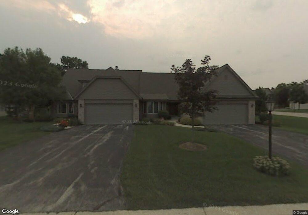
19335 W Mc Allister Ln Unit A Brookfield, WI 53045
Estimated Value: $445,000 - $553,000
3
Beds
3
Baths
2,327
Sq Ft
$211/Sq Ft
Est. Value
About This Home
This home is located at 19335 W Mc Allister Ln Unit A, Brookfield, WI 53045 and is currently estimated at $491,912, approximately $211 per square foot. 19335 W Mc Allister Ln Unit A is a home located in Waukesha County with nearby schools including John F. Miller School, Hillcrest Elementary School, and Horning Middle School.
Ownership History
Date
Name
Owned For
Owner Type
Purchase Details
Closed on
Aug 30, 2023
Sold by
Joseph S Leedale S and Joseph Cynthia L
Bought by
Paul W Moyer And Mary M Moyer Trust
Current Estimated Value
Purchase Details
Closed on
Aug 19, 2021
Sold by
James Joint Revocable Trust
Bought by
Joseph S Leedale Iii And Cynthia L Leedale Re
Purchase Details
Closed on
Sep 29, 2005
Sold by
Hintzman Jon D and Hintzman Judith L
Bought by
Barry N & Diane M James Revocable Living
Purchase Details
Closed on
Oct 28, 1999
Sold by
Regency Development Corp
Bought by
Hintzman Jon D and Hintzman Judith L
Home Financials for this Owner
Home Financials are based on the most recent Mortgage that was taken out on this home.
Original Mortgage
$110,000
Interest Rate
6.5%
Create a Home Valuation Report for This Property
The Home Valuation Report is an in-depth analysis detailing your home's value as well as a comparison with similar homes in the area
Home Values in the Area
Average Home Value in this Area
Purchase History
| Date | Buyer | Sale Price | Title Company |
|---|---|---|---|
| Paul W Moyer And Mary M Moyer Trust | $465,000 | None Listed On Document | |
| Joseph S Leedale Iii And Cynthia L Leedale Re | $425,000 | None Listed On Document | |
| Barry N & Diane M James Revocable Living | $429,000 | Nations Title | |
| Hintzman Jon D | $278,600 | -- |
Source: Public Records
Mortgage History
| Date | Status | Borrower | Loan Amount |
|---|---|---|---|
| Previous Owner | Hintzman Jon D | $110,000 |
Source: Public Records
Tax History Compared to Growth
Tax History
| Year | Tax Paid | Tax Assessment Tax Assessment Total Assessment is a certain percentage of the fair market value that is determined by local assessors to be the total taxable value of land and additions on the property. | Land | Improvement |
|---|---|---|---|---|
| 2024 | $4,583 | $460,000 | $100,000 | $360,000 |
| 2023 | $4,578 | $460,000 | $100,000 | $360,000 |
| 2022 | $4,893 | $364,700 | $90,000 | $274,700 |
| 2021 | $4,812 | $354,800 | $90,000 | $264,800 |
| 2020 | $4,938 | $354,800 | $90,000 | $264,800 |
| 2019 | $4,851 | $354,800 | $90,000 | $264,800 |
| 2018 | $4,318 | $315,600 | $70,000 | $245,600 |
| 2017 | $5,088 | $315,600 | $70,000 | $245,600 |
| 2016 | $4,639 | $315,600 | $70,000 | $245,600 |
| 2015 | $4,417 | $315,600 | $70,000 | $245,600 |
| 2014 | $4,790 | $315,600 | $70,000 | $245,600 |
| 2013 | $4,790 | $315,600 | $70,000 | $245,600 |
Source: Public Records
Map
Nearby Homes
- 550 McPride Ln Unit B
- 655 Mac Henry Cir Unit B
- 19770 Foxkirk Ct
- Lt1 Davidson Rd
- 18785 Davidson Rd
- 675 Charleston Ct Unit B
- 18740 Emerald Cir Unit E
- 18520 Emerald Cir Unit F
- 18425 Emerald Dr Unit G
- 18925 Eagle Dr Unit 101
- 18925 Eagle Dr Unit 102
- 18925 Eagle Dr Unit 202
- 18925 Eagle Dr Unit 201
- 165 Aerie Cir Unit 105
- 18710 Follett Dr Unit 502
- 18290 Prairie Falcon Ln
- 18575 Brookfield Lake Dr Unit 61
- 18275 Brookfield Lake Dr Unit 93
- 1080 Westbrooke Pkwy
- 18950 Toldt Woods Dr Unit 20
- 19335 W Mc Allister Ln Unit B
- 19335 Mcallister Ln Unit A
- 19335 Mcallister Ln Unit 19335
- 19400 Stonehedge Dr Unit A
- 19325 W Mc Allister Ln Unit A
- 19325 W Mc Allister Ln Unit B
- 19405 Stonehedge Dr Unit B
- 19330 W Mc Allister Ln Unit A
- 19330 W Mc Allister Ln Unit B
- 19360 Stonehedge Dr Unit A
- 19360 Stonehedge Dr Unit B
- 19340 Stonehedge Dr Unit A
- 19340 Stonehedge Dr Unit B
- 19435 Stonehedge Dr Unit B
- 19435 Stonehedge Dr Unit A
- 19435 Stonehedge Dr Unit 19435
- 19315 W Mc Allister Ln Unit B
- 19315 W Mc Allister Ln Unit A
- 19300 W Mc Allister Ln Unit A
- 19300 W Mc Allister Ln Unit B