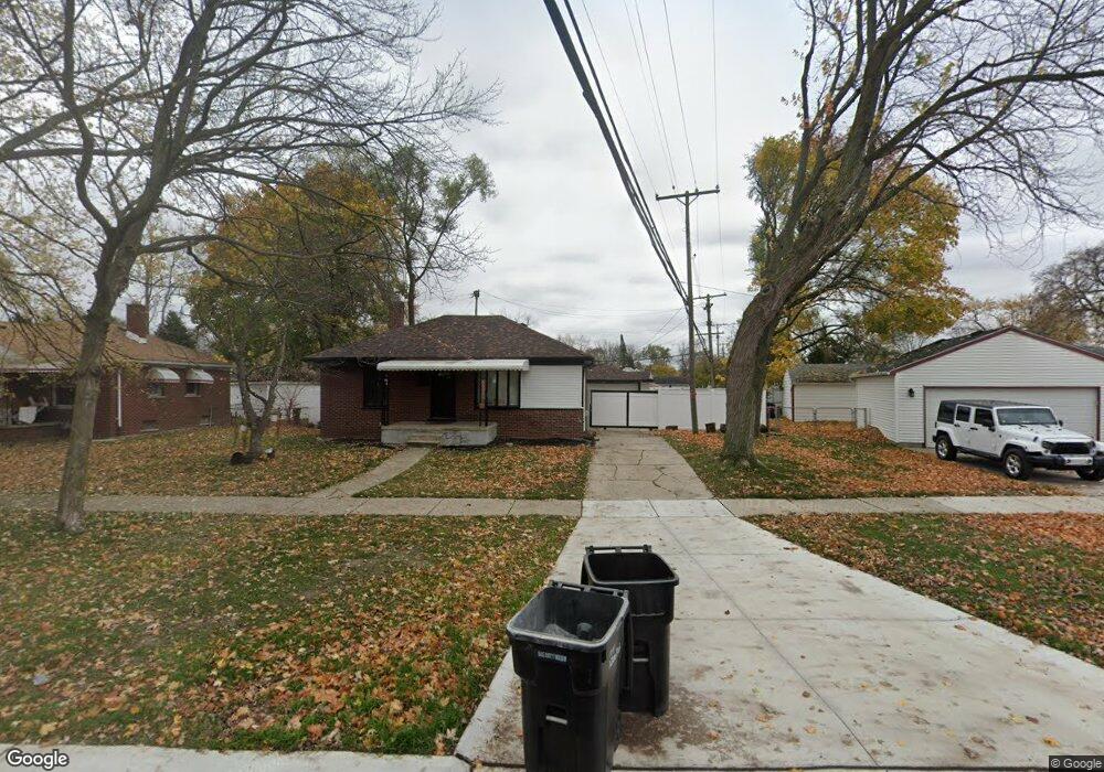
19339 Pinecrest Dr Unit Bldg-Unit Allen Park, MI 48101
Estimated Value: $200,397 - $238,000
--
Bed
2
Baths
1,101
Sq Ft
$197/Sq Ft
Est. Value
About This Home
This home is located at 19339 Pinecrest Dr Unit Bldg-Unit, Allen Park, MI 48101 and is currently estimated at $216,349, approximately $196 per square foot. 19339 Pinecrest Dr Unit Bldg-Unit is a home located in Wayne County with nearby schools including Bennie Elementary School, Allen Park Middle School, and Allen Park High School.
Ownership History
Date
Name
Owned For
Owner Type
Purchase Details
Closed on
Aug 16, 2018
Sold by
Arp Partner Properties Llc
Bought by
Quintero Jose
Current Estimated Value
Purchase Details
Closed on
Mar 7, 2017
Sold by
New Hope Community Development Non Propf
Bought by
Arp Partners Propefit Llc
Purchase Details
Closed on
Feb 8, 2017
Sold by
The Bank Of New York Mellon
Bought by
Hew Hope Community Development Non Profi
Purchase Details
Closed on
Sep 1, 2016
Sold by
Walters Alva J and Walters Alva
Bought by
The Bank Of New York Mellon and The Bank Of New York
Create a Home Valuation Report for This Property
The Home Valuation Report is an in-depth analysis detailing your home's value as well as a comparison with similar homes in the area
Home Values in the Area
Average Home Value in this Area
Purchase History
| Date | Buyer | Sale Price | Title Company |
|---|---|---|---|
| Quintero Jose | $145,000 | None Available | |
| Arp Partners Propefit Llc | -- | None Available | |
| Hew Hope Community Development Non Profi | $61,500 | Premium Title Services Inc | |
| The Bank Of New York Mellon | $131,888 | Attorney |
Source: Public Records
Tax History Compared to Growth
Tax History
| Year | Tax Paid | Tax Assessment Tax Assessment Total Assessment is a certain percentage of the fair market value that is determined by local assessors to be the total taxable value of land and additions on the property. | Land | Improvement |
|---|---|---|---|---|
| 2025 | $2,943 | $88,100 | $0 | $0 |
| 2024 | $2,943 | $76,000 | $0 | $0 |
| 2023 | $3,598 | $69,100 | $0 | $0 |
| 2022 | $3,829 | $62,300 | $0 | $0 |
| 2021 | $3,276 | $58,700 | $0 | $0 |
| 2020 | $3,736 | $54,600 | $0 | $0 |
| 2019 | $3,212 | $52,400 | $0 | $0 |
| 2018 | $3,262 | $41,100 | $0 | $0 |
| 2017 | $925 | $40,600 | $0 | $0 |
| 2016 | $2,753 | $45,800 | $0 | $0 |
| 2015 | $3,706 | $42,200 | $0 | $0 |
| 2013 | $3,590 | $39,000 | $0 | $0 |
| 2012 | $2,193 | $37,700 | $11,900 | $25,800 |
Source: Public Records
Map
Nearby Homes
- 19249 Pinecrest Dr
- 6568 Balfour Ave
- 6640 Jackson St
- 6365 Buckingham Ave
- 6485 Huron St
- 6587 Cortland Ave
- 6345 Kolb Ave
- 6540 Osage Ave
- 6506 Osage Ave
- 7190 Buckingham Ave
- 6724 Polk St
- 6911 Polk St
- 6642 Shenandoah Ave
- 5977 Weddel St
- 7580 Mayfair St
- 7221 Winona Ave
- 5939 Mayfair St
- 7868 Robinson Ave
- 5839 Balfour Ave
- 7854 Jackson St
- 19339 Pinecrest Dr
- 19323 Pinecrest Dr
- 6505 Pelham Rd
- 6536 Robinson Ave
- 6546 Robinson Ave
- 6515 Pelham Rd
- 6554 Robinson Ave
- 19267 Pinecrest Dr
- 6531 Robinson Ave
- 6529 Pelham Rd
- 6539 Robinson Ave
- 6570 Robinson Ave
- 6537 Pelham Rd
- 19257 Pinecrest Dr
- 6547 Robinson Ave
- 19324 Pinecrest Dr
- 6555 Robinson Ave
- 6545 Pelham Rd
- 19300 Pinecrest Dr
- 6563 Robinson Ave