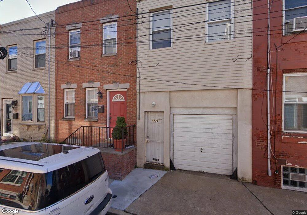
1934 Annin St Philadelphia, PA 19146
Point Breeze NeighborhoodEstimated Value: $309,044 - $332,000
2
Beds
1
Bath
1,048
Sq Ft
$303/Sq Ft
Est. Value
About This Home
This home is located at 1934 Annin St, Philadelphia, PA 19146 and is currently estimated at $317,261, approximately $302 per square foot. 1934 Annin St is a home located in Philadelphia County with nearby schools including Edwin M. Stanton School, South Philadelphia High School, and Christopher Columbus CS.
Ownership History
Date
Name
Owned For
Owner Type
Purchase Details
Closed on
Oct 26, 2006
Sold by
Mcd Holdings Llc
Bought by
Dervinis Haley K and Cronrath Adam S
Current Estimated Value
Home Financials for this Owner
Home Financials are based on the most recent Mortgage that was taken out on this home.
Original Mortgage
$177,000
Outstanding Balance
$104,313
Interest Rate
6.33%
Mortgage Type
Purchase Money Mortgage
Estimated Equity
$212,948
Purchase Details
Closed on
May 27, 2005
Sold by
Varano John and Varano Joseph
Bought by
Mcd Holding Llc
Purchase Details
Closed on
Nov 30, 2004
Sold by
Cohen Joshua
Bought by
Varano John and Varano Joseph
Purchase Details
Closed on
Jun 1, 2004
Sold by
St Albans Check Cashing Co Inc
Bought by
Cohen Joshua
Create a Home Valuation Report for This Property
The Home Valuation Report is an in-depth analysis detailing your home's value as well as a comparison with similar homes in the area
Home Values in the Area
Average Home Value in this Area
Purchase History
| Date | Buyer | Sale Price | Title Company |
|---|---|---|---|
| Dervinis Haley K | $183,000 | None Available | |
| Mcd Holding Llc | $20,000 | -- | |
| Varano John | $15,000 | -- | |
| Cohen Joshua | $9,800 | -- |
Source: Public Records
Mortgage History
| Date | Status | Borrower | Loan Amount |
|---|---|---|---|
| Open | Dervinis Haley K | $177,000 |
Source: Public Records
Tax History Compared to Growth
Tax History
| Year | Tax Paid | Tax Assessment Tax Assessment Total Assessment is a certain percentage of the fair market value that is determined by local assessors to be the total taxable value of land and additions on the property. | Land | Improvement |
|---|---|---|---|---|
| 2026 | $3,967 | $303,400 | $60,680 | $242,720 |
| 2025 | $3,967 | $303,400 | $60,680 | $242,720 |
| 2024 | $3,967 | $303,400 | $60,680 | $242,720 |
| 2023 | $3,967 | $283,400 | $58,000 | $225,400 |
| 2022 | $3,337 | $238,400 | $58,000 | $180,400 |
| 2021 | $3,967 | $0 | $0 | $0 |
| 2020 | $3,967 | $0 | $0 | $0 |
| 2019 | $3,687 | $0 | $0 | $0 |
| 2018 | $2,347 | $0 | $0 | $0 |
| 2017 | $2,347 | $0 | $0 | $0 |
| 2016 | $1,928 | $0 | $0 | $0 |
| 2015 | $1,845 | $0 | $0 | $0 |
| 2014 | -- | $167,700 | $9,520 | $158,180 |
| 2012 | -- | $11,200 | $2,240 | $8,960 |
Source: Public Records
Map
Nearby Homes
- 1918 Ellsworth St
- 1123 S 20th St
- 1121 S 20th St
- 1904 Federal St
- 1938 Federal St
- 2002 Annin St Unit 2
- 2707 11 Federal St
- 1144 S Cleveland St
- 2026 Ellsworth St
- 1151 S Cleveland St
- 1919 Latona St
- 2025 Ellsworth St
- 1024 S 19th St Unit B
- 2019 Manton St
- 2016 Manton St
- 2050 Ellsworth St
- 1239 S 19th St
- 1029 S Dorrance St
- 2008 Latona St
- 1929 Kimball St